
| Memorials | : | 0 |
| Location | : | Ter Apel, Vlagtwedde Municipality, Netherlands |
| Coordinate | : | 52.8744000, 7.0760300 |
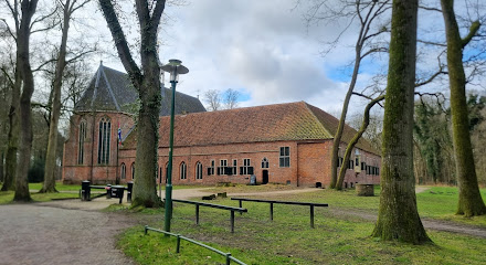
| Description | : | There were three Jewish cemeteries in the region: the first on Roswinkelstraatweg in Roswinkel, which was in use until 1886; the second in De Maten, in use until 1870 and the last in Ter Apel. The Ter Apel cemetery dates from 1886. |
frequently asked questions (FAQ):
-
Where is Joodse Begraafplaats?
Joodse Begraafplaats is located at Poortweg Ter Apel, Vlagtwedde Municipality ,Groningen , 9561LKNetherlands.
-
Joodse Begraafplaats cemetery's updated grave count on graveviews.com?
0 memorials
-
Where are the coordinates of the Joodse Begraafplaats?
Latitude: 52.8744000
Longitude: 7.0760300
Nearby Cemetories:
1. Ter Apel General Cemetery
Ter Apel, Vlagtwedde Municipality, Netherlands
Coordinate: 52.8746800, 7.0560200
2. Algemene Begraafplaats
Roswinkel, Emmen Municipality, Netherlands
Coordinate: 52.8403700, 7.0479840
3. Floralaan
Musselkanaal, Stadskanaal Municipality, Netherlands
Coordinate: 52.9359046, 7.0092084
4. Valthermond West Cemetery
Borger-Odoorn Municipality, Netherlands
Coordinate: 52.8810600, 6.9405060
5. Joodse Begraafplaats
Stadskanaal Municipality, Netherlands
Coordinate: 52.9686940, 6.9737780
6. Gemeentelijke Begraafplaats Ceresstraat
Stadskanaal, Stadskanaal Municipality, Netherlands
Coordinate: 52.9702635, 6.9754545
7. The Old Churchyard Barger-Compascuum
Barger-Compascuum, Emmen Municipality, Netherlands
Coordinate: 52.7565091, 7.0358214
8. Begraafplaats Oosterkadekerk
Stadskanaal Municipality, Netherlands
Coordinate: 52.9776980, 6.9640720
9. Gemeentelijke Begraafplaats Brugstraat
Stadskanaal, Stadskanaal Municipality, Netherlands
Coordinate: 52.9774600, 6.9632400
10. Nieuw Dordrecht General Cemetery
Nieuw-Dordrecht, Emmen Municipality, Netherlands
Coordinate: 52.7524200, 6.9653600
11. Emmen Kerkhoflaan Cemetery
Emmen, Emmen Municipality, Netherlands
Coordinate: 52.7816300, 6.9006200
12. Friedhof Wesuwe
Wesuwe, Landkreis Emsland, Germany
Coordinate: 52.7582110, 7.2099680
13. Joodse Begraafplaats Beatrixstraat
Emmen, Emmen Municipality, Netherlands
Coordinate: 52.7805510, 6.8994390
14. Friedhof Lathen
Lathen, Landkreis Emsland, Germany
Coordinate: 52.8650490, 7.3166330
15. Vlagtwedde General Cemetery
Vlagtwedde, Vlagtwedde Municipality, Netherlands
Coordinate: 53.0252400, 7.1198700
16. Joodse Begraafplaats
Bourtange, Vlagtwedde Municipality, Netherlands
Coordinate: 53.0134700, 7.1837900
17. Joodse Begraafplaats
Emmen Municipality, Netherlands
Coordinate: 52.7790860, 6.8700710
18. Joodse Begraafplaats
Vlagtwedde Municipality, Netherlands
Coordinate: 53.0266000, 7.1584000
19. Stadskanaal Noorderbegraafplaats
Stadskanaal, Stadskanaal Municipality, Netherlands
Coordinate: 53.0071900, 6.9182500
20. Begraafplaats Veelerkerkhof
Veele, Vlagtwedde Municipality, Netherlands
Coordinate: 53.0372680, 7.1001330
21. Lagerfriedhof
Versen, Landkreis Emsland, Germany
Coordinate: 52.7245552, 7.1886227
22. Onstwedde General Cemetery
Onstwedde, Stadskanaal Municipality, Netherlands
Coordinate: 53.0425700, 7.0436300
23. Joodse begraafplaats
Borger, Borger-Odoorn Municipality, Netherlands
Coordinate: 52.9291240, 6.7993350
24. Boven Pekela cemetery
Boven Pekela, Pekela Municipality, Netherlands
Coordinate: 53.0342900, 6.9338300