| Memorials | : | 0 |
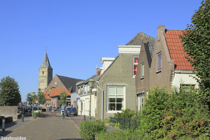
| Location | : | IJsselmuiden, Kampen Municipality, Netherlands |
| Coordinate | : | 52.5696100, 5.9342100 |
| Description | : | Kampen's Jews established a cemetery at the Bolwerk near the Veenepoort in 1764. This cemetery was closed in 1829 and part of its contents were moved to the present-day Ebbingestraat in 1834. Later, a new cemetery was founded on the Zandberg at IJsselmuiden. In 1947, the remaining graves at the Jewish cemetery on the Ebbingestraat were removed to the cemetery in IJsselmuiden. The IJsselmuiden cemetery was restored with private support in 1985 and is now maintained by the local authorities. |
frequently asked questions (FAQ):
-
Where is Joodse Begraafplaats?
Joodse Begraafplaats is located at Rondeweg IJsselmuiden, Kampen Municipality ,Overijssel ,Netherlands.
-
Joodse Begraafplaats cemetery's updated grave count on graveviews.com?
0 memorials
-
Where are the coordinates of the Joodse Begraafplaats?
Latitude: 52.5696100
Longitude: 5.9342100
Nearby Cemetories:
1. Algemene begraafplaats IJsselmuiden de Zandberg
IJsselmuiden, Kampen Municipality, Netherlands
Coordinate: 52.5688100, 5.9350200
2. Kampen Roman Catholic Cemetery
IJsselmuiden, Kampen Municipality, Netherlands
Coordinate: 52.5705100, 5.9352400
3. Grafhorst General Cemetery
Grafhorst, Kampen Municipality, Netherlands
Coordinate: 52.5782500, 5.9340800
4. Voorst General Cemetery
Zwolle, Zwolle Municipality, Netherlands
Coordinate: 52.5210700, 6.0575500
5. Joodse begraafplaats
Hasselt, Zwartewaterland Municipality, Netherlands
Coordinate: 52.5929800, 6.0923800
6. Begraafplaats Van Stolkspark
Hasselt, Zwartewaterland Municipality, Netherlands
Coordinate: 52.5897916, 6.0961902
7. Joodse Begraafplaats
Zwartsluis, Zwartewaterland Municipality, Netherlands
Coordinate: 52.6413820, 6.0723750
8. Onze Lieve Vrouwe ten Hemelopneming Basilica
Zwolle, Zwolle Municipality, Netherlands
Coordinate: 52.5121050, 6.0901940
9. Stad-Vollenhove General Cemetery
Vollenhove, Steenwijkerland Municipality, Netherlands
Coordinate: 52.6808200, 5.9459100
10. Oosterwolde General Cemetery
Oosterwolde, Oldebroek Municipality, Netherlands
Coordinate: 52.4604800, 5.8851900
11. Zwolle Katholieke Begraafplaats
Zwolle, Zwolle Municipality, Netherlands
Coordinate: 52.5186200, 6.1047100
12. Zwolle Algemene Begraafplaats
Zwolle, Zwolle Municipality, Netherlands
Coordinate: 52.5179970, 6.1084200
13. De Eekelenburg
Oldebroek, Oldebroek Municipality, Netherlands
Coordinate: 52.4472600, 5.9157800
14. Zwolle Bergklooster Cemetery
Zwolle, Zwolle Municipality, Netherlands
Coordinate: 52.5338710, 6.1309080
15. Zwolle Kranenburg Begraafplaats
Zwolle, Zwolle Municipality, Netherlands
Coordinate: 52.5307910, 6.1302850
16. Algemene begraafplaats
Dronten Municipality, Netherlands
Coordinate: 52.5272076, 5.7329484
17. Joodse Begraafplaats
Hattem Municipality, Netherlands
Coordinate: 52.4696060, 6.0762350
18. Joodse Begraafplaats
Elburg, Elburg Municipality, Netherlands
Coordinate: 52.4486337, 5.8378073
19. Joodse Begraafplaats
Zwolle, Zwolle Municipality, Netherlands
Coordinate: 52.5107800, 6.1402900
20. Begraafplaats Burchtstraat
Elburg, Elburg Municipality, Netherlands
Coordinate: 52.4417190, 5.8324400
21. Joodse Begraafplaats
Blokzijl, Steenwijkerland Municipality, Netherlands
Coordinate: 52.7253110, 5.9623440
22. Blokzijl General Cemetery
Blokzijl, Steenwijkerland Municipality, Netherlands
Coordinate: 52.7253900, 5.9624600
23. Rouveen New General Cemetery
Rouveen, Staphorst Municipality, Netherlands
Coordinate: 52.6157100, 6.1842900
24. Windesheim General Cemetery
Windesheim, Zwolle Municipality, Netherlands
Coordinate: 52.4485900, 6.1307100

