
| Memorials | : | 0 |
| Location | : | Elburg, Elburg Municipality, Netherlands |
| Coordinate | : | 52.4417190, 5.8324400 |
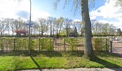
| Description | : | In use since 1829. Originally called the Nunspeterweg cemetery, in 1961 the entrance of the cemetery was moved to Burchtstraat. As a result, the name of the cemetery was changed. There is also a section with Commonwealth war graves. |
frequently asked questions (FAQ):
-
Where is Begraafplaats Burchtstraat?
Begraafplaats Burchtstraat is located at Burchtstraat 1a Elburg, Elburg Municipality ,Gelderland , 8081 BDNetherlands.
-
Begraafplaats Burchtstraat cemetery's updated grave count on graveviews.com?
0 memorials
-
Where are the coordinates of the Begraafplaats Burchtstraat?
Latitude: 52.4417190
Longitude: 5.8324400
Nearby Cemetories:
1. Joodse Begraafplaats
Elburg, Elburg Municipality, Netherlands
Coordinate: 52.4486337, 5.8378073
2. Oosterwolde General Cemetery
Oosterwolde, Oldebroek Municipality, Netherlands
Coordinate: 52.4604800, 5.8851900
3. De Eekelenburg
Oldebroek, Oldebroek Municipality, Netherlands
Coordinate: 52.4472600, 5.9157800
4. Nunspeet New General Cemetery
Nunspeet, Nunspeet Municipality, Netherlands
Coordinate: 52.3789600, 5.7984700
5. Algemene begraafplaats
Dronten Municipality, Netherlands
Coordinate: 52.5272076, 5.7329484
6. Verscholen Dorp Hidden Village Memorial
Nunspeet Municipality, Netherlands
Coordinate: 52.3363600, 5.8721700
7. Heerde Begraafplaats Engelmanskamp
Heerde, Heerde Municipality, Netherlands
Coordinate: 52.3890900, 6.0060200
8. Epe General Cemetery
Epe, Epe Municipality, Netherlands
Coordinate: 52.3473700, 5.9743200
9. Heerde Old General Cemetery
Heerde, Heerde Municipality, Netherlands
Coordinate: 52.3908300, 6.0354900
10. Algemene begraafplaats IJsselmuiden de Zandberg
IJsselmuiden, Kampen Municipality, Netherlands
Coordinate: 52.5688100, 5.9350200
11. Joodse Begraafplaats
IJsselmuiden, Kampen Municipality, Netherlands
Coordinate: 52.5696100, 5.9342100
12. Kampen Roman Catholic Cemetery
IJsselmuiden, Kampen Municipality, Netherlands
Coordinate: 52.5705100, 5.9352400
13. Grafhorst General Cemetery
Grafhorst, Kampen Municipality, Netherlands
Coordinate: 52.5782500, 5.9340800
14. Harderwijk General Cemetery
Harderwijk, Harderwijk Municipality, Netherlands
Coordinate: 52.3499300, 5.6374200
15. Joodse Begraafplaats
Hattem Municipality, Netherlands
Coordinate: 52.4696060, 6.0762350
16. Voorst General Cemetery
Zwolle, Zwolle Municipality, Netherlands
Coordinate: 52.5210700, 6.0575500
17. Begraafplaats Elspeet
Elspeet, Nunspeet Municipality, Netherlands
Coordinate: 52.2844300, 5.7867800
18. Joodse Begraafplaats Beth Chaim
Harderwijk Municipality, Netherlands
Coordinate: 52.3330300, 5.6279200
19. Onze Lieve Vrouwe ten Hemelopneming Basilica
Zwolle, Zwolle Municipality, Netherlands
Coordinate: 52.5121050, 6.0901940
20. Vaassen General Cemetery
Vaassen, Epe Municipality, Netherlands
Coordinate: 52.2823600, 5.9654300
21. Windesheim General Cemetery
Windesheim, Zwolle Municipality, Netherlands
Coordinate: 52.4485900, 6.1307100
22. Begraafplaats Uddel
Uddel, Apeldoorn Municipality, Netherlands
Coordinate: 52.2614100, 5.7895700
23. Zwolle Katholieke Begraafplaats
Zwolle, Zwolle Municipality, Netherlands
Coordinate: 52.5186200, 6.1047100
24. Zwolle Algemene Begraafplaats
Zwolle, Zwolle Municipality, Netherlands
Coordinate: 52.5179970, 6.1084200