
| Memorials | : | 0 |
| Location | : | Eindhoven Municipality, Netherlands |
| Coordinate | : | 51.4693300, 5.4443700 |
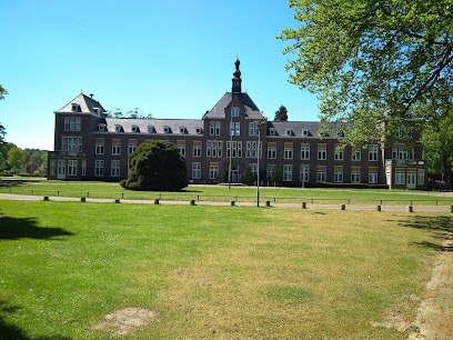
| Description | : | A cemetery, established in 1918, is located on the grounds of the Grote Beek Psychiatric Hospital. The cemetery is divided into four sections - Catholic, general, Jewish and staff.. The Jewish section has two remaining graves, with a total of approximately 25 burials (from the period 1927-1982), but the matsevahs are no longer visible. In 2009, the German artist Gunter Demnig placed 24 Stolpersteine (stumbling stones) in the path to the cemetery for the 24 Jewish patients killed by the nazis during World War II. |
frequently asked questions (FAQ):
-
Where is Joodse Begraafplaats Grote Beek?
Joodse Begraafplaats Grote Beek is located at Doctor Poletlaan Eindhoven Municipality ,Noord-Brabant , 5626NCNetherlands.
-
Joodse Begraafplaats Grote Beek cemetery's updated grave count on graveviews.com?
0 memorials
-
Where are the coordinates of the Joodse Begraafplaats Grote Beek?
Latitude: 51.4693300
Longitude: 5.4443700
Nearby Cemetories:
1. Begraafplaats Sint Paulus
Eindhoven, Eindhoven Municipality, Netherlands
Coordinate: 51.4551800, 5.4625000
2. Joodse Begraafplaats
Eindhoven, Eindhoven Municipality, Netherlands
Coordinate: 51.4507900, 5.4577600
3. Woensel General Cemetery
Woensel, Eindhoven Municipality, Netherlands
Coordinate: 51.4553100, 5.4822500
4. Begraafplaats Sint Trudo
Eindhoven Municipality, Netherlands
Coordinate: 51.4408198, 5.4546763
5. Eindhoven Sint-Catharina Cemetery
Eindhoven, Eindhoven Municipality, Netherlands
Coordinate: 51.4337600, 5.4773100
6. Sint Joris Cemetery
Stratum, Eindhoven Municipality, Netherlands
Coordinate: 51.4311800, 5.4912100
7. Sint-Severinuskerkhof
Eindhoven, Eindhoven Municipality, Netherlands
Coordinate: 51.4176300, 5.4495100
8. Nuenen Sint Clemens Roman Catholic Cemetery
Nuenen, Nuenen, Gerwen en Nederwetten Municipality, Netherlands
Coordinate: 51.4732800, 5.5508100
9. Stratum Roostenhof Cemetery
Stratum, Eindhoven Municipality, Netherlands
Coordinate: 51.4092500, 5.4962800
10. Nuenen Oude Toren Begraafplaats
Nuenen, Nuenen, Gerwen en Nederwetten Municipality, Netherlands
Coordinate: 51.4719100, 5.5572500
11. Veldhoven Begraafplaats Hoge Boght
Veldhoven, Veldhoven Municipality, Netherlands
Coordinate: 51.4116700, 5.3683800
12. Oude Joodse Begraafplaats
Oirschot Municipality, Netherlands
Coordinate: 51.4956170, 5.3138480
13. Sint-Oedenrode Roman Catholic Churchyard
Sint-Oedenrode, Sint-Oedenrode Municipality, Netherlands
Coordinate: 51.5629900, 5.4611600
14. Mierlo War Cemetery
Mierlo, Geldrop-Mierlo Municipality, Netherlands
Coordinate: 51.4356200, 5.5913500
15. Lieshout Begraafplaats
Lieshout, Laarbeek Municipality, Netherlands
Coordinate: 51.5184300, 5.5936500
16. Mariahout Roman Catholic Churchyard
Mariahout, Laarbeek Municipality, Netherlands
Coordinate: 51.5396100, 5.5720200
17. Oostelbeers Roman Catholic Churchyard
Oostelbeers, Oirschot Municipality, Netherlands
Coordinate: 51.4711900, 5.2704500
18. Stiphout Churchyard
Stiphout, Helmond Municipality, Netherlands
Coordinate: 51.4858437, 5.6170421
19. Valkenswaard Oude Katholieke Begraafplaats
Valkenswaard, Valkenswaard Municipality, Netherlands
Coordinate: 51.3531900, 5.4547700
20. Sint-Lucia Rooms-Katholieke Begraafplaats
Mierlo-Hout, Helmond Municipality, Netherlands
Coordinate: 51.4669500, 5.6329900
21. Heeze Catholic Cemetery
Heeze, Heeze-Leende Municipality, Netherlands
Coordinate: 51.3777900, 5.5755100
22. Aarle-Rixtel kerkhof
Aarle-Rixtel, Laarbeek Municipality, Netherlands
Coordinate: 51.5102394, 5.6384168
23. Cemetery de Eikenhof
Valkenswaard Municipality, Netherlands
Coordinate: 51.3369161, 5.4559452
24. Rooms Katholieke begraafplaats
Helmond, Helmond Municipality, Netherlands
Coordinate: 51.4782400, 5.6680400