
| Memorials | : | 0 |
| Location | : | Winterswijk Municipality, Netherlands |
| Coordinate | : | 51.9685800, 6.7173600 |
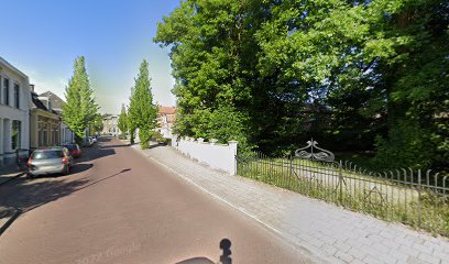
| Description | : | Established before 1647 and closed to new burials in 1880. Nine matsevahs still remain; the oldest dates from 1818. |
frequently asked questions (FAQ):
-
Where is Joodse Begraafplaats Spoorstraat?
Joodse Begraafplaats Spoorstraat is located at Spoorstraat Winterswijk Municipality ,Gelderland , 7101GSNetherlands.
-
Joodse Begraafplaats Spoorstraat cemetery's updated grave count on graveviews.com?
0 memorials
-
Where are the coordinates of the Joodse Begraafplaats Spoorstraat?
Latitude: 51.9685800
Longitude: 6.7173600
Nearby Cemetories:
1. Joodse Begraafplaats Misterweg
Winterswijk Municipality, Netherlands
Coordinate: 51.9673710, 6.7024360
2. Winterswijk General Cemetery
Winterswijk, Winterswijk Municipality, Netherlands
Coordinate: 51.9795500, 6.7254100
3. Oude Begraafplaats
Bredevoort, Aalten Municipality, Netherlands
Coordinate: 51.9409683, 6.6195741
4. Joodse Begraafplaats
Bredevoort, Aalten Municipality, Netherlands
Coordinate: 51.9408108, 6.6189064
5. Kloosterhof
Bredevoort, Aalten Municipality, Netherlands
Coordinate: 51.9461994, 6.6127766
6. Lichtenvoorde General Cemetery
Lichtenvoorde, Oost Gelre Municipality, Netherlands
Coordinate: 51.9886300, 6.5968600
7. Joodse Begraafplaats
Aalten, Aalten Municipality, Netherlands
Coordinate: 51.9252900, 6.5988300
8. Grafheuvel Nannielaantje
Aalten, Aalten Municipality, Netherlands
Coordinate: 51.9285000, 6.5957200
9. Groenlo Roman Catholic Cemetery
Groenlo, Oost Gelre Municipality, Netherlands
Coordinate: 52.0350700, 6.6137700
10. Berkenhove General Cemetery
Aalten, Aalten Municipality, Netherlands
Coordinate: 51.9342100, 6.5758700
11. Oude Begraafplaats
Aalten, Aalten Municipality, Netherlands
Coordinate: 51.9283288, 6.5776327
12. St Vitus Friedhof
Südlohn, Kreis Borken, Germany
Coordinate: 51.9491032, 6.8684885
13. Aalten Rooms-Katholieke Begraafplaats
Aalten, Aalten Municipality, Netherlands
Coordinate: 51.9218500, 6.5784000
14. Joodse Begraafsplaats
Groenlo, Oost Gelre Municipality, Netherlands
Coordinate: 52.0448890, 6.6163030
15. Nieuwe Hervormde Begraafplaats
Groenlo, Oost Gelre Municipality, Netherlands
Coordinate: 52.0455970, 6.6166189
16. Friedhof Ammeloe
Ammeloe, Kreis Borken, Germany
Coordinate: 52.0786077, 6.7938814
17. Rekken Roman Catholic Cemetery
Rekken, Berkelland Municipality, Netherlands
Coordinate: 52.0925300, 6.7145700
18. Alter Friedhhof Gemen
Gemen (Borken), Kreis Borken, Germany
Coordinate: 51.8601396, 6.8618935
19. Joodse begraafplaats
Eibergen, Berkelland Municipality, Netherlands
Coordinate: 52.1063400, 6.6546300
20. Eibergen Protestant Cemetery
Eibergen, Berkelland Municipality, Netherlands
Coordinate: 52.1125000, 6.6534600
21. Varsseveld General Cemetery
Varsseveld, Oude Ijsselstreek Municipality, Netherlands
Coordinate: 51.9402100, 6.4632300
22. Waldfriedhof Borken
Borken, Kreis Borken, Germany
Coordinate: 51.8442972, 6.8858913
23. Begraafplaats Haarlo
Haarlo, Berkelland Municipality, Netherlands
Coordinate: 52.1105311, 6.5814055
24. Nieuwe Begraafplaats
Dinxperlo, Aalten Municipality, Netherlands
Coordinate: 51.8688335, 6.4971512