
| Memorials | : | 0 |
| Location | : | Aalten, Aalten Municipality, Netherlands |
| Coordinate | : | 51.9285000, 6.5957200 |
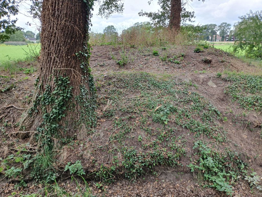
| Description | : | Aan de rand van Aalten ligt een bijzondere grafheuvel. Het voormalig landgoed 'het Smees' was destijds eigendom van Christiaan Caspar Stumph en zijn vrouw Jeanne Lesturgeon. Hij oefent het ambt van burgemeester van Aalten uit van 1811-1818. Stumph was de eerste burgemeester van Aalten. Ook de gemeentesecretarie is gevestigd op het landgoed. Stumph heeft als wens hier zijn laatste rustplaats te vinden. In 1818, de tijd van de romantiek, regelt hij een 'buitenbegraafplaats' voor zichzelf en zijn verwanten. Hij ergert zich aan wantoestanden van het begraven in of bij de kerk. Zijn beschikking is als volgt: 'Na mijn dood wens en... Read More |
frequently asked questions (FAQ):
-
Where is Grafheuvel Nannielaantje?
Grafheuvel Nannielaantje is located at Nannielaantje Aalten, Aalten Municipality ,Gelderland ,Netherlands.
-
Grafheuvel Nannielaantje cemetery's updated grave count on graveviews.com?
0 memorials
-
Where are the coordinates of the Grafheuvel Nannielaantje?
Latitude: 51.9285000
Longitude: 6.5957200
Nearby Cemetories:
1. Joodse Begraafplaats
Aalten, Aalten Municipality, Netherlands
Coordinate: 51.9252900, 6.5988300
2. Oude Begraafplaats
Aalten, Aalten Municipality, Netherlands
Coordinate: 51.9283288, 6.5776327
3. Aalten Rooms-Katholieke Begraafplaats
Aalten, Aalten Municipality, Netherlands
Coordinate: 51.9218500, 6.5784000
4. Berkenhove General Cemetery
Aalten, Aalten Municipality, Netherlands
Coordinate: 51.9342100, 6.5758700
5. Joodse Begraafplaats
Bredevoort, Aalten Municipality, Netherlands
Coordinate: 51.9408108, 6.6189064
6. Oude Begraafplaats
Bredevoort, Aalten Municipality, Netherlands
Coordinate: 51.9409683, 6.6195741
7. Kloosterhof
Bredevoort, Aalten Municipality, Netherlands
Coordinate: 51.9461994, 6.6127766
8. Lichtenvoorde General Cemetery
Lichtenvoorde, Oost Gelre Municipality, Netherlands
Coordinate: 51.9886300, 6.5968600
9. Joodse Begraafplaats Misterweg
Winterswijk Municipality, Netherlands
Coordinate: 51.9673710, 6.7024360
10. Varsseveld General Cemetery
Varsseveld, Oude Ijsselstreek Municipality, Netherlands
Coordinate: 51.9402100, 6.4632300
11. Joodse Begraafplaats Spoorstraat
Winterswijk Municipality, Netherlands
Coordinate: 51.9685800, 6.7173600
12. Nieuwe Begraafplaats
Dinxperlo, Aalten Municipality, Netherlands
Coordinate: 51.8688335, 6.4971512
13. Dinxperlo General Cemetery
Dinxperlo, Aalten Municipality, Netherlands
Coordinate: 51.8636700, 6.4893000
14. Winterswijk General Cemetery
Winterswijk, Winterswijk Municipality, Netherlands
Coordinate: 51.9795500, 6.7254100
15. Joodse Begraafplaats
Dinxperlo, Aalten Municipality, Netherlands
Coordinate: 51.8587400, 6.4797200
16. Groenlo Roman Catholic Cemetery
Groenlo, Oost Gelre Municipality, Netherlands
Coordinate: 52.0350700, 6.6137700
17. Joodse Begraafsplaats
Groenlo, Oost Gelre Municipality, Netherlands
Coordinate: 52.0448890, 6.6163030
18. Nieuwe Hervormde Begraafplaats
Groenlo, Oost Gelre Municipality, Netherlands
Coordinate: 52.0455970, 6.6166189
19. Halle Protestant Cemetery
Halle, Bronckhorst Municipality, Netherlands
Coordinate: 51.9921000, 6.4249400
20. Joodse Begraafplaats
Terborg, Oude Ijsselstreek Municipality, Netherlands
Coordinate: 51.9177220, 6.3725280
21. Joodse Begraafsplaats Oude Ijsselstreek
Gendringen, Oude Ijsselstreek Municipality, Netherlands
Coordinate: 51.8782250, 6.3860750
22. Gendringen Roman Catholic Cemetery
Gendringen, Oude Ijsselstreek Municipality, Netherlands
Coordinate: 51.8741900, 6.3785500
23. Hervormde Begraafplaats
Gendringen, Oude Ijsselstreek Municipality, Netherlands
Coordinate: 51.8710900, 6.3661700
24. Begraafplaats Kommendijk
Doetinchem Municipality, Netherlands
Coordinate: 51.9640325, 6.3423601