
| Memorials | : | 0 |
| Location | : | Groenlo, Oost Gelre Municipality, Netherlands |
| Coordinate | : | 52.0350700, 6.6137700 |
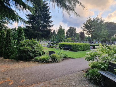
| Description | : | Groenlo is a village lying about 65 kilometres east-north-east of Arnhem and 35 kilometres south-east of Zutphen, on the road to Winterswijk. The cemetery is on the southern outskirts of Groenlo. It lies about 455 metres from the centre of the village on the western side of the road to Lievelde. |
frequently asked questions (FAQ):
-
Where is Groenlo Roman Catholic Cemetery?
Groenlo Roman Catholic Cemetery is located at Groenlo, Oost Gelre Municipality ,Gelderland ,Netherlands.
-
Groenlo Roman Catholic Cemetery cemetery's updated grave count on graveviews.com?
0 memorials
-
Where are the coordinates of the Groenlo Roman Catholic Cemetery?
Latitude: 52.0350700
Longitude: 6.6137700
Nearby Cemetories:
1. Joodse Begraafsplaats
Groenlo, Oost Gelre Municipality, Netherlands
Coordinate: 52.0448890, 6.6163030
2. Nieuwe Hervormde Begraafplaats
Groenlo, Oost Gelre Municipality, Netherlands
Coordinate: 52.0455970, 6.6166189
3. Lichtenvoorde General Cemetery
Lichtenvoorde, Oost Gelre Municipality, Netherlands
Coordinate: 51.9886300, 6.5968600
4. Joodse begraafplaats
Eibergen, Berkelland Municipality, Netherlands
Coordinate: 52.1063400, 6.6546300
5. Begraafplaats Haarlo
Haarlo, Berkelland Municipality, Netherlands
Coordinate: 52.1105311, 6.5814055
6. Eibergen Protestant Cemetery
Eibergen, Berkelland Municipality, Netherlands
Coordinate: 52.1125000, 6.6534600
7. Rekken Roman Catholic Cemetery
Rekken, Berkelland Municipality, Netherlands
Coordinate: 52.0925300, 6.7145700
8. Joodse Begraafplaats Misterweg
Winterswijk Municipality, Netherlands
Coordinate: 51.9673710, 6.7024360
9. Winterswijk General Cemetery
Winterswijk, Winterswijk Municipality, Netherlands
Coordinate: 51.9795500, 6.7254100
10. Kloosterhof
Bredevoort, Aalten Municipality, Netherlands
Coordinate: 51.9461994, 6.6127766
11. Joodse Begraafplaats Spoorstraat
Winterswijk Municipality, Netherlands
Coordinate: 51.9685800, 6.7173600
12. Oude Begraafplaats
Bredevoort, Aalten Municipality, Netherlands
Coordinate: 51.9409683, 6.6195741
13. Joodse Begraafplaats
Bredevoort, Aalten Municipality, Netherlands
Coordinate: 51.9408108, 6.6189064
14. Borculo General Cemetery
Borculo, Berkelland Municipality, Netherlands
Coordinate: 52.1183000, 6.5198400
15. Joodse Begraafplaats
Borculo, Berkelland Municipality, Netherlands
Coordinate: 52.1199100, 6.5173000
16. Berkenhove General Cemetery
Aalten, Aalten Municipality, Netherlands
Coordinate: 51.9342100, 6.5758700
17. Grafheuvel Nannielaantje
Aalten, Aalten Municipality, Netherlands
Coordinate: 51.9285000, 6.5957200
18. Ruurlo General Cemetery
Ruurlo, Berkelland Municipality, Netherlands
Coordinate: 52.0916500, 6.4642800
19. Oude Begraafplaats
Aalten, Aalten Municipality, Netherlands
Coordinate: 51.9283288, 6.5776327
20. Drostenkamp Cemetery
Neede, Berkelland Municipality, Netherlands
Coordinate: 52.1435200, 6.5936000
21. Joodse Begraafplaats
Aalten, Aalten Municipality, Netherlands
Coordinate: 51.9252900, 6.5988300
22. Ruurlo Achter Zieuwent Roman Catholic Churchyard
Ruurlo, Berkelland Municipality, Netherlands
Coordinate: 52.0833700, 6.4508500
23. Aalten Rooms-Katholieke Begraafplaats
Aalten, Aalten Municipality, Netherlands
Coordinate: 51.9218500, 6.5784000
24. Friedhof Ammeloe
Ammeloe, Kreis Borken, Germany
Coordinate: 52.0786077, 6.7938814