
| Memorials | : | 0 |
| Location | : | Dalston, London Borough of Hackney, England |
| Coordinate | : | 51.5477490, -0.0794480 |
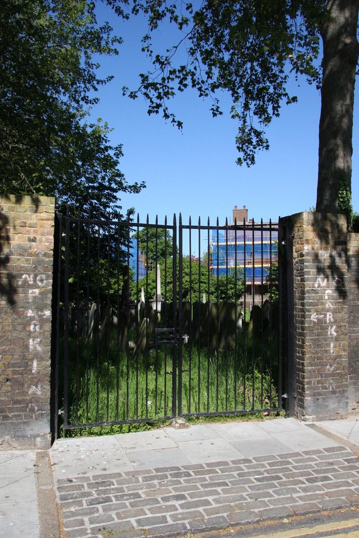
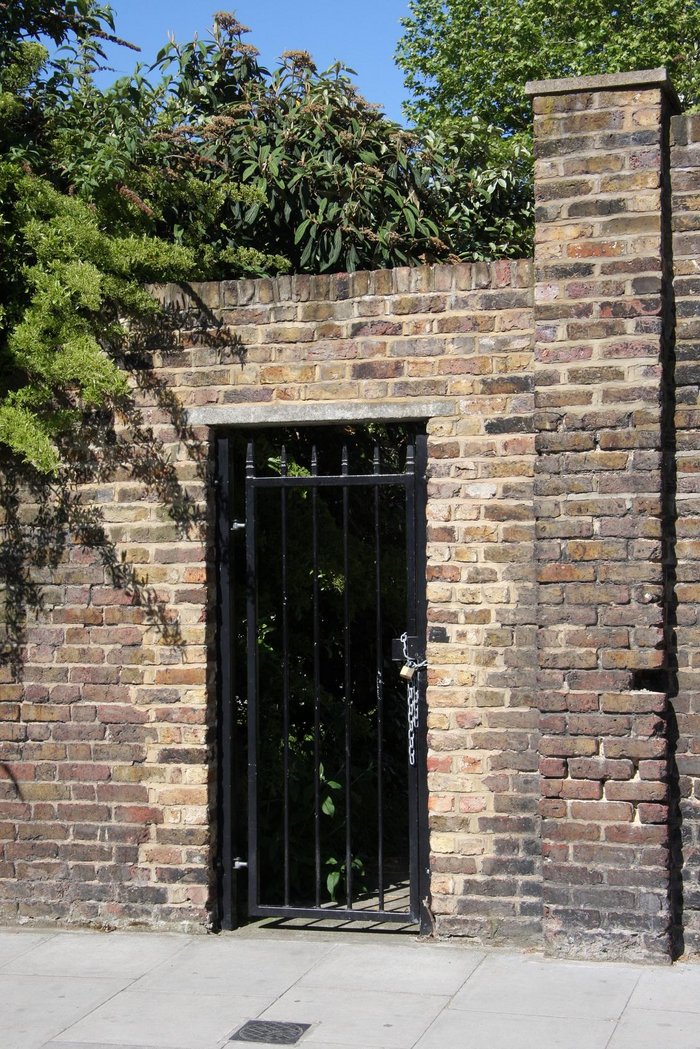
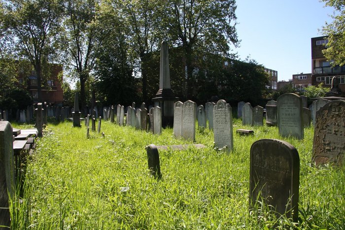
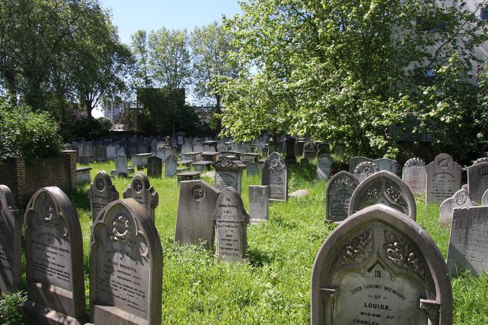
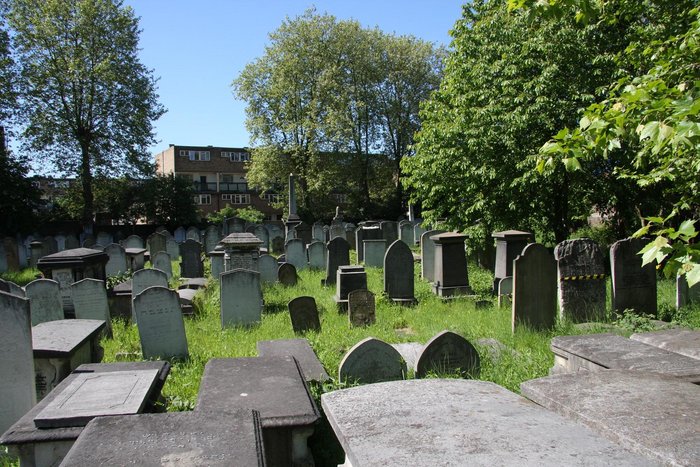
| Description | : | The Kingsbury Road Cemetery is also known as Balls Pond Road Cemetery or the Jewish Cemetery. The cemetery was founded in 1843 by West London Reform Synagogue. To protect the historic importance of the cemetery, it has been a Grade II listing since November of 2020. The buried dates are between July 13, 1843 and January 22, 1951. Several famous people from the Jewish community are buried here. |
frequently asked questions (FAQ):
-
Where is Kingsbury Road Cemetery?
Kingsbury Road Cemetery is located at Dalston, London Borough of Hackney ,Greater London ,England.
-
Kingsbury Road Cemetery cemetery's updated grave count on graveviews.com?
0 memorials
-
Where are the coordinates of the Kingsbury Road Cemetery?
Latitude: 51.5477490
Longitude: -0.0794480
Nearby Cemetories:
1. St Mary Churchyard
Stoke Newington, London Borough of Hackney, England
Coordinate: 51.5608330, -0.0843290
2. St. Augustine's Tower
Hackney, London Borough of Hackney, England
Coordinate: 51.5478360, -0.0544930
3. St. John at Hackney Churchyard
Hackney, London Borough of Hackney, England
Coordinate: 51.5491300, -0.0533140
4. Abney Park Cemetery
Stoke Newington, London Borough of Hackney, England
Coordinate: 51.5637932, -0.0743190
5. St. Mary's Churchyard
Islington, London Borough of Islington, England
Coordinate: 51.5384090, -0.1018950
6. St Mary Magdalene Church
Holloway, London Borough of Islington, England
Coordinate: 51.5488910, -0.1076150
7. St. Leonard Churchyard
Shoreditch, London Borough of Hackney, England
Coordinate: 51.5268230, -0.0773640
8. Pentonville Prison Cemetery
Barnsbury, London Borough of Islington, England
Coordinate: 51.5455690, -0.1151720
9. St Clement with St Barnabas and St Matthew
Finsbury, London Borough of Islington, England
Coordinate: 51.5277700, -0.0977600
10. St. Matthew's Churchyard
Bethnal Green, London Borough of Tower Hamlets, England
Coordinate: 51.5251190, -0.0672250
11. Holywell Priory
Shoreditch, London Borough of Hackney, England
Coordinate: 51.5238050, -0.0785300
12. St Luke Churchyard
St Luke's, London Borough of Islington, England
Coordinate: 51.5251312, -0.0941940
13. Wesleys Chapel
London Borough of Islington, England
Coordinate: 51.5237140, -0.0865760
14. Lauriston Road Jewish Cemetery
Hackney, London Borough of Hackney, England
Coordinate: 51.5373490, -0.0436210
15. Plague Grave At Seward Street And Mount Mills
Clerkenwell, London Borough of Islington, England
Coordinate: 51.5259780, -0.0985880
16. Bunhill Fields Burial Ground
London Borough of Islington, England
Coordinate: 51.5236015, -0.0888900
17. Quaker Gardens
London, City of London, England
Coordinate: 51.5239250, -0.0911890
18. Bunhill Fields Quaker Burying Ground
Islington, London Borough of Islington, England
Coordinate: 51.5239250, -0.0911890
19. St. James Chapel Churchyard
Pentonville, London Borough of Islington, England
Coordinate: 51.5317590, -0.1148990
20. Brady Street Cemetery
Whitechapel, London Borough of Tower Hamlets, England
Coordinate: 51.5218390, -0.0604950
21. The Order of St. John Cemetery
Farringdon, London Borough of Islington, England
Coordinate: 51.5231220, -0.1030110
22. Liverpool Street Station
London, City of London, England
Coordinate: 51.5187870, -0.0814920
23. St. James Churchyard
Clerkenwell, London Borough of Islington, England
Coordinate: 51.5235700, -0.1056500
24. Old Church of St. Mary Moorfields (Defunct)
London, City of London, England
Coordinate: 51.5187890, -0.0857140