
| Memorials | : | 16 |
| Location | : | Bainbridge Center, Berrien County, USA |
| Coordinate | : | 42.1380530, -86.2812620 |
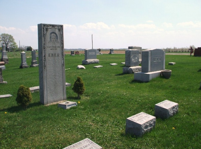
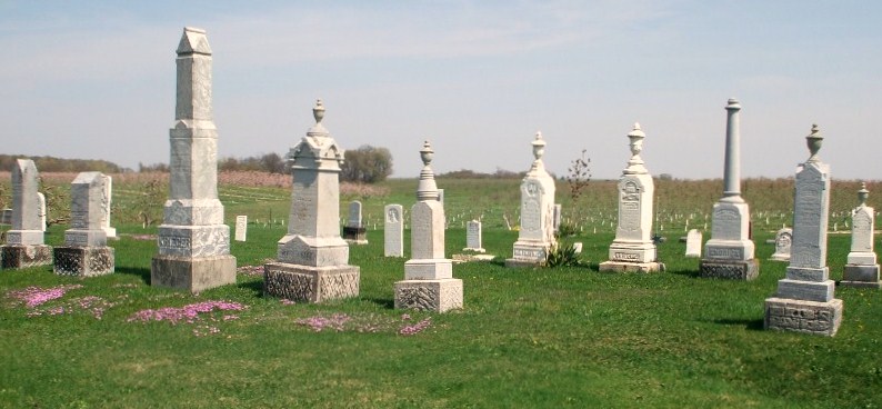
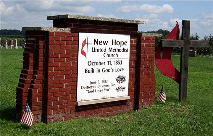
| Description | : | Located in Bainbridge Township, at the corner of North Branch Road and N. Bainbridge Center Road. New Hope Cemetery, also known as Zion Evangelical United Brethren Cemetery, was associated with the New Hope United Methodist Church until the church building burned down in 1983. On November 19, 1983, the cemetery was sold to Bainbridge Township for the sum of $1.00. The Evangelical Ecclesiastical Church was established in 1856 and it was later called the Zion Evangelical Church. This denomination merged with the United Brethren Church in 1950 and in 1968 the United Brethren merged with the Methodist... Read More |
frequently asked questions (FAQ):
-
Where is New Hope United Methodist Church Cemetery?
New Hope United Methodist Church Cemetery is located at Bainbridge Center, Berrien County ,Michigan ,USA.
-
New Hope United Methodist Church Cemetery cemetery's updated grave count on graveviews.com?
14 memorials
-
Where are the coordinates of the New Hope United Methodist Church Cemetery?
Latitude: 42.1380530
Longitude: -86.2812620
Nearby Cemetories:
1. Saint Pauls United Church of Christ Cemetery
Watervliet, Berrien County, USA
Coordinate: 42.1447222, -86.2819444
2. Saint Marys Catholic Church Cemetery
Watervliet, Berrien County, USA
Coordinate: 42.1450000, -86.2916670
3. Baptist Cemetery
Bainbridge Center, Berrien County, USA
Coordinate: 42.1455600, -86.2947300
4. Kniebes Cemetery
Coloma, Berrien County, USA
Coordinate: 42.1511002, -86.3071976
5. Bainbridge Cemetery
Bainbridge Center, Berrien County, USA
Coordinate: 42.1156006, -86.2694016
6. Byers Cemetery
Bainbridge Center, Berrien County, USA
Coordinate: 42.1156700, -86.2680820
7. Boyer Cemetery
Bainbridge Center, Berrien County, USA
Coordinate: 42.1572222, -86.3305556
8. Saint Josephs Catholic Cemetery
Watervliet, Berrien County, USA
Coordinate: 42.1852989, -86.2722015
9. Penn Yan Cemetery
Bainbridge Center, Berrien County, USA
Coordinate: 42.0868988, -86.2817001
10. Millburg Cemetery
Millburg, Berrien County, USA
Coordinate: 42.1264000, -86.3486023
11. Coloma Cemetery
Coloma, Berrien County, USA
Coordinate: 42.1860008, -86.3119965
12. Watervliet Cemetery
Watervliet, Berrien County, USA
Coordinate: 42.1886110, -86.2536110
13. Brant Cemetery
Bainbridge Township, Berrien County, USA
Coordinate: 42.0866000, -86.3197000
14. Curtis Cemetery
Hagar Township, Berrien County, USA
Coordinate: 42.1856003, -86.3544006
15. Fairview Memorial Cemetery
Watervliet, Berrien County, USA
Coordinate: 42.1969440, -86.2236110
16. Pearl Cemetery
Benton Township, Berrien County, USA
Coordinate: 42.0905991, -86.3641968
17. Zion United Church of Christ Cemetery
Eau Claire, Berrien County, USA
Coordinate: 42.0567930, -86.2369050
18. Keeler Cemetery
Keeler, Van Buren County, USA
Coordinate: 42.1129875, -86.1657715
19. Harris Cemetery
Lake Michigan Beach, Berrien County, USA
Coordinate: 42.2144012, -86.3482971
20. Dewey Lake Cemetery
Silver Creek Township, Cass County, USA
Coordinate: 42.0569077, -86.2057266
21. Pioneer Cemetery
Hartford, Van Buren County, USA
Coordinate: 42.2052200, -86.1769400
22. Maple Hill Cemetery
Hartford, Van Buren County, USA
Coordinate: 42.1980600, -86.1683300
23. North Shore Memory Gardens
Coloma, Berrien County, USA
Coordinate: 42.2024994, -86.3908005
24. Lake Shore Cemetery
Riverside, Berrien County, USA
Coordinate: 42.1669388, -86.4177780