
| Memorials | : | 4 |
| Location | : | Livingston County, USA |
| Coordinate | : | 39.8646890, -93.4205510 |
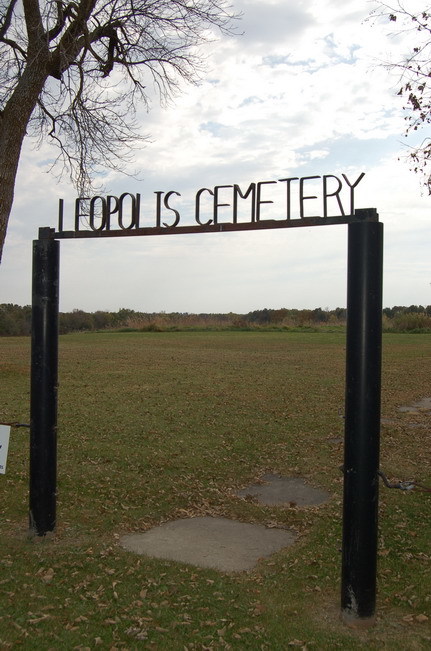
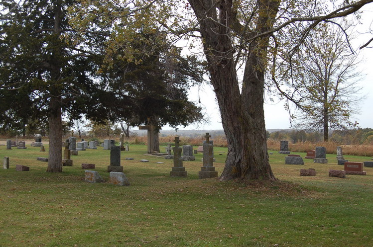
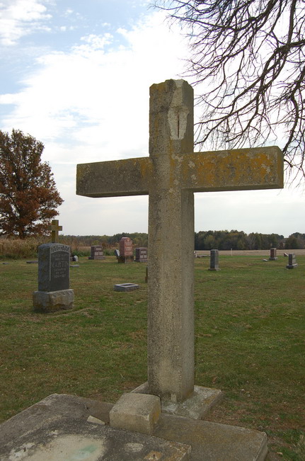
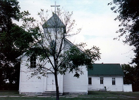
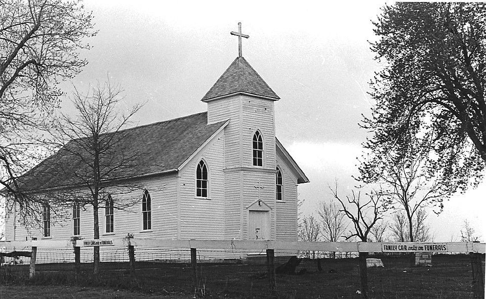
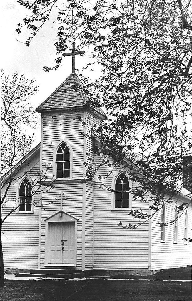
| Description | : | Take Highway US-36 to Wheeling, Missouri. Go North on Highway B for 6.1 miles (passing through Wheeling), turn left (West) on Road 220 (gravel in October 2010). Go West on Road 220 for 2 miles. After 1.2 miles, you will have to cross a one lane wooden-plank bridge. The cemetery is on the left (South) side of the road. The cemetery is well maintained. This was written in 1937: CENTENNIAL EDITION An Historical Record of Livingston County's First 100 Years HOMES IN LEOPOLIS THE FIRST CHURCHES St Patrick's Church at Leopolis is situated about eleven miles northeast of Chillicothe. ... Read More |
frequently asked questions (FAQ):
-
Where is Leopolis Cemetery?
Leopolis Cemetery is located at Livingston County ,Missouri ,USA.
-
Leopolis Cemetery cemetery's updated grave count on graveviews.com?
3 memorials
-
Where are the coordinates of the Leopolis Cemetery?
Latitude: 39.8646890
Longitude: -93.4205510


Nearby Cemetories:
1. Ricket Cemetery
Chula, Livingston County, USA
Coordinate: 39.8800011, -93.4289017
2. Ross Cemetery
Chillicothe, Livingston County, USA
Coordinate: 39.8428001, -93.4649963
3. Wallace Cemetery
Chula, Livingston County, USA
Coordinate: 39.9319000, -93.4257965
4. Plainview Cemetery
Chula, Livingston County, USA
Coordinate: 39.9291992, -93.4744034
5. Parsons Creek Cemetery
Linn County, USA
Coordinate: 39.8882800, -93.3237480
6. May Cemetery
Cream Ridge, Livingston County, USA
Coordinate: 39.9077100, -93.5124500
7. Wheeling Cemetery
Wheeling, Livingston County, USA
Coordinate: 39.7775110, -93.3888920
8. Jones Cemetery
Chillicothe, Livingston County, USA
Coordinate: 39.7982800, -93.5009700
9. Botts Cemetery
Meadville, Linn County, USA
Coordinate: 39.8361015, -93.3035965
10. Van Horne Cemetery
Livingston County, USA
Coordinate: 39.9528008, -93.3685989
11. Resthaven Memorial Gardens
Chillicothe, Livingston County, USA
Coordinate: 39.8308900, -93.5457100
12. Ward Cemetery
Farmersville, Livingston County, USA
Coordinate: 39.9324989, -93.5251999
13. A.M.E. Church Cemetery
Chillicothe, Livingston County, USA
Coordinate: 39.8036500, -93.5330400
14. Strawberry Cemetery
Linn County, USA
Coordinate: 39.8932900, -93.2860100
15. Saint Columban Catholic Cemetery
Chillicothe, Livingston County, USA
Coordinate: 39.8043700, -93.5361870
16. Meadville Cemetery
Meadville, Linn County, USA
Coordinate: 39.7928090, -93.3043960
17. Alpha Cemetery
Alpha, Grundy County, USA
Coordinate: 39.9834500, -93.4181100
18. Kessler Cemetery
Livingston County, USA
Coordinate: 39.7972069, -93.5480000
19. Bethel Cemetery
Linneus, Linn County, USA
Coordinate: 39.8818200, -93.2666500
20. Forest Park Cemetery
Chillicothe, Livingston County, USA
Coordinate: 39.8073800, -93.5575800
21. Anderson-Smith Cemetery
Chillicothe, Livingston County, USA
Coordinate: 39.8352500, -93.5828600
22. Edgewood Cemetery
Chillicothe, Livingston County, USA
Coordinate: 39.8000717, -93.5647049
23. Mount Zion Church Cemetery
Chillicothe, Livingston County, USA
Coordinate: 39.7676100, -93.5389100
24. Stucker Cemetery
Grundy County, USA
Coordinate: 39.9939003, -93.4783020