
| Memorials | : | 0 |
| Location | : | Looxahoma, Tate County, USA |
| Coordinate | : | 34.5843040, -89.8098900 |
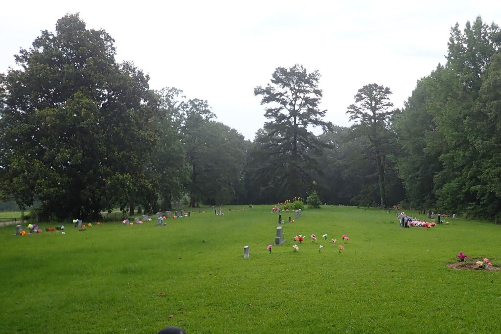
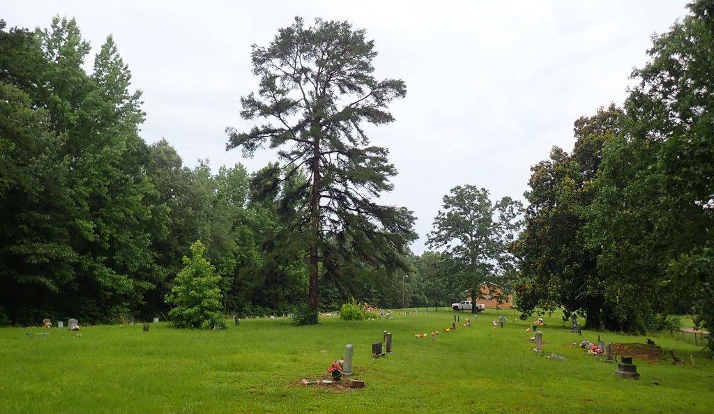
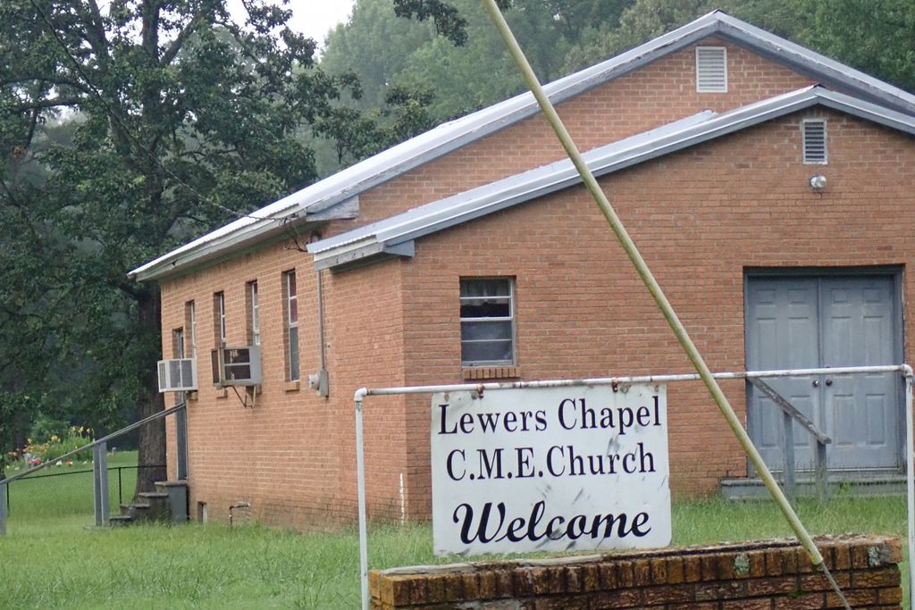
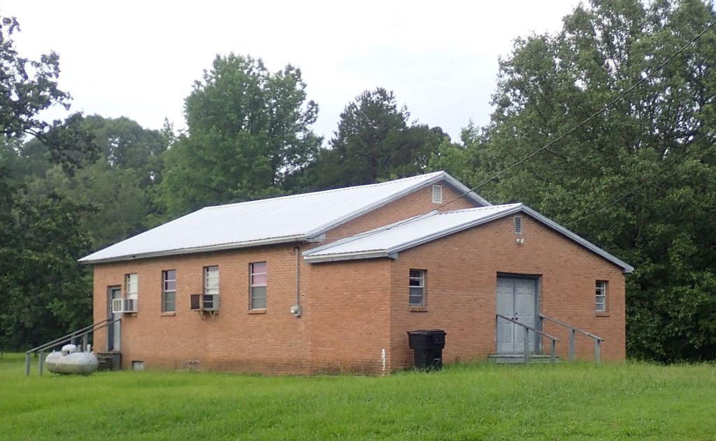
| Description | : | From the intersection of Lyles Rd. & MS-4, east of Sentabobia, travel south on Lyles Rd. for 1.0 mi.; turning east (left) onto Looxahoma-Tyro Rd., going 1.5 mi.; turning south (right) to stay on Looxahoma-Tyro Rd., going 0.4 mi.; turning south (right/straight) onto Lewers Chapel Rd., going 0.6 mi.; turning east (left) into this large 'deeded' cemetery, adjacent to the old Lewer Chapel Church building, as notated on USGS topo maps. |
frequently asked questions (FAQ):
-
Where is Lewers Chapel Cemetery?
Lewers Chapel Cemetery is located at Lewers Chapel Road Looxahoma, Tate County ,Mississippi ,USA.
-
Lewers Chapel Cemetery cemetery's updated grave count on graveviews.com?
0 memorials
-
Where are the coordinates of the Lewers Chapel Cemetery?
Latitude: 34.5843040
Longitude: -89.8098900
Nearby Cemetories:
1. Looxahoma Cemetery
Senatobia, Tate County, USA
Coordinate: 34.5980280, -89.8343410
2. Mount Vernon Church Cemetery
Looxahoma, Tate County, USA
Coordinate: 34.5765310, -89.7735120
3. Looxahoma Church of Christ Cemetery
Looxahoma, Tate County, USA
Coordinate: 34.6119930, -89.8361240
4. Brownlee Cemetery
Senatobia, Tate County, USA
Coordinate: 34.6265480, -89.8113390
5. West Looxahoma Church of Christ Cemetery
Tate County, USA
Coordinate: 34.6125120, -89.8509910
6. Zion Hill-Barr Church Cemetery
Tate County, USA
Coordinate: 34.6262520, -89.7849790
7. Mount Moriah Missionary Baptist Church Cemetery
Panola County, USA
Coordinate: 34.5345890, -89.8236370
8. Saint Maria Cemetery
Panola County, USA
Coordinate: 34.5339012, -89.8236008
9. New Zion M.B. Church Cemetery
Senatobia, Tate County, USA
Coordinate: 34.6101900, -89.8679960
10. Wright Cemetery
Looxahoma, Tate County, USA
Coordinate: 34.6291620, -89.8503950
11. Beulah Cemetery
Panola County, USA
Coordinate: 34.5275002, -89.8106003
12. House Cemetery
Barr, Tate County, USA
Coordinate: 34.6390250, -89.7852380
13. Diffee-Lowrie Cemetery
Senatobia, Tate County, USA
Coordinate: 34.5784350, -89.8808140
14. Gravel Springs Cemetery
Senatobia, Tate County, USA
Coordinate: 34.5687560, -89.8801890
15. Independent M.B. Church Cemetery
Tyro, Tate County, USA
Coordinate: 34.6020280, -89.7398360
16. Wright-Sandidge Cemetery
Tyro, Tate County, USA
Coordinate: 34.5978278, -89.7279694
17. Thyatira Sunset Cemetery
Thyatira, Tate County, USA
Coordinate: 34.6389770, -89.7572090
18. Thyatira Cemetery
Thyatira, Tate County, USA
Coordinate: 34.6393470, -89.7562520
19. Bowdre Cemetery
Senatobia, Tate County, USA
Coordinate: 34.6121280, -89.8901600
20. Ebenezer Cemetery
Panola County, USA
Coordinate: 34.5250015, -89.7600021
21. Springfield M.B. Church Cemetery
Senatobia, Tate County, USA
Coordinate: 34.5675050, -89.8974980
22. Fredonia Cemetery
Coldwater, Tate County, USA
Coordinate: 34.6588650, -89.8288760
23. Mount Patient CME Church Cemetery
Tyro, Tate County, USA
Coordinate: 34.5887370, -89.7160400
24. Tyro Church Cemetery
Tyro, Tate County, USA
Coordinate: 34.5825570, -89.7128080