
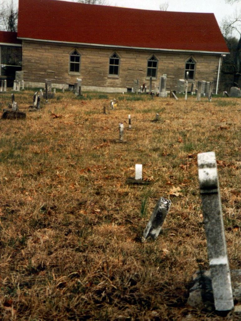
| Memorials | : | 33 |
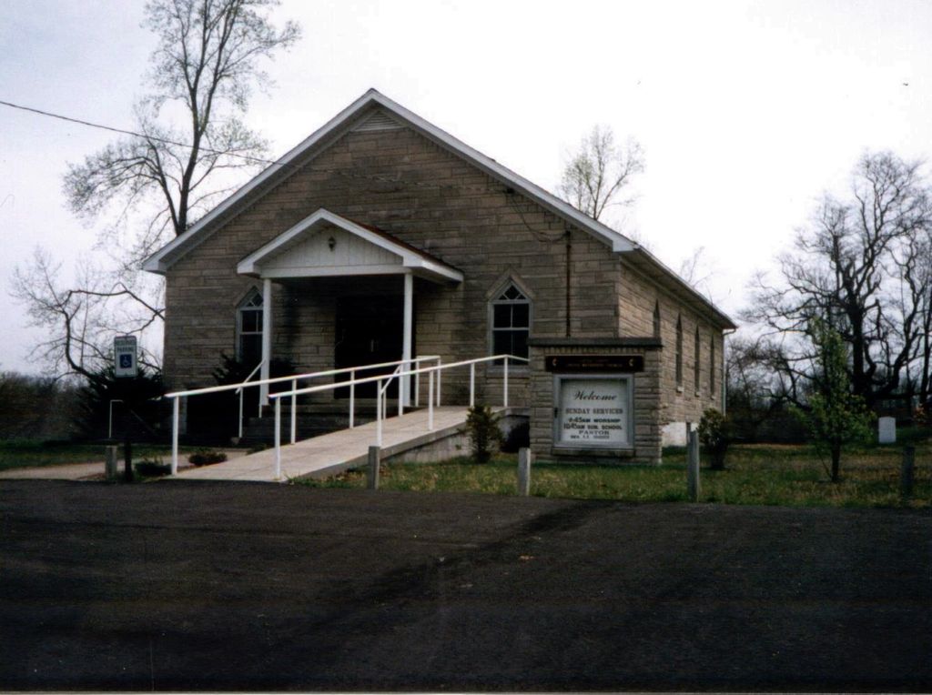
| Location | : | Clarkson, Grayson County, USA |
| Coordinate | : | 37.4854620, -86.1212950 |
| Description | : | The cemetery lies next to the Church building. It is not known when it was started, but the oldest current readable tombstone is dated 13 August 1856. |
frequently asked questions (FAQ):
-
Where is Little Clifty United Methodist Church Cemetery?
Little Clifty United Methodist Church Cemetery is located at 1187 Millerstown Road Clarkson, Grayson County ,Kentucky , 42726-8125USA.
-
Little Clifty United Methodist Church Cemetery cemetery's updated grave count on graveviews.com?
33 memorials
-
Where are the coordinates of the Little Clifty United Methodist Church Cemetery?
Latitude: 37.4854620
Longitude: -86.1212950
Nearby Cemetories:
1. John Griffin Cemetery
Grayson County, USA
Coordinate: 37.5068750, -86.1104540
2. Mount Moriah Cemetery
Grayson County, USA
Coordinate: 37.4661080, -86.1403670
3. Little Flock Missionary Baptist Church Cemetery
Grayson County, USA
Coordinate: 37.4511330, -86.1127150
4. New Hope Church Of Christ Cemetery
Big Clifty, Grayson County, USA
Coordinate: 37.5222300, -86.1076070
5. Antioch Christian Church Cemetery
Big Clifty, Grayson County, USA
Coordinate: 37.5240780, -86.1109310
6. Mount Zion Christian Church Cemetery
Grayson County, USA
Coordinate: 37.4749410, -86.0721560
7. Oak Grove Cemetery
Leitchfield, Grayson County, USA
Coordinate: 37.4610040, -86.1735050
8. Skaggs Cemetery
Millerstown, Grayson County, USA
Coordinate: 37.4302710, -86.1421900
9. Carbytown Cemetery
Hardin County, USA
Coordinate: 37.4632988, -86.0528030
10. Rock Creek Church Cemetery
Rock Creek, Grayson County, USA
Coordinate: 37.4322150, -86.1572220
11. Akers Valley Catholic Cemetery
Flint Hill, Hardin County, USA
Coordinate: 37.4886920, -86.0446040
12. Saint Mary Cemetery
Big Clifty, Grayson County, USA
Coordinate: 37.5493460, -86.1456600
13. Cedar Hill Cemetery
Big Clifty, Grayson County, USA
Coordinate: 37.5497017, -86.1453018
14. Millerstown Baptist Church Cemetery
Millerstown, Grayson County, USA
Coordinate: 37.4460500, -86.0529390
15. Petty Cemetery
Grayson County, USA
Coordinate: 37.5505981, -86.1444016
16. Petty Cemetery
Big Clifty, Grayson County, USA
Coordinate: 37.5503360, -86.1469590
17. Old Lone Oak Cemetery
Lone Oak, Grayson County, USA
Coordinate: 37.4294100, -86.0677050
18. Lone Oak Church Cemetery
Lone Oak, Grayson County, USA
Coordinate: 37.4246200, -86.0724900
19. Lone Oak Cemetery New
Lone Oak, Grayson County, USA
Coordinate: 37.4249590, -86.0716630
20. Clarkson Cemetery
Clarkson, Grayson County, USA
Coordinate: 37.4967030, -86.2146150
21. Pleasant Valley Cemetery
Grayson County, USA
Coordinate: 37.4113020, -86.0962890
22. Saint Elizabeth Cemetery
Clarkson, Grayson County, USA
Coordinate: 37.5031013, -86.2193985
23. Saint Paul Catholic Cemetery
Saint Paul, Grayson County, USA
Coordinate: 37.5391998, -86.1980972
24. Akers Family Cemetery
Summit, Hardin County, USA
Coordinate: 37.5673190, -86.1124840