
| Memorials | : | 0 |
| Location | : | Bacon Level, Randolph County, USA |
| Coordinate | : | 33.1375200, -85.3103400 |
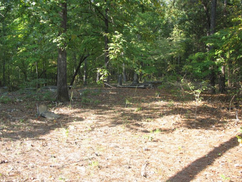
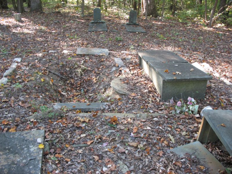
| Description | : | Township 22, Range 13, Section 5 Randolph County, Alabama On Hwy 22, Go 2.8 miles East of Roanoke, Ala, take County Road 16 about 1.8 miles south. Turn right at the first dirt road, the Cemetery is about .2 mile on the right side of road. This cemetery near the town of Welch used to be in the yard of the old Salem Primitive Baptist Church, which disbanded in the early 1900's. At that time, the congregation split amongst neighboring churches at Mt. Pisgah and Lanett, and the cemetery fell into disuse. It sits about 100 feet from a dirt road leading to... Read More |
frequently asked questions (FAQ):
-
Where is Old Salem Primitive Baptist Cemetery?
Old Salem Primitive Baptist Cemetery is located at Bacon Level, Randolph County ,Alabama ,USA.
-
Old Salem Primitive Baptist Cemetery cemetery's updated grave count on graveviews.com?
0 memorials
-
Where are the coordinates of the Old Salem Primitive Baptist Cemetery?
Latitude: 33.1375200
Longitude: -85.3103400
Nearby Cemetories:
1. Randolph Memory Gardens
Rock Mills, Randolph County, USA
Coordinate: 33.1535988, -85.3107986
2. Rock Mills Missionary Baptist Church Cemetery
Randolph County, USA
Coordinate: 33.1570530, -85.3077420
3. Fellowship Baptist Church Cemetery
Bacon Level, Randolph County, USA
Coordinate: 33.1270650, -85.2868900
4. Rock Mills Cemetery
Rock Mills, Randolph County, USA
Coordinate: 33.1644300, -85.2848000
5. Wehadkee Primitive Baptist Church Cemetery
Rock Mills, Randolph County, USA
Coordinate: 33.1694120, -85.2806240
6. Center Chapel Baptist Church Cemetery
Randolph County, USA
Coordinate: 33.1735460, -85.3333320
7. Booger Hill Cemetery
Roanoke, Randolph County, USA
Coordinate: 33.1481018, -85.3610992
8. East Roanoke Cemetery
Roanoke, Randolph County, USA
Coordinate: 33.1432991, -85.3644028
9. Bethany Lime Cemetery
Randolph County, USA
Coordinate: 33.1579680, -85.2596960
10. Cedarwood Cemetery
Roanoke, Randolph County, USA
Coordinate: 33.1519012, -85.3681030
11. Lanes Chapel Methodist Church Cemetery
Roanoke, Randolph County, USA
Coordinate: 33.1129210, -85.3645760
12. Littlefield Cemetery
Stroud, Chambers County, USA
Coordinate: 33.0853930, -85.3176780
13. Roanoke Baptist Church Cemetery
Roanoke, Randolph County, USA
Coordinate: 33.1506600, -85.3730260
14. Macedonia Cemetery
Roanoke, Randolph County, USA
Coordinate: 33.1802040, -85.3505050
15. Forest Home Christian Church Cemetery
Springfield, Randolph County, USA
Coordinate: 33.1927400, -85.3155500
16. Bethel Baptist Church Cemetery
Chambers County, USA
Coordinate: 33.0872002, -85.3463974
17. Pike Family Cemetery
Randolph County, USA
Coordinate: 33.1960270, -85.3199710
18. Stephens Family Cemetery
Stroud, Chambers County, USA
Coordinate: 33.0767600, -85.3129300
19. Lebanon Christian Church Cemetery
Springfield, Randolph County, USA
Coordinate: 33.1897400, -85.3500700
20. Skyview Memorial Garden
Five Points, Chambers County, USA
Coordinate: 33.0731010, -85.3368988
21. Pleasant Grove Cemetery
Heard County, USA
Coordinate: 33.1528015, -85.2294006
22. Mount Pisgah Baptist Church Cemetery
Roanoke, Randolph County, USA
Coordinate: 33.1592510, -85.3901760
23. Pleasant Grove Church Cemetery
Heard County, USA
Coordinate: 33.1535988, -85.2266998
24. Peace and Goodwill Baptist Church Cemetery
Randolph County, USA
Coordinate: 33.1240270, -85.3954800