| Memorials | : | 0 |
| Location | : | White Store Township, Anson County, USA |
| Coordinate | : | 34.8521805, -80.2727661 |
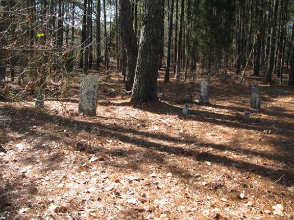
| Description | : | From Wadesboro, N.C. take Highway 109 south about 10 miles. Turn right on Long Pine Church Road. Turn right on Austin Road. Cemetery is on the right in the woods, but close to the road about 2 miles down. |
frequently asked questions (FAQ):
-
Where is Lockhart-Redfearn Cemetery?
Lockhart-Redfearn Cemetery is located at White Store Township, Anson County ,North Carolina ,USA.
-
Lockhart-Redfearn Cemetery cemetery's updated grave count on graveviews.com?
0 memorials
-
Where are the coordinates of the Lockhart-Redfearn Cemetery?
Latitude: 34.8521805
Longitude: -80.2727661
Nearby Cemetories:
1. Redfearn Cemetery
White Store Township, Anson County, USA
Coordinate: 34.8482094, -80.2799149
2. Collins Cemetery
White Store Township, Anson County, USA
Coordinate: 34.8569540, -80.2646970
3. Ellen Grove Missionary Baptist Church Cemetery
White Store Township, Anson County, USA
Coordinate: 34.8430138, -80.2746201
4. Rorie Cemetery
White Store Township, Anson County, USA
Coordinate: 34.8513010, -80.2525090
5. Huntley Cemetery
White Store Township, Anson County, USA
Coordinate: 34.8659070, -80.2583430
6. Lockhart Cemetery
Anson County, USA
Coordinate: 34.8597580, -80.2965700
7. Mount Olive Baptist Church Cemetery
White Store Township, Anson County, USA
Coordinate: 34.8681560, -80.2922430
8. Chambers Cemetery
White Store Township, Anson County, USA
Coordinate: 34.8705292, -80.2947617
9. Meltonville Baptist Church Cemetery
White Store Township, Anson County, USA
Coordinate: 34.8751050, -80.2914120
10. Gulledge Cemetery
White Store Township, Anson County, USA
Coordinate: 34.8834496, -80.2495880
11. Gulledge Cemetery
White Store Township, Anson County, USA
Coordinate: 34.8821640, -80.2390366
12. Faulkner Cemetery
White Store Township, Anson County, USA
Coordinate: 34.8852620, -80.3074190
13. Rushing Cemetery
Union County, USA
Coordinate: 34.8873040, -80.3153690
14. Long Pine United Methodist Church Cemetery
Long Pine, Anson County, USA
Coordinate: 34.8237038, -80.2201080
15. Horne Family Cemetery
Chesterfield County, USA
Coordinate: 34.8107860, -80.3114190
16. Redfearn Cemetery
White Store Township, Anson County, USA
Coordinate: 34.8831670, -80.2186670
17. Antioch Methodist Church Cemetery
Hornsboro, Chesterfield County, USA
Coordinate: 34.7971992, -80.2742004
18. Huntley Gulledge Cemetery
Monroe, Union County, USA
Coordinate: 34.8732160, -80.3360240
19. Long Pine Baptist Church Cemetery
Long Pine, Anson County, USA
Coordinate: 34.8240929, -80.2131348
20. Barrett Cemetery
White Store Township, Anson County, USA
Coordinate: 34.9109192, -80.2752991
21. Union Methodist Church Cemetery
White Store Township, Anson County, USA
Coordinate: 34.8811188, -80.2098846
22. Watson Cemetery
Mount Croghan, Chesterfield County, USA
Coordinate: 34.8075580, -80.2188800
23. Mount Moriah Baptist Church Cemetery
Marshville, Union County, USA
Coordinate: 34.8148000, -80.3364000
24. Salem Presbyterian Church Cemetery
Pageland, Chesterfield County, USA
Coordinate: 34.8122344, -80.3427844

