
| Memorials | : | 0 |
| Location | : | Hornsboro, Chesterfield County, USA |
| Coordinate | : | 34.7971992, -80.2742004 |
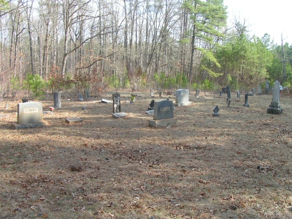
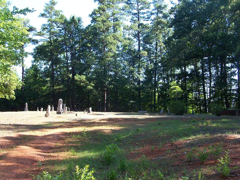
| Description | : | Directions: From Mt. Croghan, take Hwy. 9 West. Go 1 mile to Hornsboro Road on the right. Take a right onto Hornsboro Road. Go approximately 3 miles. Cemetery is in the woods on the right side of road at old church site (church is no longer there). There is a gate to this area but it is rarely locked. |
frequently asked questions (FAQ):
-
Where is Antioch Methodist Church Cemetery?
Antioch Methodist Church Cemetery is located at Mt Croghan-Hornsboro RD Hornsboro, Chesterfield County ,South Carolina ,USA.
-
Antioch Methodist Church Cemetery cemetery's updated grave count on graveviews.com?
0 memorials
-
Where are the coordinates of the Antioch Methodist Church Cemetery?
Latitude: 34.7971992
Longitude: -80.2742004

Nearby Cemetories:
1. Center Grove Baptist Church
Mount Croghan, Chesterfield County, USA
Coordinate: 34.7682330, -80.2704480
2. Horne Family Cemetery
Chesterfield County, USA
Coordinate: 34.8107860, -80.3114190
3. Oro United Methodist Church
Pageland, Chesterfield County, USA
Coordinate: 34.7811170, -80.3157230
4. Lamb of God Outreach Ministries Church Cemetery
Mount Croghan, Chesterfield County, USA
Coordinate: 34.7699190, -80.2325430
5. Ellen Grove Missionary Baptist Church Cemetery
White Store Township, Anson County, USA
Coordinate: 34.8430138, -80.2746201
6. Gum Springs Baptist Church Cemetery
Pageland, Chesterfield County, USA
Coordinate: 34.7583780, -80.3050720
7. Watson Cemetery
Mount Croghan, Chesterfield County, USA
Coordinate: 34.8075580, -80.2188800
8. Mount Croghan Memorial Park
Mount Croghan, Chesterfield County, USA
Coordinate: 34.7686005, -80.2244034
9. Mount Croghan United Methodist Church Cemetery
Mount Croghan, Chesterfield County, USA
Coordinate: 34.7686430, -80.2240780
10. Redfearn Cemetery
White Store Township, Anson County, USA
Coordinate: 34.8482094, -80.2799149
11. Long Pine United Methodist Church Cemetery
Long Pine, Anson County, USA
Coordinate: 34.8237038, -80.2201080
12. Elizabeth Baptist Church Cemetery
Mount Croghan, Chesterfield County, USA
Coordinate: 34.7806015, -80.2130966
13. Mount Moriah Baptist Church Cemetery
Marshville, Union County, USA
Coordinate: 34.8148000, -80.3364000
14. Lockhart-Redfearn Cemetery
White Store Township, Anson County, USA
Coordinate: 34.8521805, -80.2727661
15. Piney Grove A.M.E. Zion Church Cemetery
Mount Croghan, Chesterfield County, USA
Coordinate: 34.7406480, -80.2731540
16. Long Pine Baptist Church Cemetery
Long Pine, Anson County, USA
Coordinate: 34.8240929, -80.2131348
17. Rorie Cemetery
White Store Township, Anson County, USA
Coordinate: 34.8513010, -80.2525090
18. Salem Presbyterian Church Cemetery
Pageland, Chesterfield County, USA
Coordinate: 34.8122344, -80.3427844
19. Collins Cemetery
White Store Township, Anson County, USA
Coordinate: 34.8569540, -80.2646970
20. Providence Baptist Church Cemetery
Chesterfield County, USA
Coordinate: 34.7703640, -80.3404850
21. Gulledge Cemetery
Mount Croghan, Chesterfield County, USA
Coordinate: 34.7516890, -80.2247430
22. Lockhart Cemetery
Anson County, USA
Coordinate: 34.8597580, -80.2965700
23. Timmonsville Baptist Church Cemetery
Mount Croghan, Chesterfield County, USA
Coordinate: 34.7825050, -80.1944070
24. Huntley Cemetery
White Store Township, Anson County, USA
Coordinate: 34.8659070, -80.2583430