
| Memorials | : | 0 |
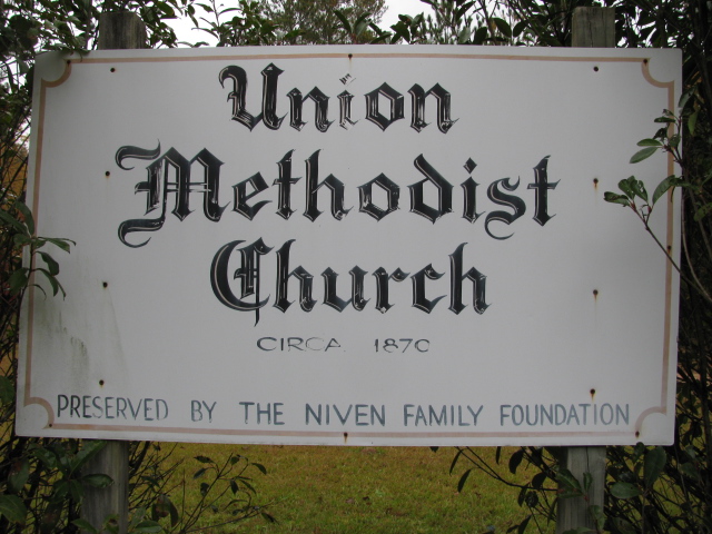
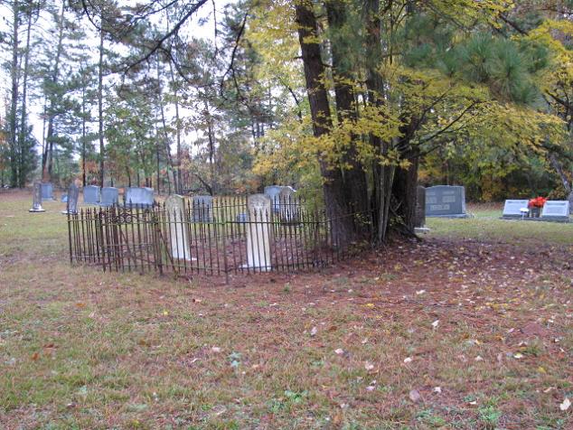
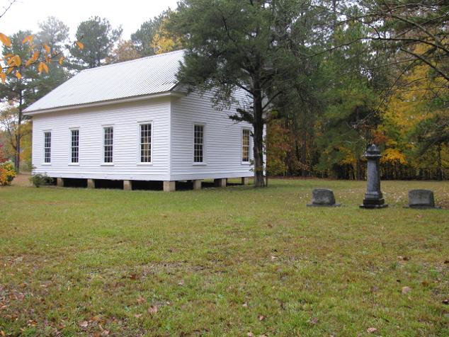
| Location | : | White Store Township, Anson County, USA |
| Coordinate | : | 34.8811188, -80.2098846 |
| Description | : | Highway 109 south from Wadesboro, N.C. about 9 miles. Turn right on Union Church Road (1003). Church is about 2 miles on the right. Note: This is a complete listing. |
frequently asked questions (FAQ):
-
Where is Union Methodist Church Cemetery?
Union Methodist Church Cemetery is located at White Store Township, Anson County ,North Carolina ,USA.
-
Union Methodist Church Cemetery cemetery's updated grave count on graveviews.com?
0 memorials
-
Where are the coordinates of the Union Methodist Church Cemetery?
Latitude: 34.8811188
Longitude: -80.2098846
Nearby Cemetories:
1. Redfearn Cemetery
White Store Township, Anson County, USA
Coordinate: 34.8831670, -80.2186670
2. Gulledge Cemetery
White Store Township, Anson County, USA
Coordinate: 34.8821640, -80.2390366
3. McGregor Cemetery
White Store Township, Anson County, USA
Coordinate: 34.8868904, -80.1724396
4. Gulledge Cemetery
White Store Township, Anson County, USA
Coordinate: 34.8834496, -80.2495880
5. Gordon Mountain Cemetery
Wadesboro Township, Anson County, USA
Coordinate: 34.9162604, -80.2001372
6. Rev. Joel Gulledge Cemetery
Deep Creek, Anson County, USA
Coordinate: 34.8620071, -80.1693420
7. Poplar Hill Missionary Baptist Church Cemetery
Polkton, Anson County, USA
Coordinate: 34.9182590, -80.2223500
8. Huntley Cemetery
White Store Township, Anson County, USA
Coordinate: 34.8659070, -80.2583430
9. West Deep Creek Missionary Baptist Church Cemetery
Deep Creek, Anson County, USA
Coordinate: 34.8592380, -80.1647100
10. Elisha Gulledge Cemetery
Deep Creek, Anson County, USA
Coordinate: 34.8441124, -80.1828995
11. Porter Cemetery
Deep Creek, Anson County, USA
Coordinate: 34.8510200, -80.1717210
12. Rorie Cemetery
White Store Township, Anson County, USA
Coordinate: 34.8513010, -80.2525090
13. Chewning Cemetery
Lowrys, Anson County, USA
Coordinate: 34.8983231, -80.1577988
14. John Horne Cemetery
White Store Township, Anson County, USA
Coordinate: 34.9261230, -80.1853470
15. Thomas Huntley Gulledge Cemetery
Deep Creek, Anson County, USA
Coordinate: 34.8483086, -80.1639938
16. Deep Creek Baptist Church Cemetery
Deep Creek, Anson County, USA
Coordinate: 34.8543210, -80.1575160
17. Collins Cemetery
White Store Township, Anson County, USA
Coordinate: 34.8569540, -80.2646970
18. Webb Cemetery
Anson County, USA
Coordinate: 34.8598320, -80.1532240
19. Tillman Cemetery
Travis, Anson County, USA
Coordinate: 34.9068350, -80.1492490
20. Gaddy Cemetery
Deep Creek, Anson County, USA
Coordinate: 34.8924332, -80.1427307
21. Long Pine Baptist Church Cemetery
Long Pine, Anson County, USA
Coordinate: 34.8240929, -80.2131348
22. Poplar Hill United Methodist Church Cemetery
Polkton, Anson County, USA
Coordinate: 34.9383230, -80.2031990
23. Long Pine United Methodist Church Cemetery
Long Pine, Anson County, USA
Coordinate: 34.8237038, -80.2201080
24. Gulledge-Webb Cemetery
Deep Creek, Anson County, USA
Coordinate: 34.8697357, -80.1394882