
| Memorials | : | 0 |
| Location | : | White Store Township, Anson County, USA |
| Coordinate | : | 34.8569540, -80.2646970 |
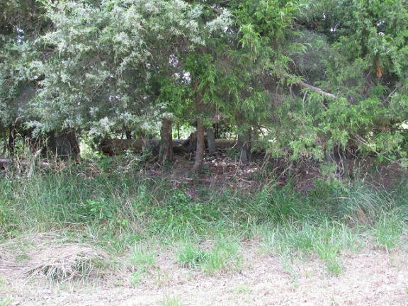
| Description | : | Take highway 109 south from Wadesboro, N.C. about 10 miles. Turn right on Union Church Road. Go about 3 miles and turn left on Austin Road. Turn left on Tice Road. Cemetery is in a clump of trees on your left in the field. |
frequently asked questions (FAQ):
-
Where is Collins Cemetery?
Collins Cemetery is located at Tice Road White Store Township, Anson County ,North Carolina ,USA.
-
Collins Cemetery cemetery's updated grave count on graveviews.com?
0 memorials
-
Where are the coordinates of the Collins Cemetery?
Latitude: 34.8569540
Longitude: -80.2646970
Nearby Cemetories:
1. Lockhart-Redfearn Cemetery
White Store Township, Anson County, USA
Coordinate: 34.8521805, -80.2727661
2. Huntley Cemetery
White Store Township, Anson County, USA
Coordinate: 34.8659070, -80.2583430
3. Rorie Cemetery
White Store Township, Anson County, USA
Coordinate: 34.8513010, -80.2525090
4. Redfearn Cemetery
White Store Township, Anson County, USA
Coordinate: 34.8482094, -80.2799149
5. Ellen Grove Missionary Baptist Church Cemetery
White Store Township, Anson County, USA
Coordinate: 34.8430138, -80.2746201
6. Mount Olive Baptist Church Cemetery
White Store Township, Anson County, USA
Coordinate: 34.8681560, -80.2922430
7. Lockhart Cemetery
Anson County, USA
Coordinate: 34.8597580, -80.2965700
8. Chambers Cemetery
White Store Township, Anson County, USA
Coordinate: 34.8705292, -80.2947617
9. Meltonville Baptist Church Cemetery
White Store Township, Anson County, USA
Coordinate: 34.8751050, -80.2914120
10. Gulledge Cemetery
White Store Township, Anson County, USA
Coordinate: 34.8834496, -80.2495880
11. Gulledge Cemetery
White Store Township, Anson County, USA
Coordinate: 34.8821640, -80.2390366
12. Faulkner Cemetery
White Store Township, Anson County, USA
Coordinate: 34.8852620, -80.3074190
13. Redfearn Cemetery
White Store Township, Anson County, USA
Coordinate: 34.8831670, -80.2186670
14. Long Pine United Methodist Church Cemetery
Long Pine, Anson County, USA
Coordinate: 34.8237038, -80.2201080
15. Union Methodist Church Cemetery
White Store Township, Anson County, USA
Coordinate: 34.8811188, -80.2098846
16. Rushing Cemetery
Union County, USA
Coordinate: 34.8873040, -80.3153690
17. Long Pine Baptist Church Cemetery
Long Pine, Anson County, USA
Coordinate: 34.8240929, -80.2131348
18. Barrett Cemetery
White Store Township, Anson County, USA
Coordinate: 34.9109192, -80.2752991
19. Horne Family Cemetery
Chesterfield County, USA
Coordinate: 34.8107860, -80.3114190
20. Antioch Methodist Church Cemetery
Hornsboro, Chesterfield County, USA
Coordinate: 34.7971992, -80.2742004
21. Huntley Gulledge Cemetery
Monroe, Union County, USA
Coordinate: 34.8732160, -80.3360240
22. Watson Cemetery
Mount Croghan, Chesterfield County, USA
Coordinate: 34.8075580, -80.2188800
23. Elisha Gulledge Cemetery
Deep Creek, Anson County, USA
Coordinate: 34.8441124, -80.1828995
24. Poplar Hill Missionary Baptist Church Cemetery
Polkton, Anson County, USA
Coordinate: 34.9182590, -80.2223500