
| Memorials | : | 28 |
| Location | : | Selma, Clark County, USA |
| Coordinate | : | 39.7908110, -83.7166970 |
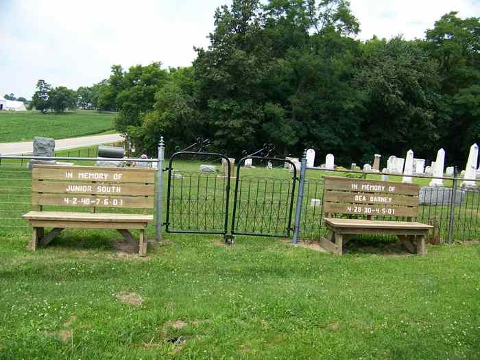
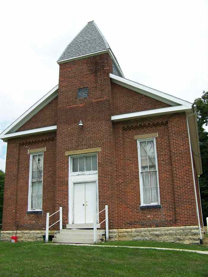
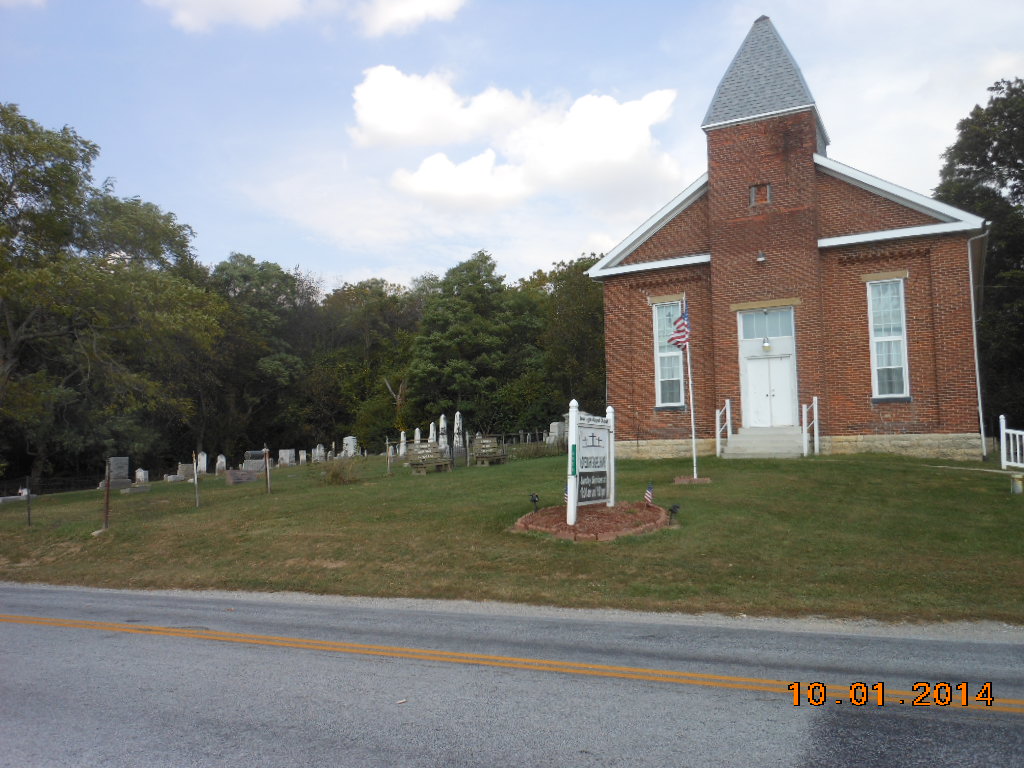
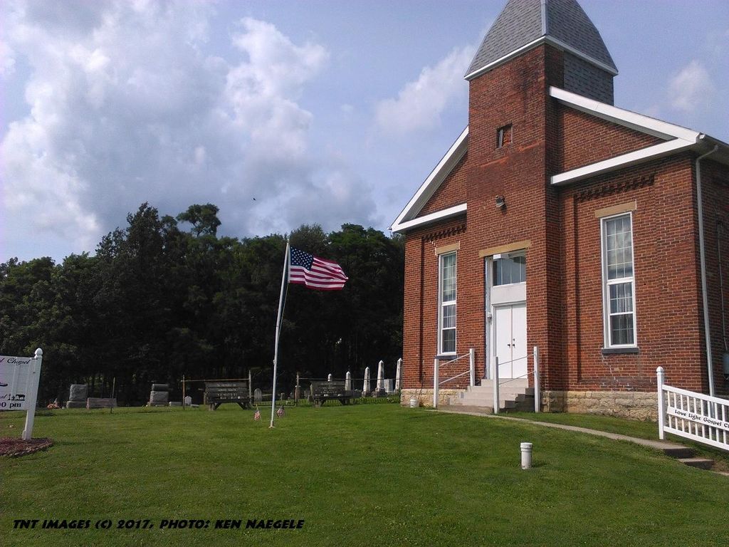
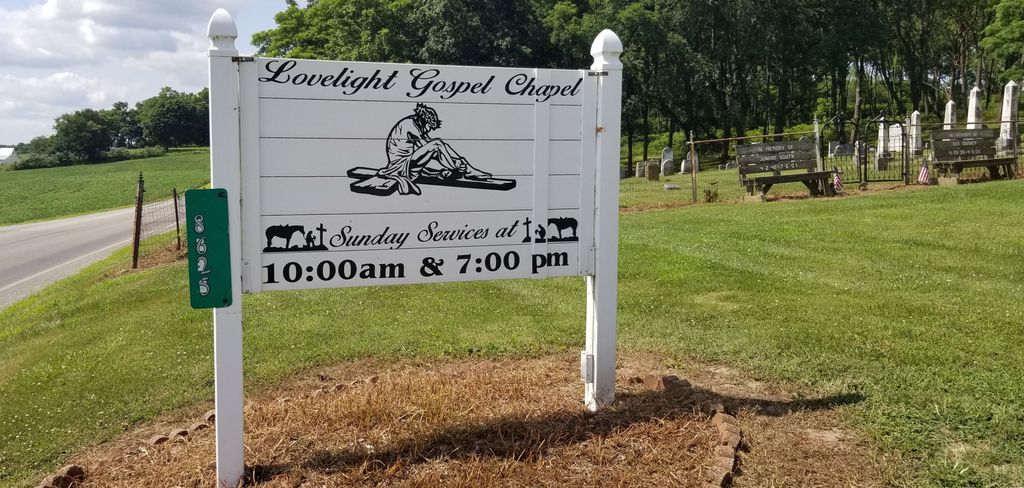
| Description | : | Selma Methodist Episcopal Cemetery is located on the north side of Selma Pike, about ¼ mile northwest of US-42, in Selma, Ohio (Madison Township, Clark County). The church is now called Love Light Gospel Chapel. The cemetery is located in Madison Township, Clark County, Ohio, and is # 1675 (Selma Methodist Episcopal Cemetery) in “Ohio Cemeteries 1803-2003”, compiled by the Ohio Genealogical Society. The U.S. Geological Survey (USGS) Geographic Names Information System (GNIS) feature ID for the cemetery is 1961175 (Selma Methodist Episcopal Cemetery). |
frequently asked questions (FAQ):
-
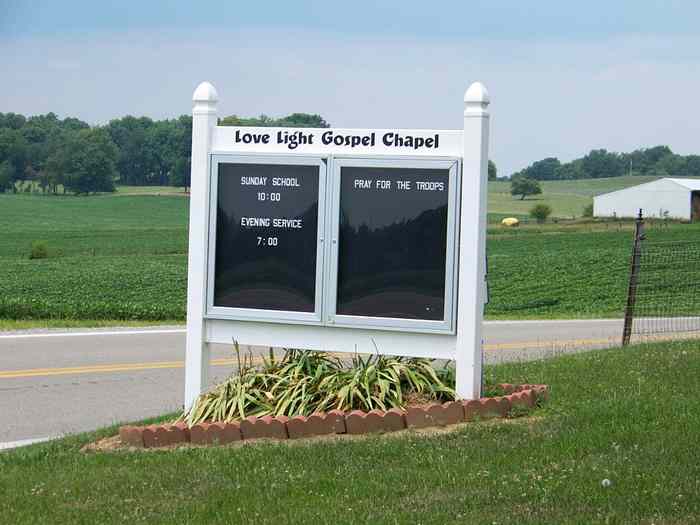
Where is Love Light Gospel Chapel Cemetery?
Love Light Gospel Chapel Cemetery is located at 8625 Selma Pike Selma, Clark County ,Ohio , 45368USA.
-
Love Light Gospel Chapel Cemetery cemetery's updated grave count on graveviews.com?
28 memorials
-
Where are the coordinates of the Love Light Gospel Chapel Cemetery?
Latitude: 39.7908110
Longitude: -83.7166970
Nearby Cemetories:
1. Cook Family Cemetery
Selma, Clark County, USA
Coordinate: 39.7911360, -83.7163580
2. Green Plain Cemetery #2
Selma, Clark County, USA
Coordinate: 39.7850860, -83.7055440
3. Bloxom Cemetery
Clark County, USA
Coordinate: 39.7841988, -83.7277985
4. Old Quaker Cemetery
South Charleston, Clark County, USA
Coordinate: 39.8102989, -83.6900024
5. Buffenbarger Cemetery
Pitchin, Clark County, USA
Coordinate: 39.8372002, -83.7121964
6. Pleasant Grove Baptist Cemetery
Clark County, USA
Coordinate: 39.8457200, -83.7292900
7. Brock Cemetery (Defunct)
Gladstone, Greene County, USA
Coordinate: 39.7464970, -83.6702420
8. Andrews Cemetery
Grape Grove, Greene County, USA
Coordinate: 39.7316720, -83.7099830
9. Pitchin Methodist Church Cemetery
Pitchin, Clark County, USA
Coordinate: 39.8408160, -83.7591690
10. Bethel Methodist Cemetery
Ross Township, Greene County, USA
Coordinate: 39.7262730, -83.6928210
11. Lawrence Cemetery
Ross Township, Greene County, USA
Coordinate: 39.7251770, -83.7405660
12. Methodist Cemetery
South Charleston, Clark County, USA
Coordinate: 39.8250750, -83.6336800
13. Garlough Cemetery
Pitchin, Clark County, USA
Coordinate: 39.8563995, -83.7592010
14. Greenlawn Cemetery
South Charleston, Clark County, USA
Coordinate: 39.8342018, -83.6350021
15. Baptist Cemetery
Cedarville, Greene County, USA
Coordinate: 39.7355240, -83.7877370
16. Grape Grove Cemetery
Jamestown, Greene County, USA
Coordinate: 39.7182999, -83.6686020
17. North Cemetery
Cedarville, Greene County, USA
Coordinate: 39.7546997, -83.8116989
18. Saint Charles Cemetery
South Charleston, Clark County, USA
Coordinate: 39.8316994, -83.6247025
19. Greenwood Cemetery
Jamestown, Greene County, USA
Coordinate: 39.7056700, -83.7052060
20. Davisson-Ellsworth Cemetery
South Charleston, Clark County, USA
Coordinate: 39.8288410, -83.6153980
21. Clifton Union Cemetery
Miami Township, Greene County, USA
Coordinate: 39.8012000, -83.8301000
22. Steele Cemetery
Springfield, Clark County, USA
Coordinate: 39.8702510, -83.7698680
23. Lisbon Cemetery
Lisbon, Clark County, USA
Coordinate: 39.8591995, -83.6393967
24. Paullin Cemetery
Jamestown, Greene County, USA
Coordinate: 39.6985080, -83.7126310