
| Memorials | : | 10 |
| Location | : | South Charleston, Clark County, USA |
| Coordinate | : | 39.8250750, -83.6336800 |
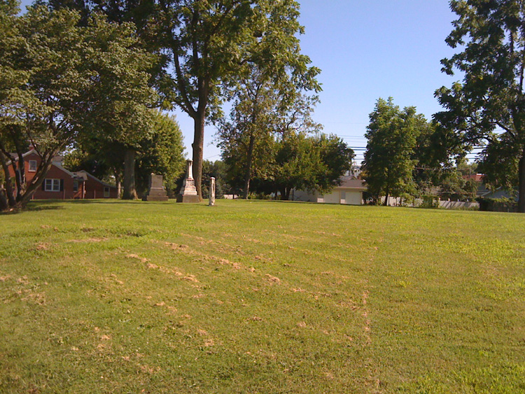
| Description | : | This cemetery, behind the Methodist Church on Church Street, served the community from pioneer days until the opening of the larger Greenlawn Cemetery in the 1880s. Most monuments and burials were moved, but as it was at the cost of the families, those who had moved away may not have been made aware. Most stones are gone, but it is presumed that many early residents who were not moved to Greenlawn remain here, most in graves now unmarked. In the journal Genealogy, A Journal of American Ancestry, vol. 3 (1913-4), ed. Lyman Horace Weeks, New York 1913, p. 31 (Apr 1914),... Read More |
frequently asked questions (FAQ):
-
Where is Methodist Cemetery?
Methodist Cemetery is located at South Charleston, Clark County ,Ohio ,USA.
-
Methodist Cemetery cemetery's updated grave count on graveviews.com?
10 memorials
-
Where are the coordinates of the Methodist Cemetery?
Latitude: 39.8250750
Longitude: -83.6336800
Nearby Cemetories:
1. Greenlawn Cemetery
South Charleston, Clark County, USA
Coordinate: 39.8342018, -83.6350021
2. Saint Charles Cemetery
South Charleston, Clark County, USA
Coordinate: 39.8316994, -83.6247025
3. Davisson-Ellsworth Cemetery
South Charleston, Clark County, USA
Coordinate: 39.8288410, -83.6153980
4. Lisbon Cemetery
Lisbon, Clark County, USA
Coordinate: 39.8591995, -83.6393967
5. Old Quaker Cemetery
South Charleston, Clark County, USA
Coordinate: 39.8102989, -83.6900024
6. Williams Chapel Cemetery
Madison County, USA
Coordinate: 39.8497009, -83.5603027
7. Buffenbarger Cemetery
Pitchin, Clark County, USA
Coordinate: 39.8372002, -83.7121964
8. Green Plain Cemetery #2
Selma, Clark County, USA
Coordinate: 39.7850860, -83.7055440
9. Correl Cemetery
Madison County, USA
Coordinate: 39.7902985, -83.5539017
10. Cook Family Cemetery
Selma, Clark County, USA
Coordinate: 39.7911360, -83.7163580
11. Love Light Gospel Chapel Cemetery
Selma, Clark County, USA
Coordinate: 39.7908110, -83.7166970
12. Plattsburg Cemetery
Plattsburg, Clark County, USA
Coordinate: 39.8939476, -83.6038132
13. Pleasant Grove Baptist Cemetery
Clark County, USA
Coordinate: 39.8457200, -83.7292900
14. Pancake Cemetery
South Solon, Madison County, USA
Coordinate: 39.7655983, -83.5678024
15. Wraggs Cemetery
Clark County, USA
Coordinate: 39.9028015, -83.6667023
16. Bloxom Cemetery
Clark County, USA
Coordinate: 39.7841988, -83.7277985
17. Fletcher Chapel Cemetery
Harmony, Clark County, USA
Coordinate: 39.8936005, -83.6956024
18. Brock Cemetery (Defunct)
Gladstone, Greene County, USA
Coordinate: 39.7464970, -83.6702420
19. South Solon Cemetery
South Solon, Madison County, USA
Coordinate: 39.7352982, -83.6166992
20. Goodfellow Cemetery
Harmony, Clark County, USA
Coordinate: 39.9146620, -83.6556300
21. Rose Hill Burial Park
Springfield, Clark County, USA
Coordinate: 39.8903008, -83.7192001
22. Linson Cemetery
Madison County, USA
Coordinate: 39.7723600, -83.5336000
23. Thomas Cemetery
South Solon, Madison County, USA
Coordinate: 39.7378006, -83.5899963
24. Wilson Chapel Cemetery
Plattsburg, Clark County, USA
Coordinate: 39.8981018, -83.5547028