
| Memorials | : | 36 |
| Location | : | South Charleston, Clark County, USA |
| Coordinate | : | 39.8102989, -83.6900024 |
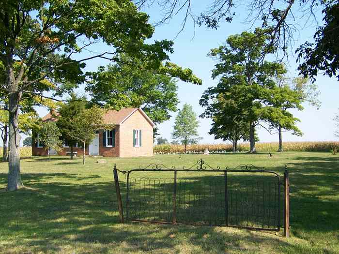
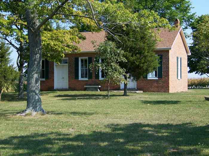
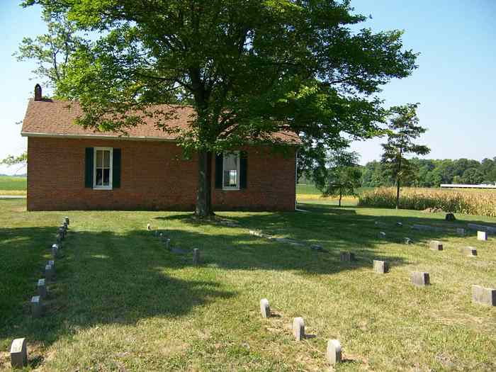
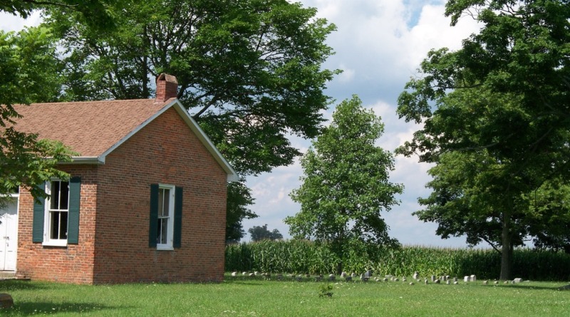
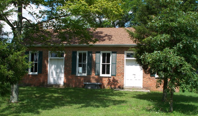
| Description | : | The Green Plain Monthly Meetinghouse is a historic former Quaker house of worship near South Charleston in Clark County, Ohio, United States. Built in 1843, it was used by a part of a monthly meeting that was established in the area in 1822. The original Green Plain Monthly Meeting lasted for only a short while, splitting into Orthodox and Hicksite branches just four years after it was founded: the Orthodox members settled in the community of Selma, while the Hicksites kept the original property. In turn, the Hicksites split in 1843 over the issue of slavery; the liberal party kept... Read More |
frequently asked questions (FAQ):
-
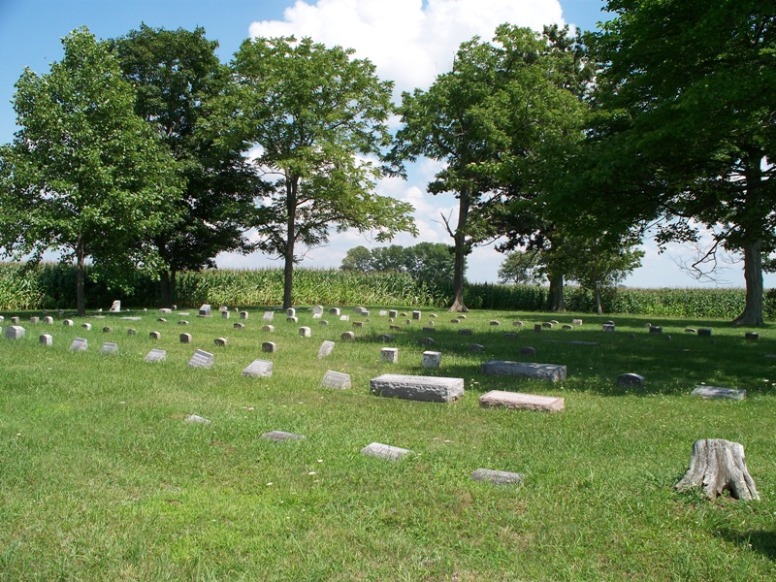
Where is Old Quaker Cemetery?
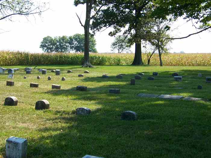
Old Quaker Cemetery is located at South Charleston–Clifton Road South Charleston, Clark County ,Ohio , 45368USA.
-
Old Quaker Cemetery cemetery's updated grave count on graveviews.com?
36 memorials
-
Where are the coordinates of the Old Quaker Cemetery?
Latitude: 39.8102989
Longitude: -83.6900024
Nearby Cemetories:
1. Cook Family Cemetery
Selma, Clark County, USA
Coordinate: 39.7911360, -83.7163580
2. Green Plain Cemetery #2
Selma, Clark County, USA
Coordinate: 39.7850860, -83.7055440
3. Love Light Gospel Chapel Cemetery
Selma, Clark County, USA
Coordinate: 39.7908110, -83.7166970
4. Buffenbarger Cemetery
Pitchin, Clark County, USA
Coordinate: 39.8372002, -83.7121964
5. Bloxom Cemetery
Clark County, USA
Coordinate: 39.7841988, -83.7277985
6. Methodist Cemetery
South Charleston, Clark County, USA
Coordinate: 39.8250750, -83.6336800
7. Pleasant Grove Baptist Cemetery
Clark County, USA
Coordinate: 39.8457200, -83.7292900
8. Greenlawn Cemetery
South Charleston, Clark County, USA
Coordinate: 39.8342018, -83.6350021
9. Saint Charles Cemetery
South Charleston, Clark County, USA
Coordinate: 39.8316994, -83.6247025
10. Davisson-Ellsworth Cemetery
South Charleston, Clark County, USA
Coordinate: 39.8288410, -83.6153980
11. Pitchin Methodist Church Cemetery
Pitchin, Clark County, USA
Coordinate: 39.8408160, -83.7591690
12. Lisbon Cemetery
Lisbon, Clark County, USA
Coordinate: 39.8591995, -83.6393967
13. Brock Cemetery (Defunct)
Gladstone, Greene County, USA
Coordinate: 39.7464970, -83.6702420
14. Garlough Cemetery
Pitchin, Clark County, USA
Coordinate: 39.8563995, -83.7592010
15. Andrews Cemetery
Grape Grove, Greene County, USA
Coordinate: 39.7316720, -83.7099830
16. Rose Hill Burial Park
Springfield, Clark County, USA
Coordinate: 39.8903008, -83.7192001
17. Fletcher Chapel Cemetery
Harmony, Clark County, USA
Coordinate: 39.8936005, -83.6956024
18. Bethel Methodist Cemetery
Ross Township, Greene County, USA
Coordinate: 39.7262730, -83.6928210
19. Steele Cemetery
Springfield, Clark County, USA
Coordinate: 39.8702510, -83.7698680
20. Calvary Cemetery
Springfield, Clark County, USA
Coordinate: 39.8843994, -83.7585983
21. Grape Grove Cemetery
Jamestown, Greene County, USA
Coordinate: 39.7182999, -83.6686020
22. Lawrence Cemetery
Ross Township, Greene County, USA
Coordinate: 39.7251770, -83.7405660
23. South Solon Cemetery
South Solon, Madison County, USA
Coordinate: 39.7352982, -83.6166992
24. Wraggs Cemetery
Clark County, USA
Coordinate: 39.9028015, -83.6667023