
| Memorials | : | 0 |
| Location | : | Morrison County, USA |
| Coordinate | : | 46.2378490, -94.5171960 |
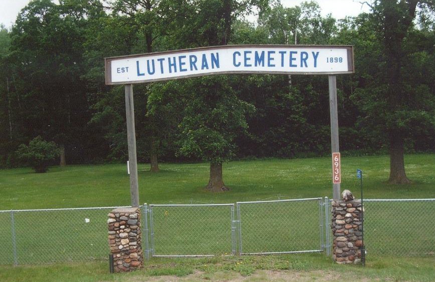
| Description | : | On August 31, 1898, a Warranty Deed transferred 2.0 acres of property from the N. P. Railway Co. to the Swedish Evangilical Lutheran Church. A church was erected but closed in about 1905. The church building was subsequently moved to Pillager, Minnesota. Hans Nelson provided a mortgage and became the property owner. On June 2, 1930, the property was transferred to Scandia Valley Township, Morrison County, Minnesota. The township is the current cemetery owner. The cemetery is located in the SE1/4SE1/4 Section 13 Township 132 North Range 31 West. The cemetery has two visible grave monuments and others may have been... Read More |
frequently asked questions (FAQ):
-
Where is Lutheran Cemetery?
Lutheran Cemetery is located at 6936 330th Street (County Road 203) Morrison County ,Minnesota , 56443USA.
-
Lutheran Cemetery cemetery's updated grave count on graveviews.com?
0 memorials
-
Where are the coordinates of the Lutheran Cemetery?
Latitude: 46.2378490
Longitude: -94.5171960
Nearby Cemetories:
1. Rail Prairie Union Cemetery
Morrison County, USA
Coordinate: 46.2519900, -94.4962200
2. Ogema Point Cemetery
Cushing, Morrison County, USA
Coordinate: 46.2146988, -94.5393982
3. Scandia Valley Cemetery West
Cushing, Morrison County, USA
Coordinate: 46.2138890, -94.5400000
4. Pillager Frontier Cemetery
Pillager, Cass County, USA
Coordinate: 46.3171997, -94.4944000
5. Franzen Family Cemetery
Little Falls, Morrison County, USA
Coordinate: 46.3158970, -94.4431250
6. Wildwood Cemetery
Pillager, Cass County, USA
Coordinate: 46.3311005, -94.4627991
7. Cushing Union Cemetery
Cushing, Morrison County, USA
Coordinate: 46.1409580, -94.5755700
8. Roseland Cemetery
Randall, Morrison County, USA
Coordinate: 46.1286011, -94.5136032
9. Sylvan Cemetery
Sylvan, Cass County, USA
Coordinate: 46.3333300, -94.4113900
10. Fort Ripley Cemetery
Fort Ripley, Crow Wing County, USA
Coordinate: 46.1761000, -94.3615700
11. Saint Francis Assisi Cemetery
Brainerd, Crow Wing County, USA
Coordinate: 46.2752980, -94.3352060
12. Motley Public Cemetery
Todd County, USA
Coordinate: 46.3278008, -94.6556015
13. Oak Hill Cemetery
Crow Wing County, USA
Coordinate: 46.2158012, -94.3285980
14. Saint John Holy Cross Cemetery
Brainerd, Crow Wing County, USA
Coordinate: 46.2790970, -94.3328890
15. Dixon Cemetery
Fort Ripley, Crow Wing County, USA
Coordinate: 46.2154930, -94.3246630
16. Gull River Cemetery
Cass County, USA
Coordinate: 46.3356018, -94.3685989
17. Saint James Cemetery
Fawn Lake Township, Todd County, USA
Coordinate: 46.2799988, -94.7181015
18. Bridgeman Cemetery
Cass County, USA
Coordinate: 46.3796997, -94.5689011
19. Randall Cemetery
Randall, Morrison County, USA
Coordinate: 46.0910988, -94.5143967
20. Oak Land Cemetery
Crow Wing County, USA
Coordinate: 46.2722015, -94.3043976
21. Oak Hill Cemetery
Randall, Morrison County, USA
Coordinate: 46.0855290, -94.5185410
22. Saint James Catholic Cemetery
Randall, Morrison County, USA
Coordinate: 46.0830994, -94.4933014
23. Batavia Cemetery
Browerville, Todd County, USA
Coordinate: 46.1933500, -94.7612830
24. Green Prairie Cemetery
Morrison County, USA
Coordinate: 46.1022400, -94.3527800