
| Memorials | : | 1 |
| Location | : | Cushing, Morrison County, USA |
| Coordinate | : | 46.2138890, -94.5400000 |
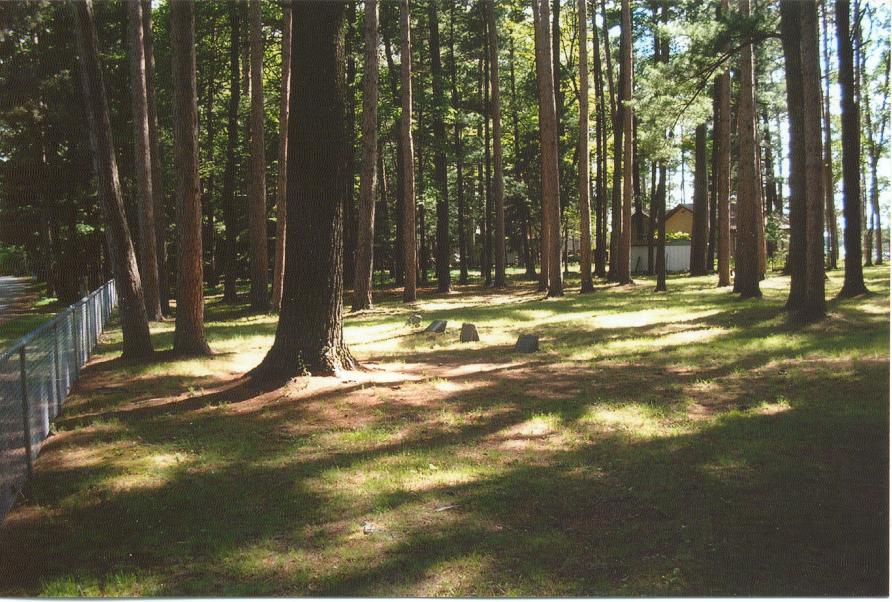
| Description | : | A Quit Claim Deed, filed for the record on February 19, 1907, transferred one acre of land from Watkin Pugh and Jennie Pugh, his wife, to the Township of Scandia Valley. This is the old cemetery portion which contains a beautiful stand of white pine and it is fenced with gates for access. The new part of the cemetery was established on November 15, 1939 when 1.16 acres of land was transferred from J. C. Patience and Mary L. Patience, his wife, to the Township of Scandia Valley via Deed Record No. 111. The property was to be used as a... Read More |
frequently asked questions (FAQ):
-
Where is Scandia Valley Cemetery West?
Scandia Valley Cemetery West is located at Ogema Point Drive Cushing, Morrison County ,Minnesota , 56443USA.
-
Scandia Valley Cemetery West cemetery's updated grave count on graveviews.com?
1 memorials
-
Where are the coordinates of the Scandia Valley Cemetery West?
Latitude: 46.2138890
Longitude: -94.5400000
Nearby Cemetories:
1. Ogema Point Cemetery
Cushing, Morrison County, USA
Coordinate: 46.2146988, -94.5393982
2. Lutheran Cemetery
Morrison County, USA
Coordinate: 46.2378490, -94.5171960
3. Rail Prairie Union Cemetery
Morrison County, USA
Coordinate: 46.2519900, -94.4962200
4. Cushing Union Cemetery
Cushing, Morrison County, USA
Coordinate: 46.1409580, -94.5755700
5. Roseland Cemetery
Randall, Morrison County, USA
Coordinate: 46.1286011, -94.5136032
6. Pillager Frontier Cemetery
Pillager, Cass County, USA
Coordinate: 46.3171997, -94.4944000
7. Franzen Family Cemetery
Little Falls, Morrison County, USA
Coordinate: 46.3158970, -94.4431250
8. Randall Cemetery
Randall, Morrison County, USA
Coordinate: 46.0910988, -94.5143967
9. Wildwood Cemetery
Pillager, Cass County, USA
Coordinate: 46.3311005, -94.4627991
10. Fort Ripley Cemetery
Fort Ripley, Crow Wing County, USA
Coordinate: 46.1761000, -94.3615700
11. Oak Hill Cemetery
Randall, Morrison County, USA
Coordinate: 46.0855290, -94.5185410
12. Saint James Catholic Cemetery
Randall, Morrison County, USA
Coordinate: 46.0830994, -94.4933014
13. Motley Public Cemetery
Todd County, USA
Coordinate: 46.3278008, -94.6556015
14. Saint James Cemetery
Fawn Lake Township, Todd County, USA
Coordinate: 46.2799988, -94.7181015
15. Oak Hill Cemetery
Crow Wing County, USA
Coordinate: 46.2158012, -94.3285980
16. Sylvan Cemetery
Sylvan, Cass County, USA
Coordinate: 46.3333300, -94.4113900
17. Dixon Cemetery
Fort Ripley, Crow Wing County, USA
Coordinate: 46.2154930, -94.3246630
18. Saint Francis Assisi Cemetery
Brainerd, Crow Wing County, USA
Coordinate: 46.2752980, -94.3352060
19. Batavia Cemetery
Browerville, Todd County, USA
Coordinate: 46.1933500, -94.7612830
20. Saint John Holy Cross Cemetery
Brainerd, Crow Wing County, USA
Coordinate: 46.2790970, -94.3328890
21. Bridgeman Cemetery
Cass County, USA
Coordinate: 46.3796997, -94.5689011
22. DeMoss Cemetery
Morrison County, USA
Coordinate: 46.0497600, -94.5933380
23. Gull River Cemetery
Cass County, USA
Coordinate: 46.3356018, -94.3685989
24. Green Prairie Cemetery
Morrison County, USA
Coordinate: 46.1022400, -94.3527800