
| Memorials | : | 2 |
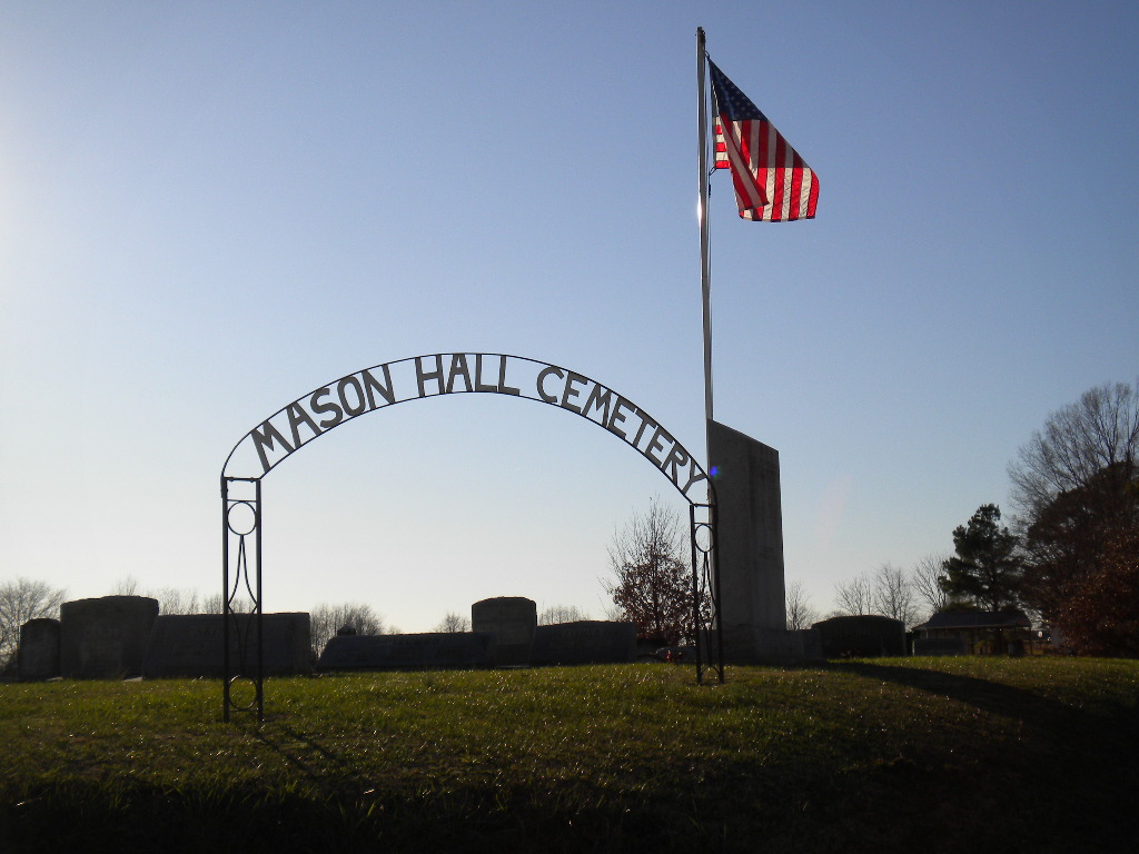
| Location | : | Mason Hall, Obion County, USA |
| Coordinate | : | 36.2042100, -89.0935750 |
| Description | : | From intersection of US-51 & TN-105 E, travel east on TN-105 E for 1.0 mi. towards Trimble. At Main St. turn north (left) then west (right) onto E. Mitchell St., going 0.4, turning northeast (left), continuing onto TN-89 N/Mason Hall Rd. for 5.1 mi. Upon entry into Mason Hall, at the curve of the highway, go straight ahead onto Sturdivant Rd. for about 0.1 mi., turn south (right) onto Old Turnpike Rd/New Salem Rd., going 0.1 mi to the entrance of the cemetery on the west (right) side of the road. It is a large well maintained cemetery. |
frequently asked questions (FAQ):
-
Where is Mason Hall Cemetery?
Mason Hall Cemetery is located at 4986 Old Turnpike Rd Mason Hall, Obion County ,Tennessee , 38233USA.
-
Mason Hall Cemetery cemetery's updated grave count on graveviews.com?
2 memorials
-
Where are the coordinates of the Mason Hall Cemetery?
Latitude: 36.2042100
Longitude: -89.0935750
Nearby Cemetories:
1. New Salem Baptist Church Cemetery
Mason Hall, Obion County, USA
Coordinate: 36.2150800, -89.1016300
2. Hollomon Cemetery
Mason Hall, Obion County, USA
Coordinate: 36.2143980, -89.0792070
3. Bethpage Baptist Church Cemetery
Gibson County, USA
Coordinate: 36.1683000, -89.0950000
4. Roach Cemetery
Obion County, USA
Coordinate: 36.2398222, -89.1122983
5. Miles Cemetery
Kenton, Obion County, USA
Coordinate: 36.2453720, -89.1021810
6. North Union Cemetery
Kenton, Gibson County, USA
Coordinate: 36.1652985, -89.0736008
7. Finch Cemetery
Mason Hall, Obion County, USA
Coordinate: 36.2522470, -89.0862550
8. Pettus Family Cemetery
Yorkville, Gibson County, USA
Coordinate: 36.1797000, -89.1472700
9. New Concord Cemetery
Kenton, Obion County, USA
Coordinate: 36.2222210, -89.0341160
10. Union Grove Cemetery
Kenton, Obion County, USA
Coordinate: 36.2496986, -89.0616989
11. West Side Cemetery
Kenton, Gibson County, USA
Coordinate: 36.1979200, -89.0267000
12. Jones Cemetery
Trimble, Dyer County, USA
Coordinate: 36.1891590, -89.1589510
13. Sunnyside Cemetery
Kenton, Gibson County, USA
Coordinate: 36.1982994, -89.0252991
14. Cool Springs Cumberland Presbyterian Cemetery
Cool Springs, Gibson County, USA
Coordinate: 36.1618996, -89.1393967
15. Bruce Family Cemetery
Obion County, USA
Coordinate: 36.2500000, -89.0410000
16. Rossons Cemetery
Kenton, Gibson County, USA
Coordinate: 36.1799158, -89.0083141
17. Smithson-Askew Cemetery
Rutherford, Gibson County, USA
Coordinate: 36.1667300, -89.0159600
18. Liberty Grove Cemetery
Rutherford, Gibson County, USA
Coordinate: 36.1439760, -89.0371100
19. Macedonia Baptist Church Cemetery
Kenton, Obion County, USA
Coordinate: 36.2186050, -88.9894770
20. Carroll Cemetery
Rutherford, Gibson County, USA
Coordinate: 36.1453900, -89.0140800
21. Keathley & Peel Family Cemetery
Gibson County, USA
Coordinate: 36.1651820, -88.9949470
22. New Victory MB Church Cemetery
Rutherford, Gibson County, USA
Coordinate: 36.1596780, -88.9978150
23. Pierce Cemetery
Trimble, Dyer County, USA
Coordinate: 36.1996210, -89.2041830
24. Bells Chapel Cemetery
Dyer, Gibson County, USA
Coordinate: 36.1164017, -89.0686035