
| Memorials | : | 1 |
| Location | : | Gibson County, USA |
| Coordinate | : | 36.1651820, -88.9949470 |
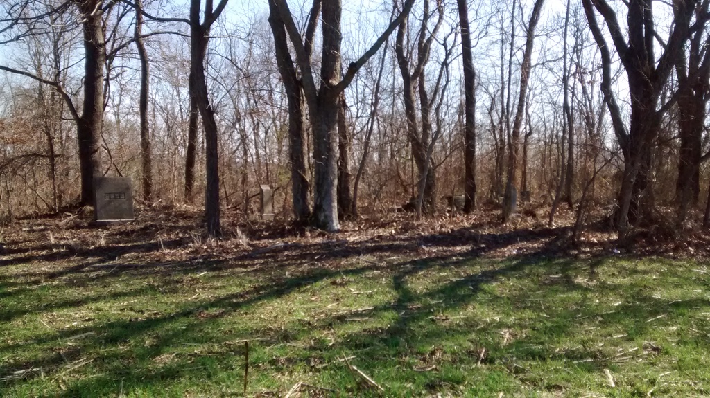
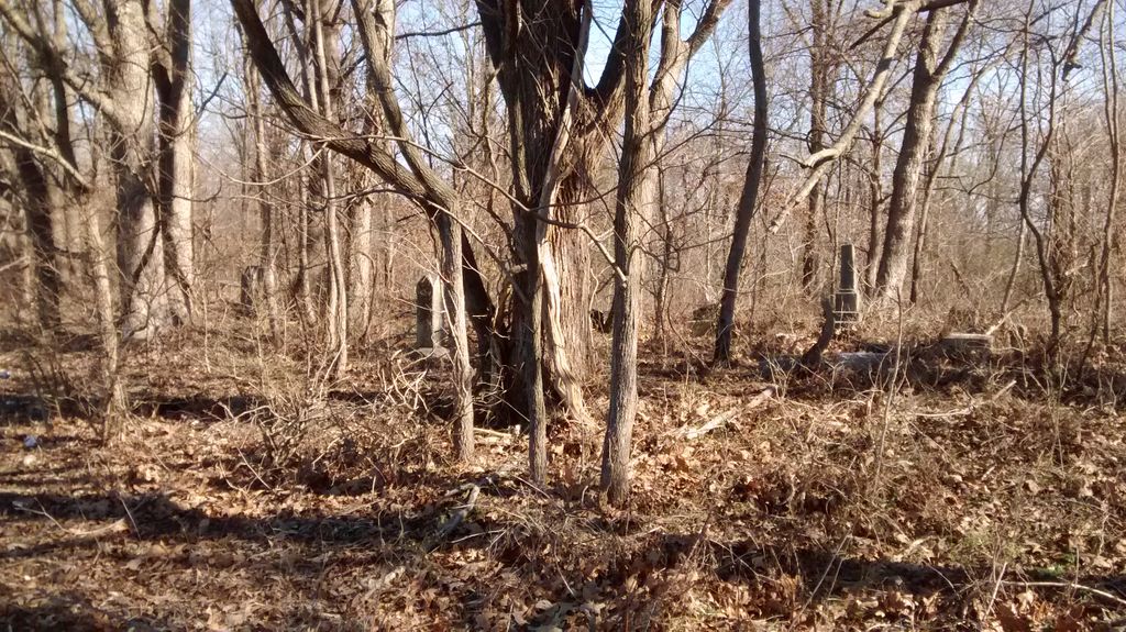
| Description | : | Located north of Rutherford from Hwy-45W/Kenton Hwy., turn east onto TN-5 for about 100 yards., then turn north (left) onto Creek Rd. going about 0.9 mi. northwards (do not turn east), follow the farm road for another 200 yards, then walk due east across the farm field to the edge of the wooded area & the cemetery. This location is about 1000 ft. north of the TV/Radio tower. This is an old cemetery that has not been maintained. |
frequently asked questions (FAQ):
-
Where is Keathley & Peel Family Cemetery?
Keathley & Peel Family Cemetery is located at Cheek Rd Gibson County ,Tennessee , 38369USA.
-
Keathley & Peel Family Cemetery cemetery's updated grave count on graveviews.com?
1 memorials
-
Where are the coordinates of the Keathley & Peel Family Cemetery?
Latitude: 36.1651820
Longitude: -88.9949470
Nearby Cemetories:
1. New Victory MB Church Cemetery
Rutherford, Gibson County, USA
Coordinate: 36.1596780, -88.9978150
2. Smithson-Askew Cemetery
Rutherford, Gibson County, USA
Coordinate: 36.1667300, -89.0159600
3. Rossons Cemetery
Kenton, Gibson County, USA
Coordinate: 36.1799158, -89.0083141
4. Carroll Cemetery
Rutherford, Gibson County, USA
Coordinate: 36.1453900, -89.0140800
5. Old Bluff Cemetery
Rutherford, Gibson County, USA
Coordinate: 36.1417870, -88.9751880
6. Walnut Grove Baptist Church Cemetery
Gibson County, USA
Coordinate: 36.1742000, -88.9606000
7. Crockett Memorial Plot
Rutherford, Gibson County, USA
Coordinate: 36.1299620, -88.9871980
8. Rutherford Cemetery
Rutherford, Gibson County, USA
Coordinate: 36.1258011, -88.9989014
9. Beech Grove Cemetery
Rutherford, Gibson County, USA
Coordinate: 36.1591988, -88.9464035
10. Liberty Grove Cemetery
Rutherford, Gibson County, USA
Coordinate: 36.1439760, -89.0371100
11. Sunnyside Cemetery
Kenton, Gibson County, USA
Coordinate: 36.1982994, -89.0252991
12. West Side Cemetery
Kenton, Gibson County, USA
Coordinate: 36.1979200, -89.0267000
13. Flowers Chapel Cemetery
Rutherford, Gibson County, USA
Coordinate: 36.1198820, -89.0265080
14. Macedonia Baptist Church Cemetery
Kenton, Obion County, USA
Coordinate: 36.2186050, -88.9894770
15. Wilkes Cemetery
Rutherford, Gibson County, USA
Coordinate: 36.1097380, -89.0214500
16. North Union Cemetery
Kenton, Gibson County, USA
Coordinate: 36.1652985, -89.0736008
17. Taylor Family Cemetery
Rutherford, Gibson County, USA
Coordinate: 36.1049700, -89.0226300
18. New Concord Cemetery
Kenton, Obion County, USA
Coordinate: 36.2222210, -89.0341160
19. Salem Cemetery
Rutherford, Gibson County, USA
Coordinate: 36.1217003, -88.9266968
20. Hopper Cemetery
Dyer, Gibson County, USA
Coordinate: 36.0936200, -88.9878680
21. China Grove Church Cemetery
Gibson County, USA
Coordinate: 36.1383018, -88.9113998
22. Bells Chapel Cemetery
Dyer, Gibson County, USA
Coordinate: 36.1164017, -89.0686035
23. Flowers - Wright Cemetery
Dyer, Gibson County, USA
Coordinate: 36.0951100, -89.0348700
24. Thompson Cemetery
Rutherford, Gibson County, USA
Coordinate: 36.1047220, -89.0553430