
| Memorials | : | 1 |
| Location | : | Curlew, Ferry County, USA |
| Coordinate | : | 48.8745300, -118.6020000 |
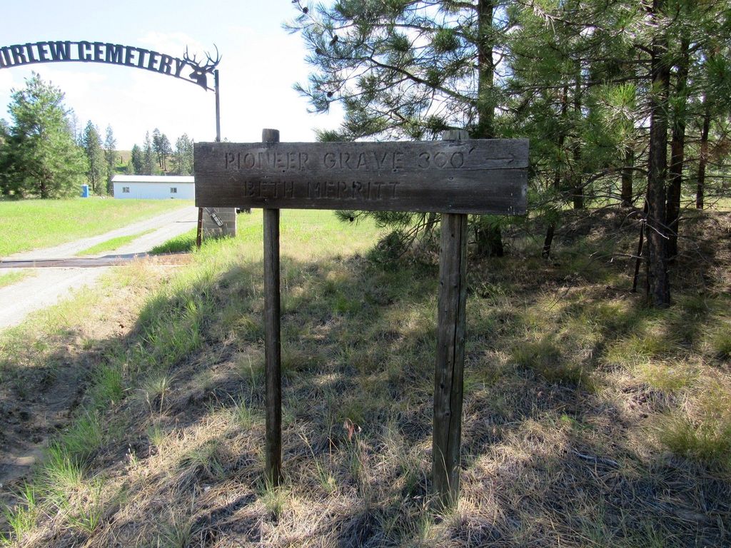
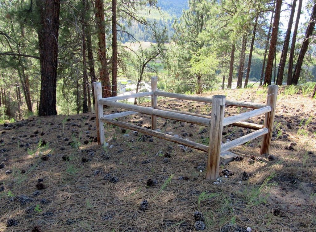
| Description | : | The burial spot is all alone on the flat of the hill, evergreen trees on the one side and a field of grass on the other side. Someone has built a fence around the lone burial spot to protect it. The headstone is a cement rectangle with a funeral marker in the center top of it. Lat: 48° 52' 29"N, Lon: 118° 36' 04"W I used to have great photos. Sadly, I lost them. |
frequently asked questions (FAQ):
-
Where is Merritt Pioneer Grave?
Merritt Pioneer Grave is located at Curlew, Ferry County ,Washington ,USA.
-
Merritt Pioneer Grave cemetery's updated grave count on graveviews.com?
0 memorials
-
Where are the coordinates of the Merritt Pioneer Grave?
Latitude: 48.8745300
Longitude: -118.6020000
Nearby Cemetories:
1. Curlew City Cemetery
Curlew, Ferry County, USA
Coordinate: 48.8734163, -118.6010599
2. Curlew Indian Cemetery
Curlew, Ferry County, USA
Coordinate: 48.8811145, -118.6002982
3. Somday Family Cemetery
Malo, Ferry County, USA
Coordinate: 48.8290000, -118.5990000
4. Danville Cemetery
Ferry County, USA
Coordinate: 48.9885640, -118.5151702
5. Ranald McDonald Cemetery
Toroda, Ferry County, USA
Coordinate: 48.9472094, -118.7617135
6. Eagle Cliff Cemetery
Toroda, Ferry County, USA
Coordinate: 48.9404375, -118.7946296
7. USCC Sion Cemetery
Grand Forks, Kootenay Boundary Regional District, Canada
Coordinate: 49.0159500, -118.4964300
8. Village of Midway Cemetery
Midway, Kootenay Boundary Regional District, Canada
Coordinate: 49.0082520, -118.7609490
9. Evergreen Cemetery
Grand Forks, Kootenay Boundary Regional District, Canada
Coordinate: 49.0243650, -118.4520650
10. Outlook Khristovoye Doukhobor Cemetery
Grand Forks, Kootenay Boundary Regional District, Canada
Coordinate: 49.0402930, -118.4835600
11. Phoenix Cemetery
Greenwood, Kootenay Boundary Regional District, Canada
Coordinate: 49.1019000, -118.6285500
12. Gilpin Cemetery # 1
Gilpin, Kootenay Boundary Regional District, Canada
Coordinate: 49.0090920, -118.3181980
13. Republic Cemetery
Republic, Ferry County, USA
Coordinate: 48.6555363, -118.7218022
14. Gilpin Cemetery # 2
Gilpin, Kootenay Boundary Regional District, Canada
Coordinate: 49.0084500, -118.3073490
15. Greenwood Cemetery
Greenwood, Kootenay Boundary Regional District, Canada
Coordinate: 49.1250200, -118.6836000
16. Orient Cemetery
Orient, Ferry County, USA
Coordinate: 48.8578987, -118.2032013
17. Thomason Ranch Graves
Okanogan County, USA
Coordinate: 48.7757200, -118.9821900
18. Laurier Cemetery
Ferry County, USA
Coordinate: 48.9855500, -118.2189000
19. Cascade Cemetery
Cascade, Kootenay Boundary Regional District, Canada
Coordinate: 49.0188990, -118.2247300
20. Thorp Cemetery
Chesaw, Okanogan County, USA
Coordinate: 48.9549900, -119.0316700
21. Chesaw Cemetery
Okanogan County, USA
Coordinate: 48.9299900, -119.0541800
22. Kelly Hill Cemetery
Stevens County, USA
Coordinate: 48.8130989, -118.1268997
23. Wauconda Cemetery
Wauconda, Okanogan County, USA
Coordinate: 48.7408300, -119.0597300
24. Pia Mission Cemetery
Stevens County, USA
Coordinate: 48.7960700, -118.1097300