
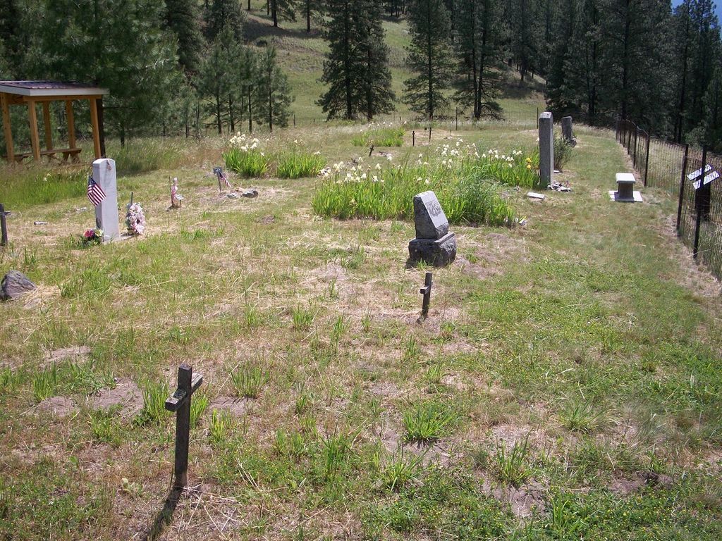
| Memorials | : | 3 |
| Location | : | Toroda, Ferry County, USA |
| Coordinate | : | 48.9472094, -118.7617135 |
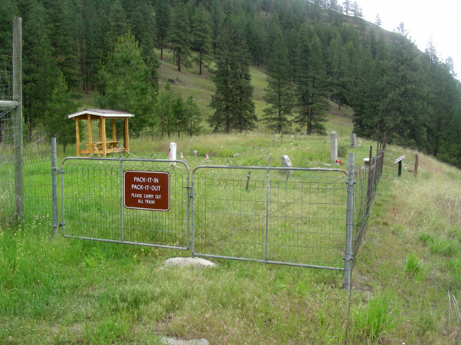
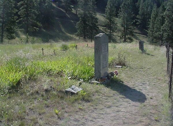
| Description | : | Burial place of Ranald McDonald. This is the "Smallest State Park in Washinton", so once you get close, there are plenty of signs to guide you to the cemetery. |
frequently asked questions (FAQ):
-
Where is Ranald McDonald Cemetery?
Ranald McDonald Cemetery is located at Toroda, Ferry County ,Washington ,USA.
-
Ranald McDonald Cemetery cemetery's updated grave count on graveviews.com?
3 memorials
-
Where are the coordinates of the Ranald McDonald Cemetery?
Latitude: 48.9472094
Longitude: -118.7617135
Nearby Cemetories:
1. Eagle Cliff Cemetery
Toroda, Ferry County, USA
Coordinate: 48.9404375, -118.7946296
2. Village of Midway Cemetery
Midway, Kootenay Boundary Regional District, Canada
Coordinate: 49.0082520, -118.7609490
3. Curlew Indian Cemetery
Curlew, Ferry County, USA
Coordinate: 48.8811145, -118.6002982
4. Merritt Pioneer Grave
Curlew, Ferry County, USA
Coordinate: 48.8745300, -118.6020000
5. Curlew City Cemetery
Curlew, Ferry County, USA
Coordinate: 48.8734163, -118.6010599
6. Somday Family Cemetery
Malo, Ferry County, USA
Coordinate: 48.8290000, -118.5990000
7. Danville Cemetery
Ferry County, USA
Coordinate: 48.9885640, -118.5151702
8. Thorp Cemetery
Chesaw, Okanogan County, USA
Coordinate: 48.9549900, -119.0316700
9. Phoenix Cemetery
Greenwood, Kootenay Boundary Regional District, Canada
Coordinate: 49.1019000, -118.6285500
10. Greenwood Cemetery
Greenwood, Kootenay Boundary Regional District, Canada
Coordinate: 49.1250200, -118.6836000
11. USCC Sion Cemetery
Grand Forks, Kootenay Boundary Regional District, Canada
Coordinate: 49.0159500, -118.4964300
12. Chesaw Cemetery
Okanogan County, USA
Coordinate: 48.9299900, -119.0541800
13. Outlook Khristovoye Doukhobor Cemetery
Grand Forks, Kootenay Boundary Regional District, Canada
Coordinate: 49.0402930, -118.4835600
14. Evergreen Cemetery
Grand Forks, Kootenay Boundary Regional District, Canada
Coordinate: 49.0243650, -118.4520650
15. Thomason Ranch Graves
Okanogan County, USA
Coordinate: 48.7757200, -118.9821900
16. Bridesville Cemetery
Bridesville, Kootenay Boundary Regional District, Canada
Coordinate: 49.0370800, -119.1372300
17. Kipling Cemetery
Okanogan County, USA
Coordinate: 48.9080500, -119.1652900
18. Wauconda Cemetery
Wauconda, Okanogan County, USA
Coordinate: 48.7408300, -119.0597300
19. Republic Cemetery
Republic, Ferry County, USA
Coordinate: 48.6555363, -118.7218022
20. Molson Cemetery
Molson, Okanogan County, USA
Coordinate: 48.9657000, -119.2105000
21. Gilpin Cemetery # 1
Gilpin, Kootenay Boundary Regional District, Canada
Coordinate: 49.0090920, -118.3181980
22. Gilpin Cemetery # 2
Gilpin, Kootenay Boundary Regional District, Canada
Coordinate: 49.0084500, -118.3073490
23. Sidley-Lawless Cemetery
Sidley, Kootenay Boundary Regional District, Canada
Coordinate: 49.0153330, -119.2234330
24. Immanuel Lutheran Cemetery
Havillah, Okanogan County, USA
Coordinate: 48.8305500, -119.2033500