| Memorials | : | 3 |
| Location | : | Greenwood, Kootenay Boundary Regional District, Canada |
| Coordinate | : | 49.1019000, -118.6285500 |
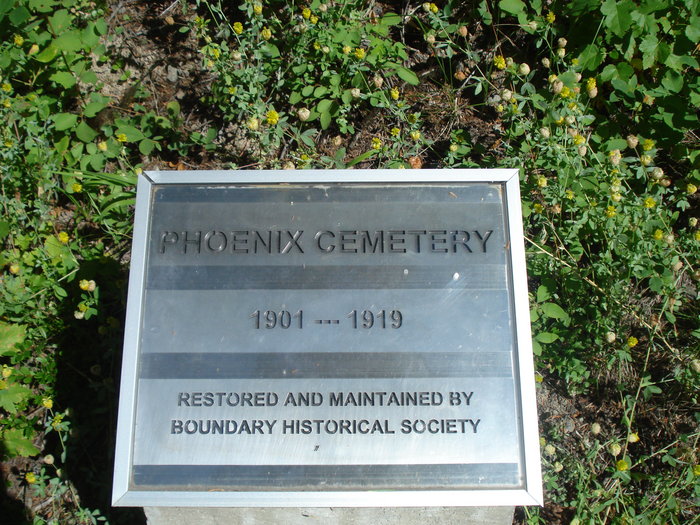
| Description | : | Phoenix Cemetery lies about 4 miles east of Greenwood, and about 3 miles west of Phoenix. The Phoenix Cemetery was the burial grounds for the mining town of Phoenix British Columbia Canada. It was a booming copper mining community from the late 1890s until 1919. The town no longer exists today. While the mines operated the residents experienced many hardships and deaths. It became apparent to the city that they needed a cemetery. The city Council received approval to open a city cemetery after a likely sight was approval in 1901. The first burial in the cemetery was in January of... Read More |
frequently asked questions (FAQ):
-
Where is Phoenix Cemetery?
Phoenix Cemetery is located at Phoenix Road Greenwood, Kootenay Boundary Regional District ,British Columbia ,Canada.
-
Phoenix Cemetery cemetery's updated grave count on graveviews.com?
3 memorials
-
Where are the coordinates of the Phoenix Cemetery?
Latitude: 49.1019000
Longitude: -118.6285500
Nearby Cemetories:
1. Greenwood Cemetery
Greenwood, Kootenay Boundary Regional District, Canada
Coordinate: 49.1250200, -118.6836000
2. Outlook Khristovoye Doukhobor Cemetery
Grand Forks, Kootenay Boundary Regional District, Canada
Coordinate: 49.0402930, -118.4835600
3. USCC Sion Cemetery
Grand Forks, Kootenay Boundary Regional District, Canada
Coordinate: 49.0159500, -118.4964300
4. Village of Midway Cemetery
Midway, Kootenay Boundary Regional District, Canada
Coordinate: 49.0082520, -118.7609490
5. Danville Cemetery
Ferry County, USA
Coordinate: 48.9885640, -118.5151702
6. Evergreen Cemetery
Grand Forks, Kootenay Boundary Regional District, Canada
Coordinate: 49.0243650, -118.4520650
7. Ranald McDonald Cemetery
Toroda, Ferry County, USA
Coordinate: 48.9472094, -118.7617135
8. Eagle Cliff Cemetery
Toroda, Ferry County, USA
Coordinate: 48.9404375, -118.7946296
9. Curlew Indian Cemetery
Curlew, Ferry County, USA
Coordinate: 48.8811145, -118.6002982
10. Gilpin Cemetery # 1
Gilpin, Kootenay Boundary Regional District, Canada
Coordinate: 49.0090920, -118.3181980
11. Merritt Pioneer Grave
Curlew, Ferry County, USA
Coordinate: 48.8745300, -118.6020000
12. Curlew City Cemetery
Curlew, Ferry County, USA
Coordinate: 48.8734163, -118.6010599
13. Gilpin Cemetery # 2
Gilpin, Kootenay Boundary Regional District, Canada
Coordinate: 49.0084500, -118.3073490
14. Somday Family Cemetery
Malo, Ferry County, USA
Coordinate: 48.8290000, -118.5990000
15. Cascade Cemetery
Cascade, Kootenay Boundary Regional District, Canada
Coordinate: 49.0188990, -118.2247300
16. Laurier Cemetery
Ferry County, USA
Coordinate: 48.9855500, -118.2189000
17. Thorp Cemetery
Chesaw, Okanogan County, USA
Coordinate: 48.9549900, -119.0316700
18. Chesaw Cemetery
Okanogan County, USA
Coordinate: 48.9299900, -119.0541800
19. Bridesville Cemetery
Bridesville, Kootenay Boundary Regional District, Canada
Coordinate: 49.0370800, -119.1372300
20. Orient Cemetery
Orient, Ferry County, USA
Coordinate: 48.8578987, -118.2032013
21. Sidley-Lawless Cemetery
Sidley, Kootenay Boundary Regional District, Canada
Coordinate: 49.0153330, -119.2234330
22. Thomason Ranch Graves
Okanogan County, USA
Coordinate: 48.7757200, -118.9821900
23. Kipling Cemetery
Okanogan County, USA
Coordinate: 48.9080500, -119.1652900
24. Molson Cemetery
Molson, Okanogan County, USA
Coordinate: 48.9657000, -119.2105000


