
| Memorials | : | 9 |
| Location | : | Richmond, Jefferson County, USA |
| Coordinate | : | 40.4317460, -80.7709400 |
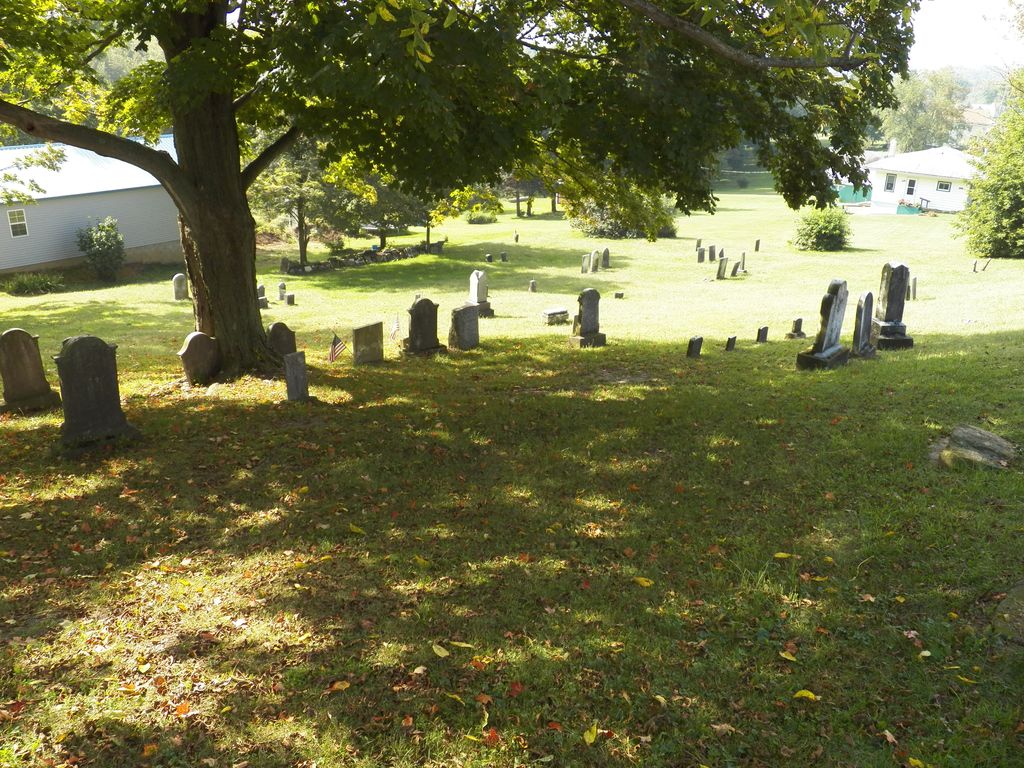
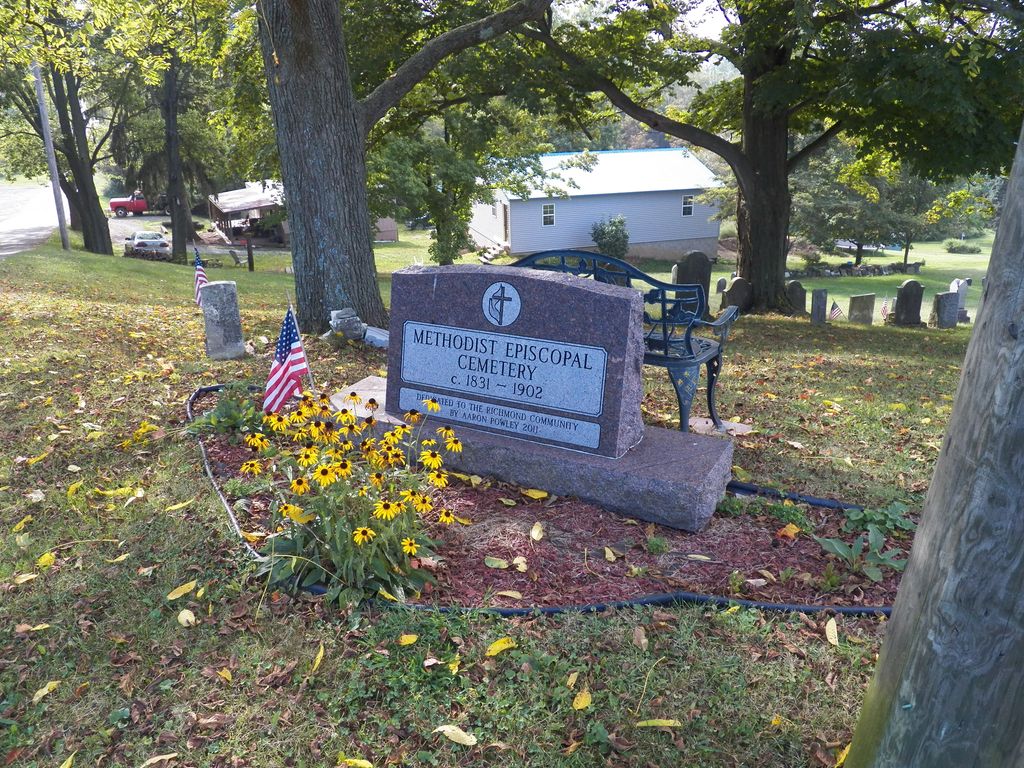
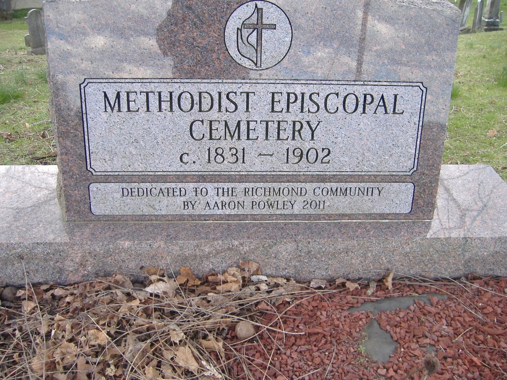
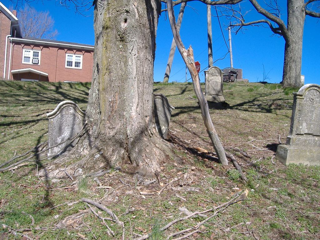
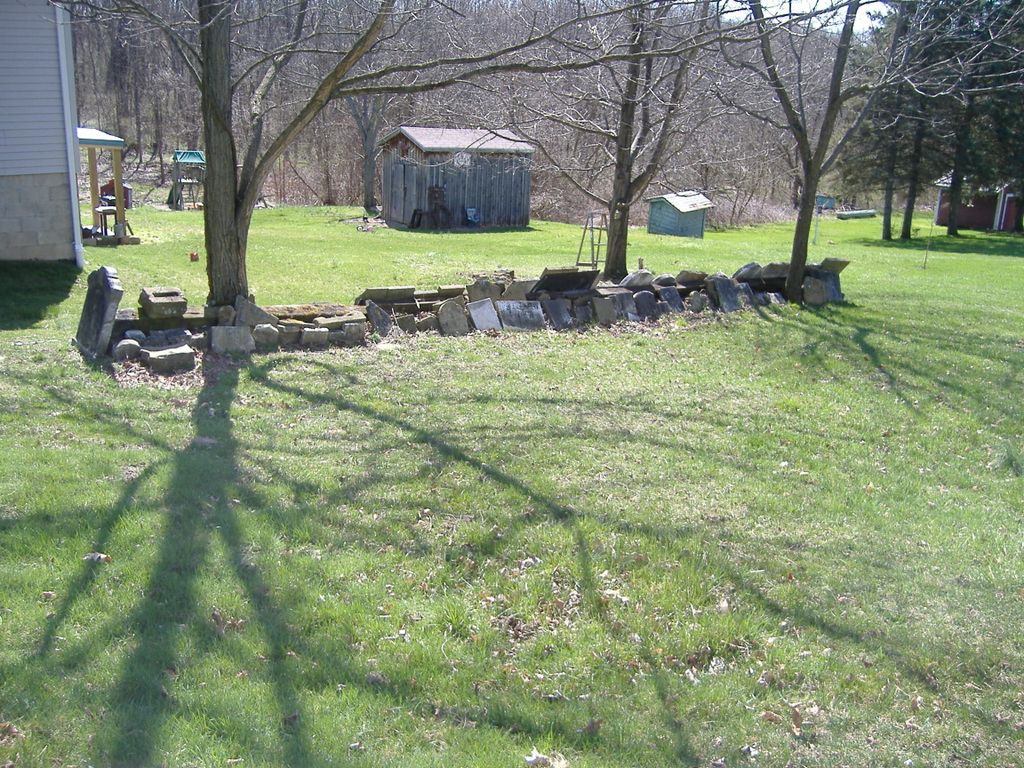
| Description | : | The cemetery is located on the southeast corner of the intersection of E Legion Street and Cedar Road (Township Road 205) on the opposite side of Cedar Road from the Richmond United Methodist Church. The cemetery is located in Salem Township, Jefferson County, Ohio, and is # 6071 (Richmond Methodist Church Cemetery) in “Ohio Cemeteries 1803-2003”, compiled by the Ohio Genealogical Society. The U.S. Geological Survey (USGS) Geographic Names Information System (GNIS) feature ID for the cemetery is 1961709 (Richmond Methodist Cemetery). |
frequently asked questions (FAQ):
-
Where is Methodist-Episcopal Cemetery?
Methodist-Episcopal Cemetery is located at E Legion Street and Cedar Road (Township Road 205) Richmond, Jefferson County ,Ohio , 43944USA.
-
Methodist-Episcopal Cemetery cemetery's updated grave count on graveviews.com?
9 memorials
-
Where are the coordinates of the Methodist-Episcopal Cemetery?
Latitude: 40.4317460
Longitude: -80.7709400
Nearby Cemetories:
1. Richmond United Presbyterian Cemetery
Salem Township, Jefferson County, USA
Coordinate: 40.4310989, -80.7680969
2. Richmond Union Cemetery
Richmond, Jefferson County, USA
Coordinate: 40.4289017, -80.7763977
3. Carne Cemetery
Salem Township, Jefferson County, USA
Coordinate: 40.4089012, -80.7667007
4. Quaker Cemetery
Richmond, Jefferson County, USA
Coordinate: 40.4112680, -80.7883450
5. Andrews Cemetery
Ross Township, Jefferson County, USA
Coordinate: 40.4674530, -80.7682190
6. Wallace Cemetery
Salem Township, Jefferson County, USA
Coordinate: 40.4391170, -80.8176500
7. Mount Tabor Methodist Church Cemetery
Richmond, Jefferson County, USA
Coordinate: 40.4519997, -80.7286987
8. Mount Hope Cemetery
Salem Township, Jefferson County, USA
Coordinate: 40.4075012, -80.8182983
9. Two Ridges Cemetery
Wintersville, Jefferson County, USA
Coordinate: 40.3944016, -80.7328033
10. Leas Cemetery
Salem Township, Jefferson County, USA
Coordinate: 40.4106710, -80.8383720
11. Osage Cemetery
Toronto, Jefferson County, USA
Coordinate: 40.4739500, -80.7234100
12. Fort Steuben Burial Estates
Wintersville, Jefferson County, USA
Coordinate: 40.3891983, -80.7236023
13. Queen of All Saints Cemetery
Bloomingdale, Jefferson County, USA
Coordinate: 40.3841050, -80.8094450
14. Shane Cemetery
Shane, Jefferson County, USA
Coordinate: 40.4808006, -80.8127975
15. Center Chapel Cemetery
Island Creek Township, Jefferson County, USA
Coordinate: 40.4276600, -80.6942300
16. Mount Zion Cemetery
Holt, Jefferson County, USA
Coordinate: 40.4893400, -80.7867100
17. Coulter Cemetery
Wintersville, Jefferson County, USA
Coordinate: 40.4000970, -80.7014690
18. Holy Family Hermitage Cemetery
Bloomingdale, Jefferson County, USA
Coordinate: 40.3840650, -80.8243020
19. Montgomery Cemetery
East Springfield, Jefferson County, USA
Coordinate: 40.4776540, -80.8347600
20. Shelley Cemetery
Knox Township, Jefferson County, USA
Coordinate: 40.4817009, -80.7106018
21. East Springfield Cemetery
East Springfield, Jefferson County, USA
Coordinate: 40.4490890, -80.8592080
22. Annapolis Lutheran Cemetery
Annapolis, Jefferson County, USA
Coordinate: 40.4130307, -80.8608010
23. Grimm Cemetery
Knox Township, Jefferson County, USA
Coordinate: 40.4708390, -80.6923170
24. Annapolis Cemetery
Salem Township, Jefferson County, USA
Coordinate: 40.4100583, -80.8636942