
| Memorials | : | 22 |
| Location | : | Coleford, Forest of Dean District, England |
| Coordinate | : | 51.8058810, 2.5983550 |
| Description | : | Mile End is a small village in the English county of Gloucestershire. It belongs to the civil parish of Coleford, which is also its post town. Mile End is 1 mile (1.6 km) northeast of Coleford. The village lies at the western edge of the Forest of Dean. The village merges with the village of Broadwell to the south. Mile End is situated on the road leading northeast out of Coalford. The road between Mile End and Poolgreen was known in 1317 as the Derkesty (later Dark Stile).[1] It was an important route from Mitcheldean, and in the later 17th century... Read More |
frequently asked questions (FAQ):
-
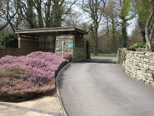
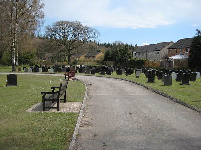
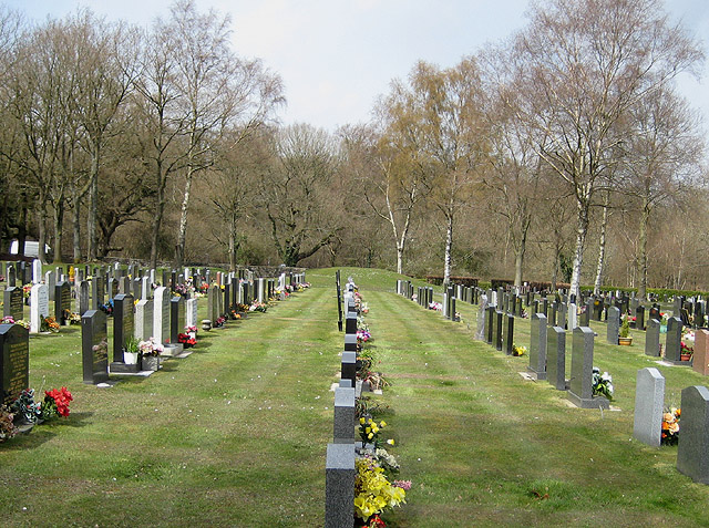
Where is Mile End Cemetery?
Mile End Cemetery is located at Coleford, Forest of Dean District ,Gloucestershire ,England.
-
Mile End Cemetery cemetery's updated grave count on graveviews.com?
22 memorials
-
Where are the coordinates of the Mile End Cemetery?
Latitude: 51.8058810
Longitude: 2.5983550
Nearby Cemetories:
1. All Saints Church
Herefordshire Unitary Authority, England
Coordinate: 52.3229700, 2.4334400
2. Westkapelle General Cemetery
Westkapelle, Veere Municipality, Netherlands
Coordinate: 51.5291200, 3.4469300
3. Chantry Holy Trinity Churchyard
Holcombe, Mendip District, England
Coordinate: 51.2218500, 2.4039500
4. Blankenberge Communal Cemetery
Blankenberge, Arrondissement Brugge, Belgium
Coordinate: 51.3069010, 3.1289580
5. Wenduine Communal Cemetery
De Haan, Arrondissement Oostende, Belgium
Coordinate: 51.2912580, 3.0892830
6. Zeebrugge Memorial
Bruges, Arrondissement Brugge, Belgium
Coordinate: 51.3321600, 3.2074000
7. Zeebrugge Churchyard
Bruges, Arrondissement Brugge, Belgium
Coordinate: 51.3321700, 3.2076700
8. Saint Peter and Saint Paul Church
Ostend, Arrondissement Oostende, Belgium
Coordinate: 51.2296200, 2.9211600
9. Oostende Old Communal Cemetery
Ostend, Arrondissement Oostende, Belgium
Coordinate: 51.2188200, 2.8956200
10. Nieuwmunster Churchyard
Zuienkerke, Arrondissement Brugge, Belgium
Coordinate: 51.2738400, 3.0984200
11. Bredene Churchyard
Bredene, Arrondissement Oostende, Belgium
Coordinate: 51.2350860, 2.9770370
12. Mariakerke Churchyard
Ostend, Arrondissement Oostende, Belgium
Coordinate: 51.2114300, 2.8720900
13. Vlissegem Churchyard
De Haan, Arrondissement Oostende, Belgium
Coordinate: 51.2550900, 3.0561100
14. Heist Communal Cemetery
Knokke-Heist, Arrondissement Brugge, Belgium
Coordinate: 51.3340247, 3.2509426
15. Klemskerke Gemeentelijke Begraafplaats
De Haan, Arrondissement Oostende, Belgium
Coordinate: 51.2426300, 3.0243600
16. Zoutelande General Cemetery
Zoutelande, Veere Municipality, Netherlands
Coordinate: 51.5019500, 3.4800200
17. Oostende New Communal Cemetery
Ostend, Arrondissement Oostende, Belgium
Coordinate: 51.2093030, 2.9152390
18. Middelkerke Communal Cemetery
Middelkerke, Arrondissement Oostende, Belgium
Coordinate: 51.1863700, 2.8281500
19. Stene Communal Cemetery
Ostend, Arrondissement Oostende, Belgium
Coordinate: 51.2016500, 2.9169000
20. Ramskapelle Communal Cemetery
Knokke-Heist, Arrondissement Brugge, Belgium
Coordinate: 51.3152428, 3.2502794
21. Knokke Communal Cemetery Old
Knokke-Heist, Arrondissement Brugge, Belgium
Coordinate: 51.3389511, 3.2947397
22. Oostkapelle General Cemetery
Oostkapelle, Veere Municipality, Netherlands
Coordinate: 51.5671500, 3.5547700
23. Knokke Communal Cemetery New
Knokke-Heist, Arrondissement Brugge, Belgium
Coordinate: 51.3232231, 3.2927012
24. Biggekerke Communal Cemetery
Biggekerke, Veere Municipality, Netherlands
Coordinate: 51.5020500, 3.5208200