
| Memorials | : | 18 |
| Location | : | Milledgeville, McNairy County, USA |
| Coordinate | : | 35.3723650, -88.3712060 |
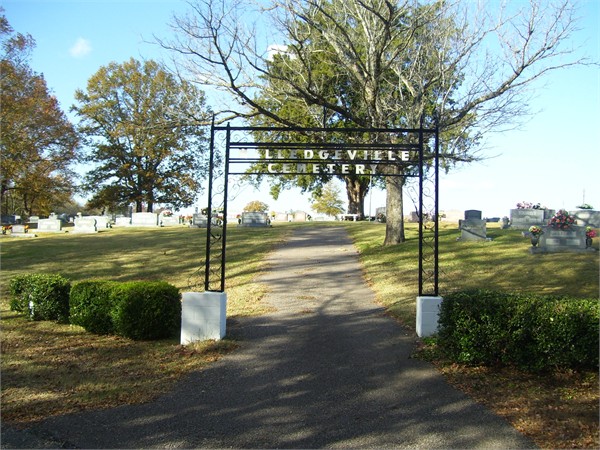
| Description | : | From the intersection of Main St. & TN-22, in Milledgeville, travel south on Main St. going about 100 yd.; turning west (right) onto Odom Ave., going about 0.2 mi. to the entrance arch of the cemetery. |
frequently asked questions (FAQ):
-
Where is Milledgeville Cemetery?
Milledgeville Cemetery is located at 166 Odom Avenue Milledgeville, McNairy County ,Tennessee ,USA.
-
Milledgeville Cemetery cemetery's updated grave count on graveviews.com?
10 memorials
-
Where are the coordinates of the Milledgeville Cemetery?
Latitude: 35.3723650
Longitude: -88.3712060
Nearby Cemetories:
1. Amis Cemetery
Hardin County, USA
Coordinate: 35.3521996, -88.3625031
2. Mount Zion Cemetery
Adamsville, McNairy County, USA
Coordinate: 35.3576680, -88.4036580
3. Mount Zion Cemetery
Milledgeville, McNairy County, USA
Coordinate: 35.3574982, -88.4036026
4. Johnson Cemetery
Enville, Chester County, USA
Coordinate: 35.3995020, -88.4091130
5. Brazelton Cemetery
Lebanon, Hardin County, USA
Coordinate: 35.3868220, -88.3217120
6. Enville Baptist Church Cemetery
Enville, Chester County, USA
Coordinate: 35.3854530, -88.4287630
7. Morris Chapel Church Cemetery
Morris Chapel, Hardin County, USA
Coordinate: 35.3244900, -88.3521030
8. Hurricane Church Cemetery
Hinkle, Hardin County, USA
Coordinate: 35.4080320, -88.3240380
9. Woodlawn Cemetery
Enville, Chester County, USA
Coordinate: 35.3922005, -88.4319000
10. Lebanon Cemetery
Lebanon, Hardin County, USA
Coordinate: 35.3683014, -88.2941971
11. Hanna Cemetery
Hinkle, Hardin County, USA
Coordinate: 35.3991600, -88.3006680
12. Mud Creek Cemetery
Adamsville, McNairy County, USA
Coordinate: 35.3072870, -88.3929300
13. Hardin Cemetery
Adamsville, McNairy County, USA
Coordinate: 35.3231010, -88.4285965
14. O'Neal Cemetery
McNairy County, USA
Coordinate: 35.3671410, -88.4553990
15. Benson Cemetery
Chester County, USA
Coordinate: 35.4453011, -88.3685989
16. Grove Springs Cemetery
Chester County, USA
Coordinate: 35.4413986, -88.4049988
17. Spring Hill Cemetery
Sardis, Henderson County, USA
Coordinate: 35.4277992, -88.3091965
18. McBride Cemetery
Sardis, Henderson County, USA
Coordinate: 35.4406013, -88.3106003
19. Carroll Cemetery
Chester County, USA
Coordinate: 35.4477997, -88.4197006
20. Marl Bluff Cemetery
Sardis, Henderson County, USA
Coordinate: 35.4570870, -88.3561740
21. Sweeney Cemetery
Morris Chapel, Hardin County, USA
Coordinate: 35.2942680, -88.3214600
22. Rocky Knob Church Cemetery
Finger, McNairy County, USA
Coordinate: 35.3541985, -88.4783020
23. Cabo Cemetery
Enville, Chester County, USA
Coordinate: 35.4245700, -88.4619800
24. Winding Ridge Cemetery
Adamsville, McNairy County, USA
Coordinate: 35.2895770, -88.4190540