
| Memorials | : | 1 |
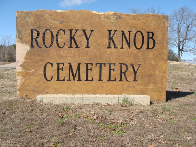
| Location | : | Finger, McNairy County, USA |
| Coordinate | : | 35.3541985, -88.4783020 |
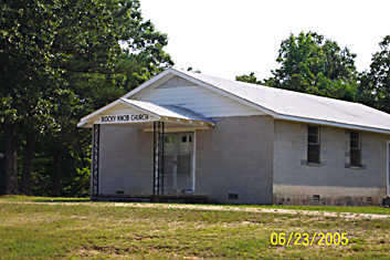
| Description | : | From the intersection of Rocky Knob Rd. & Center Hill Rd., east of Finger, travel south on Rocky Knob Rd. going 1.0 mi., turning north (left) into the circular driveway of the cemetery, about 200' west of the Rocky Knob Church. |
frequently asked questions (FAQ):
-
Where is Rocky Knob Church Cemetery?
Rocky Knob Church Cemetery is located at 2389 Rocky Knob Road Finger, McNairy County ,Tennessee , 38334USA.
-
Rocky Knob Church Cemetery cemetery's updated grave count on graveviews.com?
1 memorials
-
Where are the coordinates of the Rocky Knob Church Cemetery?
Latitude: 35.3541985
Longitude: -88.4783020
Nearby Cemetories:
1. O'Neal Cemetery
McNairy County, USA
Coordinate: 35.3671410, -88.4553990
2. Baucum Cemetery (Defunct)
McNairy County, USA
Coordinate: 35.3302994, -88.4935989
3. Blakeley Cemetery
Adamsville, McNairy County, USA
Coordinate: 35.3156050, -88.4795500
4. Maggie Jones United Methodist Church Cemetery
Finger, McNairy County, USA
Coordinate: 35.3291700, -88.5166300
5. Hopewell Church Cemetery
Finger, McNairy County, USA
Coordinate: 35.3758011, -88.5203018
6. Ingraham Cemetery
Finger, McNairy County, USA
Coordinate: 35.3266150, -88.5151560
7. Plunk Cemetery
Finger, McNairy County, USA
Coordinate: 35.3382988, -88.5333023
8. Enville Baptist Church Cemetery
Enville, Chester County, USA
Coordinate: 35.3854530, -88.4287630
9. Hardin Cemetery
Adamsville, McNairy County, USA
Coordinate: 35.3231010, -88.4285965
10. Woodlawn Cemetery
Enville, Chester County, USA
Coordinate: 35.3922005, -88.4319000
11. Sweetlips Cemetery
Sweet Lips, Chester County, USA
Coordinate: 35.3992004, -88.5205994
12. Hendrix Cemetery
Finger, McNairy County, USA
Coordinate: 35.3189590, -88.5338280
13. Alexander Cemetery
Finger, McNairy County, USA
Coordinate: 35.3029830, -88.5120090
14. Mars Hill Cemetery
Adamsville, McNairy County, USA
Coordinate: 35.2954310, -88.4607290
15. Mount Zion Cemetery
Adamsville, McNairy County, USA
Coordinate: 35.3576680, -88.4036580
16. Mount Zion Cemetery
Milledgeville, McNairy County, USA
Coordinate: 35.3574982, -88.4036026
17. White Plains Cemetery
Finger, McNairy County, USA
Coordinate: 35.3731670, -88.5516960
18. Malone Cemetery
Finger, McNairy County, USA
Coordinate: 35.3602440, -88.5572960
19. Cabo Cemetery
Enville, Chester County, USA
Coordinate: 35.4245700, -88.4619800
20. Anderson Slave Cemetery
Finger, McNairy County, USA
Coordinate: 35.3598000, -88.5659000
21. Johnson Cemetery
Enville, Chester County, USA
Coordinate: 35.3995020, -88.4091130
22. Wharton Cemetery
Purdy, McNairy County, USA
Coordinate: 35.2898140, -88.5192220
23. Lanes Chapel Cemetery
Finger, McNairy County, USA
Coordinate: 35.3312510, -88.5639110
24. Winding Ridge Cemetery
Adamsville, McNairy County, USA
Coordinate: 35.2895770, -88.4190540