
| Memorials | : | 0 |
| Location | : | Sardis, Henderson County, USA |
| Coordinate | : | 35.4570870, -88.3561740 |
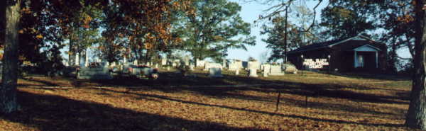
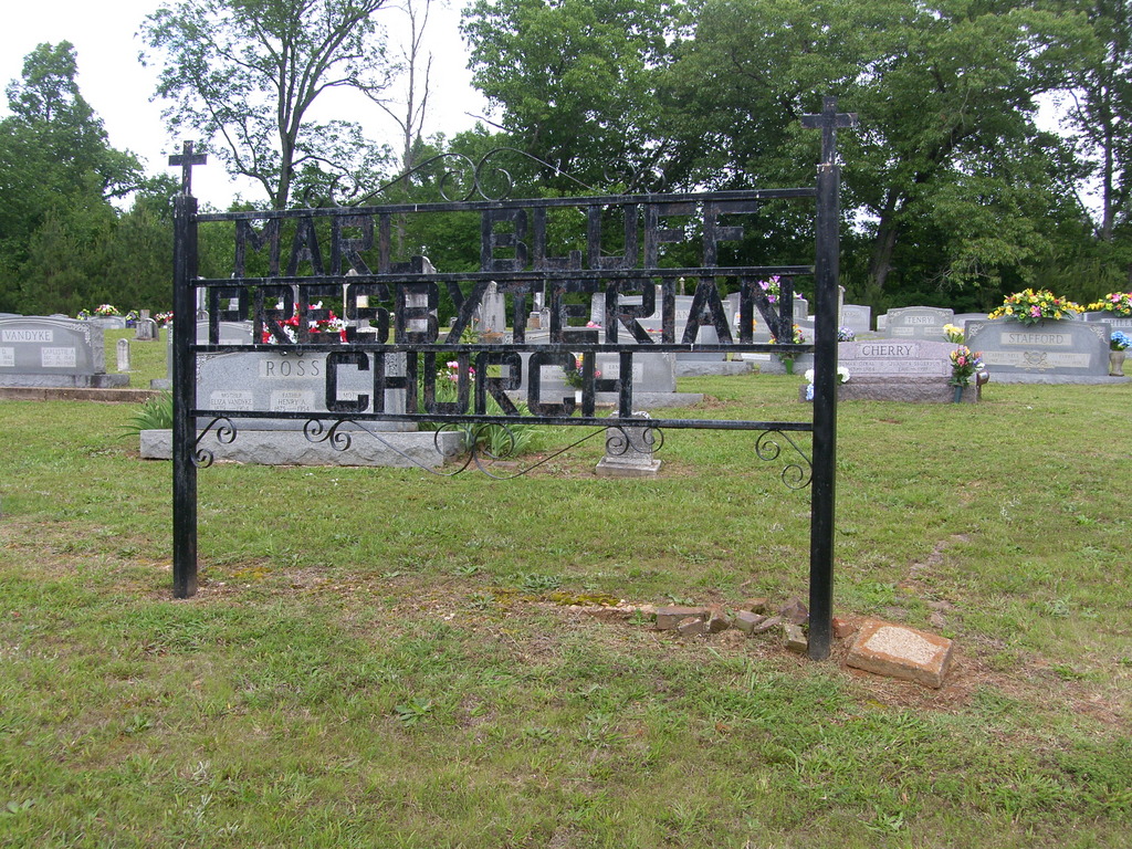
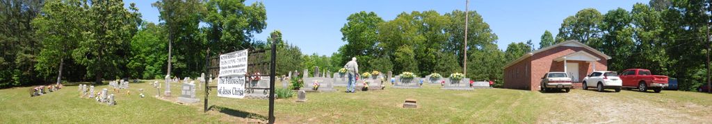
| Description | : | This cemetery is located at Marl Bluff Presbyterian Church. Drive south from Lexington on highway 22 going into Chester County. Turn left on the road marked for Sardis. (Hwy 201) Pass back into Henderson County and turn right at the next intersection. All turns are marked. |
frequently asked questions (FAQ):
-
Where is Marl Bluff Cemetery?
Marl Bluff Cemetery is located at Sardis, Henderson County ,Tennessee ,USA.
-
Marl Bluff Cemetery cemetery's updated grave count on graveviews.com?
0 memorials
-
Where are the coordinates of the Marl Bluff Cemetery?
Latitude: 35.4570870
Longitude: -88.3561740
Nearby Cemetories:
1. Benson Cemetery
Chester County, USA
Coordinate: 35.4453011, -88.3685989
2. Little Hurricane Cemetery
Sardis, Henderson County, USA
Coordinate: 35.4605060, -88.3302360
3. Edge Cemetery
Reagan, Henderson County, USA
Coordinate: 35.4788830, -88.3620300
4. Roby Cemetery
Chester County, USA
Coordinate: 35.4644012, -88.3983002
5. McBride Cemetery
Sardis, Henderson County, USA
Coordinate: 35.4406013, -88.3106003
6. Grove Springs Cemetery
Chester County, USA
Coordinate: 35.4413986, -88.4049988
7. Pleasant View Cemetery
Sardis, Henderson County, USA
Coordinate: 35.4639730, -88.3019970
8. Union Hill Church Cemetery
Reagan, Henderson County, USA
Coordinate: 35.4977250, -88.3826800
9. Ridley Chapel Cemetery
Reagan, Henderson County, USA
Coordinate: 35.5026110, -88.3454170
10. Criner Cemetery
Roby, Chester County, USA
Coordinate: 35.4662000, -88.4141000
11. Spring Hill Cemetery
Sardis, Henderson County, USA
Coordinate: 35.4277992, -88.3091965
12. Stone Hill Pentecostal Church Cemetery
Reagan, Henderson County, USA
Coordinate: 35.4931480, -88.4004280
13. Carroll Cemetery
Chester County, USA
Coordinate: 35.4477997, -88.4197006
14. Hurricane Church Cemetery
Hinkle, Hardin County, USA
Coordinate: 35.4080320, -88.3240380
15. Shiloh Cemetery
Reagan, Henderson County, USA
Coordinate: 35.4876190, -88.4149490
16. Barren Springs Cemetery
Reagan, Henderson County, USA
Coordinate: 35.5183310, -88.3400860
17. Sardis Cemetery
Sardis, Henderson County, USA
Coordinate: 35.4366020, -88.2833100
18. Preslar Cemetery
Henderson County, USA
Coordinate: 35.5167007, -88.3846970
19. Mount Moriah Cemetery
Henderson County, USA
Coordinate: 35.5222500, -88.3593700
20. Patterson Cemetery
Reagan, Henderson County, USA
Coordinate: 35.5072000, -88.4108000
21. Stewart Cemetery
Chester County, USA
Coordinate: 35.4700012, -88.4417038
22. Prospect Church Cemetery
Sardis, Henderson County, USA
Coordinate: 35.4584950, -88.2683120
23. Johnson Cemetery
Enville, Chester County, USA
Coordinate: 35.3995020, -88.4091130
24. Patterson Cemetery
Reagan, Henderson County, USA
Coordinate: 35.5110680, -88.4156360