
| Memorials | : | 247 |
| Location | : | Minster on Sea, Swale Borough, England |
| Coordinate | : | 51.4219320, 0.8119580 |
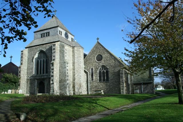
| Description | : | Minster Abbey or, to give it its full title, The Abbey Church of the Blessed Virgin Mary and Saint Sexburga, occupies the highest hilltop position on the otherwise flat Isle of Sheppey in Kent and has been a place of worship for over 1,400 years. Founded as a Benedictine nunnery by the widowed Queen Sexburgha in 664, it was endowed with land given by her son Ercombert, King of Kent. With no stone on the island the building material was hewn at Boughton Monchelsea and brought down the River Medway and the Swale. Examples of early Saxon stone and Roman tiles,... Read More |
frequently asked questions (FAQ):
-
Where is Minster Abbey?
Minster Abbey is located at High St Street Minster on Sea, Swale Borough ,Kent , ME12 3QDEngland.
-
Minster Abbey cemetery's updated grave count on graveviews.com?
5 memorials
-
Where are the coordinates of the Minster Abbey?
Latitude: 51.4219320
Longitude: 0.8119580
Nearby Cemetories:
1. Ss Mary and Sexburga New Churchyard
Minster on Sea, Swale Borough, England
Coordinate: 51.4235540, 0.8098720
2. Sheppey Cemetery
Sheerness, Swale Borough, England
Coordinate: 51.4232780, 0.7718320
3. All Saints Churchyard
Eastchurch, Swale Borough, England
Coordinate: 51.4068909, 0.8574320
4. Holy Trinity Churchyard
Queenborough, Swale Borough, England
Coordinate: 51.4174080, 0.7443560
5. St Clement Churchyard
Leysdown, Swale Borough, England
Coordinate: 51.3970440, 0.9066620
6. All Saints Churchyard
Iwade, Swale Borough, England
Coordinate: 51.3787920, 0.7306550
7. St James Churchyard
Grain, Medway Unitary Authority, England
Coordinate: 51.4585991, 0.7173300
8. Holy Trinity Churchyard
Milton Regis, Swale Borough, England
Coordinate: 51.3556700, 0.7401300
9. St Giles Churchyard
Tonge, Swale Borough, England
Coordinate: 51.3424640, 0.7757790
10. St Mary Churchyard
Teynham, Swale Borough, England
Coordinate: 51.3377640, 0.8213570
11. St Thomas the Apostle Churchyard
Harty, Swale Borough, England
Coordinate: 51.3598251, 0.9045590
12. Garden of England Crematorium
Bobbing, Swale Borough, England
Coordinate: 51.3595330, 0.7179190
13. Murston Cemetery
Sittingbourne, Swale Borough, England
Coordinate: 51.3424700, 0.7527100
14. Deerton Natural Burial Ground
Teynham, Swale Borough, England
Coordinate: 51.3344460, 0.8297850
15. St. Bartholomew's Churchyard
Bobbing, Swale Borough, England
Coordinate: 51.3537600, 0.7101420
16. St. Laurence's Churchyard
Bapchild, Swale Borough, England
Coordinate: 51.3330520, 0.7655020
17. St Mary Churchyard
Luddenham, Swale Borough, England
Coordinate: 51.3324180, 0.8586720
18. Holy Trinity Church
Sittingbourne, Swale Borough, England
Coordinate: 51.3416000, 0.7316000
19. St Peter's Churchyard
Oare, Swale Borough, England
Coordinate: 51.3335910, 0.8804350
20. St Margaret of Antioch Churchyard
Lower Halstow, Swale Borough, England
Coordinate: 51.3752975, 0.6711660
21. Sittingbourne Cemetery
Sittingbourne, Swale Borough, England
Coordinate: 51.3345300, 0.7348000
22. St. Nicholas Churchyard
Rodmersham, Swale Borough, England
Coordinate: 51.3227780, 0.7627730
23. St Mary Churchyard
Norton, Swale Borough, England
Coordinate: 51.3149750, 0.8221900
24. St. Andrew the Apostle Churchyard
Shoeburyness, Southend-on-Sea Unitary Authority, England
Coordinate: 51.5273210, 0.7801570