
| Memorials | : | 0 |
| Location | : | Monster, Westland Municipality, Netherlands |
| Coordinate | : | 52.0293500, 4.1781900 |
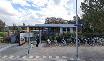
| Description | : | Monster is a small town on the main road between The Hague and Hook of Holland, lying 15 kilometres south-west of The Hague and 10 kilometres north of Hook of Holland. The cemetery is on the north side of the town, in Molenweg, 200 metres from the junction with Haagweg, and about 200 metres south of the windmill. |
frequently asked questions (FAQ):
-
Where is Monster General Cemetery?
Monster General Cemetery is located at Monster, Westland Municipality ,Zuid-Holland ,Netherlands.
-
Monster General Cemetery cemetery's updated grave count on graveviews.com?
0 memorials
-
Where are the coordinates of the Monster General Cemetery?
Latitude: 52.0293500
Longitude: 4.1781900
Nearby Cemetories:
1. 's Gravenzande General Cemetery
's-Gravenzande, Westland Municipality, Netherlands
Coordinate: 51.9955500, 4.1618300
2. Joodse Begraafplaats
Naaldwijk, Westland Municipality, Netherlands
Coordinate: 51.9953000, 4.1945700
3. Westduin Cemetery
Den Haag Municipality, Netherlands
Coordinate: 52.0570000, 4.2244500
4. Loosduinen Abbey Church Cemetery
Loosduinen, Den Haag Municipality, Netherlands
Coordinate: 52.0505920, 4.2349720
5. Hoek Van Holland General Cemetery
Hoek van Holland, Rotterdam Municipality, Netherlands
Coordinate: 51.9824900, 4.1251600
6. Begraafplaats Oud Eik en Duinen
The Hague (Den Haag), Den Haag Municipality, Netherlands
Coordinate: 52.0677680, 4.2647120
7. Algemene begraafplaats Wateringen
Wateringen, Westland Municipality, Netherlands
Coordinate: 52.0233765, 4.2847066
8. Begraafplaats Nieuw Eykenduynen
The Hague (Den Haag), Den Haag Municipality, Netherlands
Coordinate: 52.0683300, 4.2677800
9. De Lier Cemetery
De Lier, Westland Municipality, Netherlands
Coordinate: 51.9712106, 4.2550109
10. Yardenhuis van Rijswijk
Rijswijk, Rijswijk Municipality, Netherlands
Coordinate: 52.0224480, 4.3065550
11. Sint-Jacobskerk
The Hague (Den Haag), Den Haag Municipality, Netherlands
Coordinate: 52.0772429, 4.3063240
12. Portugees Israëlitische Begraafplaats
Den Haag Centrum, Den Haag Municipality, Netherlands
Coordinate: 52.0881600, 4.2967600
13. Rooms Katholieke Begraafplaats
Rijswijk, Rijswijk Municipality, Netherlands
Coordinate: 52.0517400, 4.3299400
14. Kloosterkerk
The Hague (Den Haag), Den Haag Municipality, Netherlands
Coordinate: 52.0819108, 4.3096609
15. Nieuwe Kerk
The Hague (Den Haag), Den Haag Municipality, Netherlands
Coordinate: 52.0763640, 4.3156760
16. Rooms-Katholieke Begraafplaats
Schipluiden, Midden-Delfland Municipality, Netherlands
Coordinate: 51.9865029, 4.3193462
17. Begraafplaats Sint Petrus Banden
The Hague (Den Haag), Den Haag Municipality, Netherlands
Coordinate: 52.0936900, 4.2996800
18. Oude-Kerk Kerkhof
Rijswijk, Rijswijk Municipality, Netherlands
Coordinate: 52.0558439, 4.3343807
19. Oud-Rijswijk Cemetery
Rijswijk, Rijswijk Municipality, Netherlands
Coordinate: 52.0473620, 4.3375760
20. Algemene Begraafplaats Kerkhoflaan
The Hague (Den Haag), Den Haag Municipality, Netherlands
Coordinate: 52.0954819, 4.3036821
21. Begraafplaats Sint Barbara
The Hague (Den Haag), Den Haag Municipality, Netherlands
Coordinate: 52.0684300, 4.3405300
22. Oude Kerk
Delft, Delft Municipality, Netherlands
Coordinate: 52.0126510, 4.3558930
23. Nieuwe Kerk
Delft, Delft Municipality, Netherlands
Coordinate: 52.0122500, 4.3606780
24. Joodse Begraafplaats
Delft Municipality, Netherlands
Coordinate: 52.0133880, 4.3713430