
| Memorials | : | 0 |
| Location | : | 's-Gravenzande, Westland Municipality, Netherlands |
| Coordinate | : | 51.9955500, 4.1618300 |
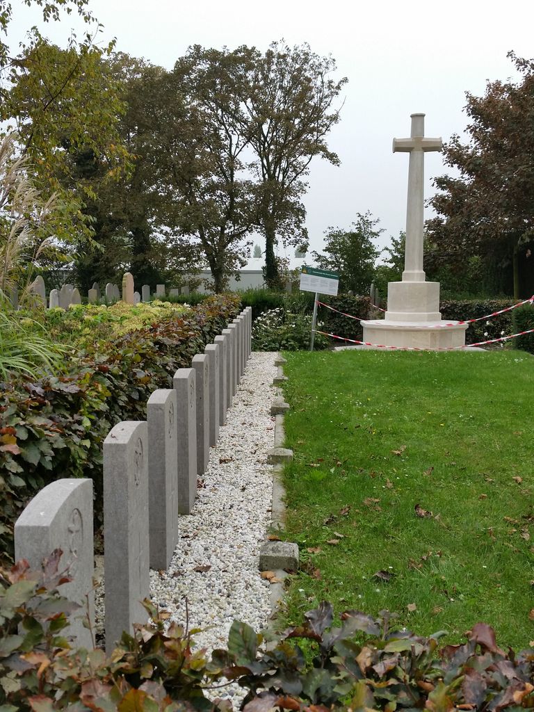
| Description | : | 's Gravenzande is situated to the south-west of Den Haag (The Hague) on the coast in Zuid-Holland (South Holland.) From the Rotterdam ring E25 follow the signs for The Hook of Holland, and then follow the E30 through Monster to 's Gravenzande. Follow the main road through the town, called Naaldwijkseweg, and the cemetery is along here near the windmill and next to the church. 's-Gravenzande was granted city rights in 1246 by Count William II of Holland who, just like his father Count Floris IV, regularly resided at his estate near the town. It is therefore the only "city"... Read More |
frequently asked questions (FAQ):
-
Where is 's Gravenzande General Cemetery?
's Gravenzande General Cemetery is located at 's-Gravenzande, Westland Municipality ,Zuid-Holland ,Netherlands.
-
's Gravenzande General Cemetery cemetery's updated grave count on graveviews.com?
0 memorials
-
Where are the coordinates of the 's Gravenzande General Cemetery?
Latitude: 51.9955500
Longitude: 4.1618300
Nearby Cemetories:
1. Joodse Begraafplaats
Naaldwijk, Westland Municipality, Netherlands
Coordinate: 51.9953000, 4.1945700
2. Hoek Van Holland General Cemetery
Hoek van Holland, Rotterdam Municipality, Netherlands
Coordinate: 51.9824900, 4.1251600
3. Monster General Cemetery
Monster, Westland Municipality, Netherlands
Coordinate: 52.0293500, 4.1781900
4. De Lier Cemetery
De Lier, Westland Municipality, Netherlands
Coordinate: 51.9712106, 4.2550109
5. Loosduinen Abbey Church Cemetery
Loosduinen, Den Haag Municipality, Netherlands
Coordinate: 52.0505920, 4.2349720
6. Westduin Cemetery
Den Haag Municipality, Netherlands
Coordinate: 52.0570000, 4.2244500
7. Algemene begraafplaats Wateringen
Wateringen, Westland Municipality, Netherlands
Coordinate: 52.0233765, 4.2847066
8. Yardenhuis van Rijswijk
Rijswijk, Rijswijk Municipality, Netherlands
Coordinate: 52.0224480, 4.3065550
9. Oostvoorne Protestant Cemetery
Oostvoorne, Westvoorne Municipality, Netherlands
Coordinate: 51.9103000, 4.0997100
10. Begraafplaats Oud Eik en Duinen
The Hague (Den Haag), Den Haag Municipality, Netherlands
Coordinate: 52.0677680, 4.2647120
11. Rooms-Katholieke Begraafplaats
Schipluiden, Midden-Delfland Municipality, Netherlands
Coordinate: 51.9865029, 4.3193462
12. Begraafplaats Nieuw Eykenduynen
The Hague (Den Haag), Den Haag Municipality, Netherlands
Coordinate: 52.0683300, 4.2677800
13. Brielle Oude Algemene Begraafplaats
Brielle, Brielle Municipality, Netherlands
Coordinate: 51.8974400, 4.1595100
14. Algemene Begraafplaats
Maassluis, Maassluis Municipality, Netherlands
Coordinate: 51.9162000, 4.2579500
15. Oostvoorne Roman Catholic Cemetery
Oostvoorne, Westvoorne Municipality, Netherlands
Coordinate: 51.8962300, 4.1527600
16. Rozenburg General Cemetery
Rozenburg, Rotterdam Municipality, Netherlands
Coordinate: 51.9034500, 4.2513600
17. Brielle Nieuwe Algemene Begraafplaats
Brielle, Brielle Municipality, Netherlands
Coordinate: 51.8861377, 4.1633283
18. Rooms Katholieke Begraafplaats
Rijswijk, Rijswijk Municipality, Netherlands
Coordinate: 52.0517400, 4.3299400
19. Oud-Rijswijk Cemetery
Rijswijk, Rijswijk Municipality, Netherlands
Coordinate: 52.0473620, 4.3375760
20. Oude Kerk
Delft, Delft Municipality, Netherlands
Coordinate: 52.0126510, 4.3558930
21. Sint-Jacobskerk
The Hague (Den Haag), Den Haag Municipality, Netherlands
Coordinate: 52.0772429, 4.3063240
22. Zwartewaal General Cemetery
Zwartewaal, Brielle Municipality, Netherlands
Coordinate: 51.8781800, 4.2135600
23. Oude-Kerk Kerkhof
Rijswijk, Rijswijk Municipality, Netherlands
Coordinate: 52.0558439, 4.3343807
24. Holy Begraafplaats
Vlaardingen, Vlaardingen Municipality, Netherlands
Coordinate: 51.9384700, 4.3380100