
| Memorials | : | 0 |
| Location | : | Den Haag Municipality, Netherlands |
| Coordinate | : | 52.0570000, 4.2244500 |
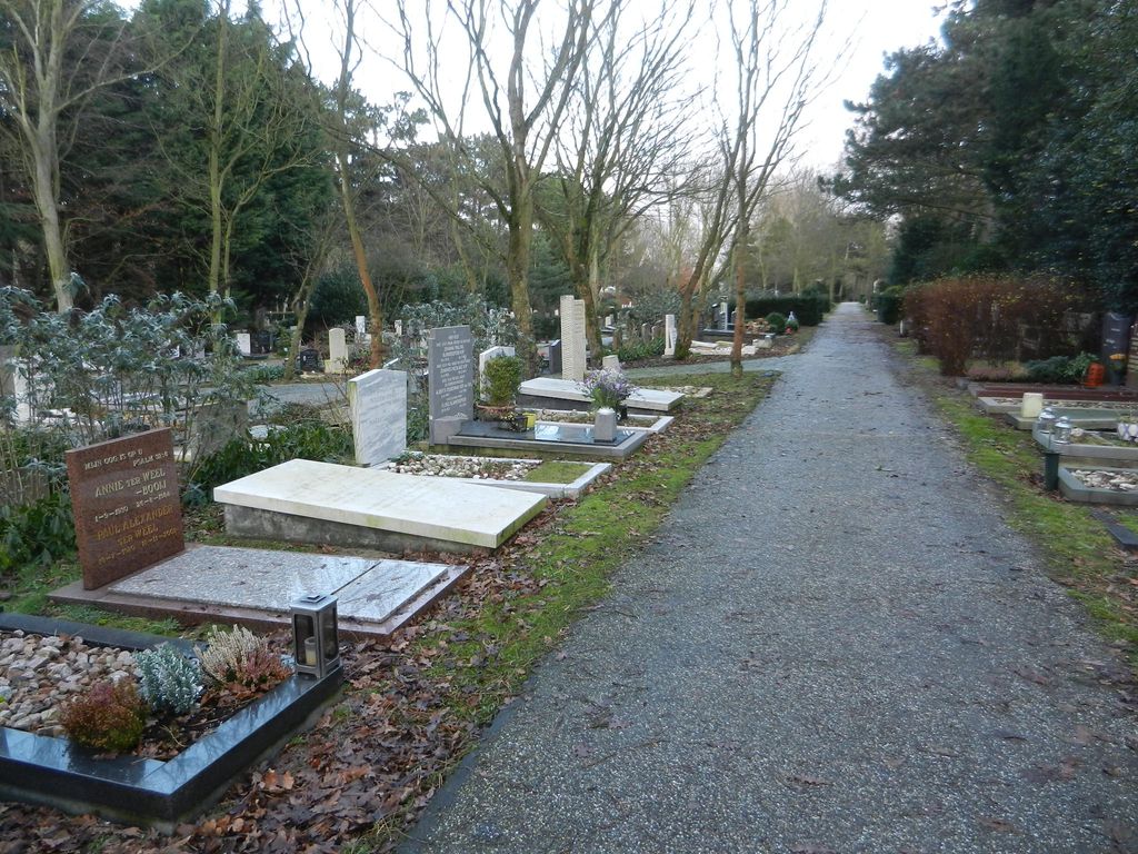
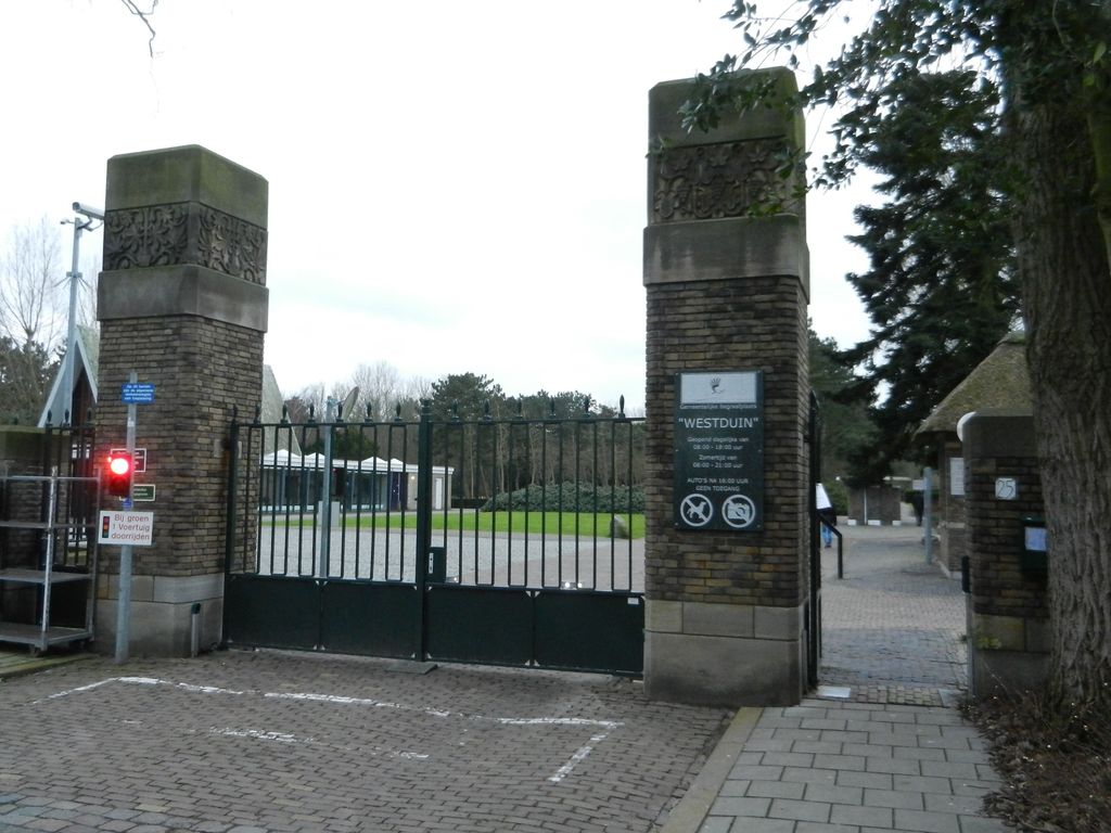
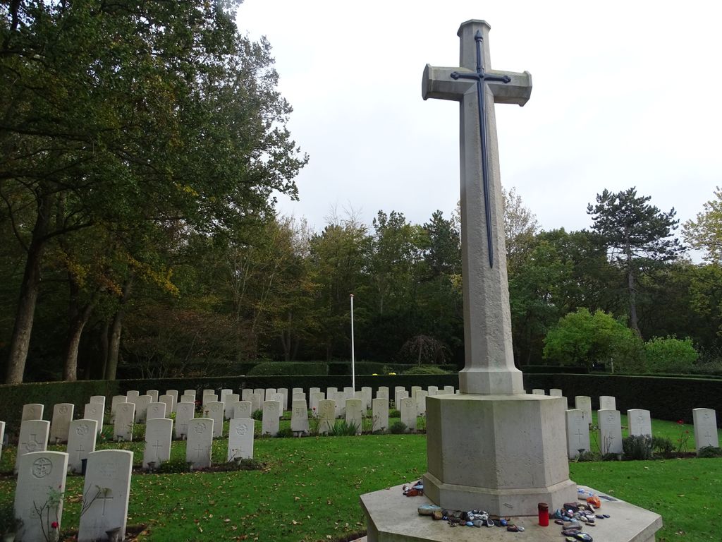
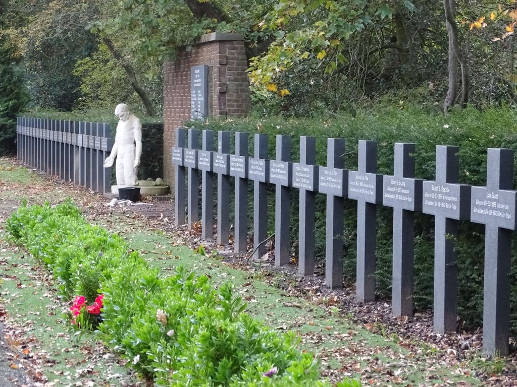
| Description | : | Westduin is a suburb in the south-western district of The Hague (Den Haag). From the A4 motorway take exit (afrit) 12 RIJSWIJK / DEN HAAG ZUID / HOEK VAN HOLLAND. Follow the signs for N211 direction DEN HAAG ZUID. Continue along this road (LOZERLAAN) for approx 7kms, the road name then becomes OCKENBURGHSTRAAT, after 400m turn left at the signpost for BEGRAAFPLAATS. In this cemetery will be found, in a separate section, 87 Commonwealth casaulties of World War II, the majory of them airmen. Also buried here are members of the Dutch resistance to German occupation. |
frequently asked questions (FAQ):
-
Where is Westduin Cemetery?
Westduin Cemetery is located at OCKENBURGHSTRAAT 27 Den Haag Municipality ,Zuid-Holland , 2553AANetherlands.
-
Westduin Cemetery cemetery's updated grave count on graveviews.com?
0 memorials
-
Where are the coordinates of the Westduin Cemetery?
Latitude: 52.0570000
Longitude: 4.2244500
Nearby Cemetories:
1. Loosduinen Abbey Church Cemetery
Loosduinen, Den Haag Municipality, Netherlands
Coordinate: 52.0505920, 4.2349720
2. Begraafplaats Oud Eik en Duinen
The Hague (Den Haag), Den Haag Municipality, Netherlands
Coordinate: 52.0677680, 4.2647120
3. Begraafplaats Nieuw Eykenduynen
The Hague (Den Haag), Den Haag Municipality, Netherlands
Coordinate: 52.0683300, 4.2677800
4. Monster General Cemetery
Monster, Westland Municipality, Netherlands
Coordinate: 52.0293500, 4.1781900
5. Algemene begraafplaats Wateringen
Wateringen, Westland Municipality, Netherlands
Coordinate: 52.0233765, 4.2847066
6. Sint-Jacobskerk
The Hague (Den Haag), Den Haag Municipality, Netherlands
Coordinate: 52.0772429, 4.3063240
7. Portugees Israëlitische Begraafplaats
Den Haag Centrum, Den Haag Municipality, Netherlands
Coordinate: 52.0881600, 4.2967600
8. Kloosterkerk
The Hague (Den Haag), Den Haag Municipality, Netherlands
Coordinate: 52.0819108, 4.3096609
9. Begraafplaats Sint Petrus Banden
The Hague (Den Haag), Den Haag Municipality, Netherlands
Coordinate: 52.0936900, 4.2996800
10. Nieuwe Kerk
The Hague (Den Haag), Den Haag Municipality, Netherlands
Coordinate: 52.0763640, 4.3156760
11. Yardenhuis van Rijswijk
Rijswijk, Rijswijk Municipality, Netherlands
Coordinate: 52.0224480, 4.3065550
12. Algemene Begraafplaats Kerkhoflaan
The Hague (Den Haag), Den Haag Municipality, Netherlands
Coordinate: 52.0954819, 4.3036821
13. Joodse Begraafplaats
Naaldwijk, Westland Municipality, Netherlands
Coordinate: 51.9953000, 4.1945700
14. Rooms Katholieke Begraafplaats
Rijswijk, Rijswijk Municipality, Netherlands
Coordinate: 52.0517400, 4.3299400
15. Oude-Kerk Kerkhof
Rijswijk, Rijswijk Municipality, Netherlands
Coordinate: 52.0558439, 4.3343807
16. Oud-Rijswijk Cemetery
Rijswijk, Rijswijk Municipality, Netherlands
Coordinate: 52.0473620, 4.3375760
17. Begraafplaats Sint Barbara
The Hague (Den Haag), Den Haag Municipality, Netherlands
Coordinate: 52.0684300, 4.3405300
18. 's Gravenzande General Cemetery
's-Gravenzande, Westland Municipality, Netherlands
Coordinate: 51.9955500, 4.1618300
19. De Lier Cemetery
De Lier, Westland Municipality, Netherlands
Coordinate: 51.9712106, 4.2550109
20. Rooms-Katholieke Begraafplaats
Schipluiden, Midden-Delfland Municipality, Netherlands
Coordinate: 51.9865029, 4.3193462
21. Oude Kerk
Delft, Delft Municipality, Netherlands
Coordinate: 52.0126510, 4.3558930
22. Nieuwe Kerk
Delft, Delft Municipality, Netherlands
Coordinate: 52.0122500, 4.3606780
23. Hoek Van Holland General Cemetery
Hoek van Holland, Rotterdam Municipality, Netherlands
Coordinate: 51.9824900, 4.1251600
24. Joodse Begraafplaats
Delft Municipality, Netherlands
Coordinate: 52.0133880, 4.3713430