
| Memorials | : | 0 |
| Location | : | Hoek van Holland, Rotterdam Municipality, Netherlands |
| Coordinate | : | 51.9824900, 4.1251600 |
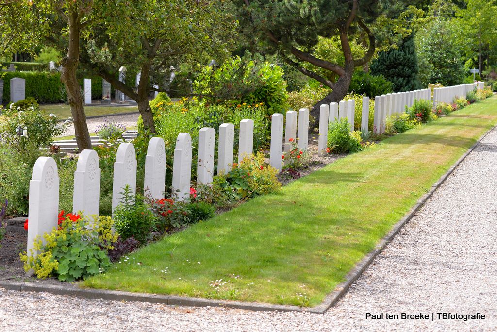
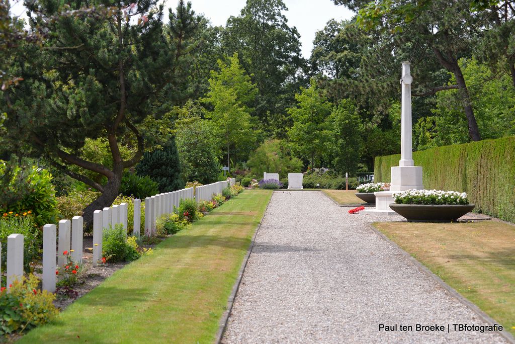
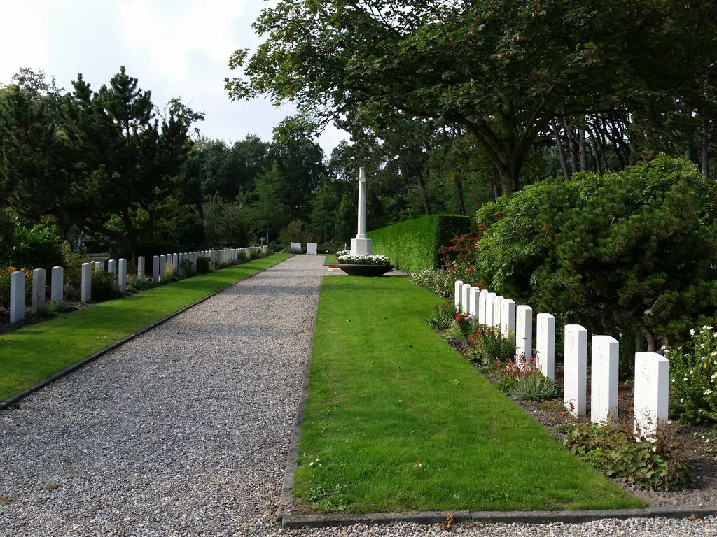
| Description | : | The Hook of Holland is situated to the south-west of Den Haag on the coast. From Rotterdam follow the A20 direction HOEK van HOLLAND till the end and then follow the N220 (this is the MAASDIJK) direction HOEK van HOLLAND to its end. Turn left and follow signs for CENTRUM (this is the DIRK van den BURGWEG) after approx 5km turn left onto KERKHOFWEG (signposted ALGEMENE BEGRAAFPLAATS) the cemetery is along here on the right hand side. Few Commonwealth troops were in the Netherlands during the 1940 invasion by the Germans, but a small force composed of Royal... Read More |
frequently asked questions (FAQ):
-
Where is Hoek Van Holland General Cemetery?
Hoek Van Holland General Cemetery is located at Kerkhofweg 6 Hoek van Holland, Rotterdam Municipality ,Zuid-Holland , 3151TNNetherlands.
-
Hoek Van Holland General Cemetery cemetery's updated grave count on graveviews.com?
0 memorials
-
Where are the coordinates of the Hoek Van Holland General Cemetery?
Latitude: 51.9824900
Longitude: 4.1251600
Nearby Cemetories:
1. 's Gravenzande General Cemetery
's-Gravenzande, Westland Municipality, Netherlands
Coordinate: 51.9955500, 4.1618300
2. Joodse Begraafplaats
Naaldwijk, Westland Municipality, Netherlands
Coordinate: 51.9953000, 4.1945700
3. Monster General Cemetery
Monster, Westland Municipality, Netherlands
Coordinate: 52.0293500, 4.1781900
4. Oostvoorne Protestant Cemetery
Oostvoorne, Westvoorne Municipality, Netherlands
Coordinate: 51.9103000, 4.0997100
5. De Lier Cemetery
De Lier, Westland Municipality, Netherlands
Coordinate: 51.9712106, 4.2550109
6. Brielle Oude Algemene Begraafplaats
Brielle, Brielle Municipality, Netherlands
Coordinate: 51.8974400, 4.1595100
7. Oostvoorne Roman Catholic Cemetery
Oostvoorne, Westvoorne Municipality, Netherlands
Coordinate: 51.8962300, 4.1527600
8. Loosduinen Abbey Church Cemetery
Loosduinen, Den Haag Municipality, Netherlands
Coordinate: 52.0505920, 4.2349720
9. Westduin Cemetery
Den Haag Municipality, Netherlands
Coordinate: 52.0570000, 4.2244500
10. Brielle Nieuwe Algemene Begraafplaats
Brielle, Brielle Municipality, Netherlands
Coordinate: 51.8861377, 4.1633283
11. Algemene Begraafplaats
Maassluis, Maassluis Municipality, Netherlands
Coordinate: 51.9162000, 4.2579500
12. Algemene begraafplaats Wateringen
Wateringen, Westland Municipality, Netherlands
Coordinate: 52.0233765, 4.2847066
13. Rozenburg General Cemetery
Rozenburg, Rotterdam Municipality, Netherlands
Coordinate: 51.9034500, 4.2513600
14. Zeeweg General Cemetery
Rockanje, Westvoorne Municipality, Netherlands
Coordinate: 51.8747900, 4.0674300
15. Zwartewaal General Cemetery
Zwartewaal, Brielle Municipality, Netherlands
Coordinate: 51.8781800, 4.2135600
16. Yardenhuis van Rijswijk
Rijswijk, Rijswijk Municipality, Netherlands
Coordinate: 52.0224480, 4.3065550
17. Rooms-Katholieke Begraafplaats
Schipluiden, Midden-Delfland Municipality, Netherlands
Coordinate: 51.9865029, 4.3193462
18. Begraafplaats Oud Eik en Duinen
The Hague (Den Haag), Den Haag Municipality, Netherlands
Coordinate: 52.0677680, 4.2647120
19. Begraafplaats Nieuw Eykenduynen
The Hague (Den Haag), Den Haag Municipality, Netherlands
Coordinate: 52.0683300, 4.2677800
20. Begraafplaats Heenvliet
Heenvliet, Nissewaard Municipality, Netherlands
Coordinate: 51.8654244, 4.2359608
21. Holy Begraafplaats
Vlaardingen, Vlaardingen Municipality, Netherlands
Coordinate: 51.9384700, 4.3380100
22. Protestant Church Cemetery
Heenvliet, Nissewaard Municipality, Netherlands
Coordinate: 51.8643528, 4.2439972
23. Nieuw-Helvoet General Cemetery
Nieuw-Helvoet, Hellevoetsluis Municipality, Netherlands
Coordinate: 51.8400400, 4.1244610
24. Rooms Katholieke Begraafplaats
Rijswijk, Rijswijk Municipality, Netherlands
Coordinate: 52.0517400, 4.3299400