
| Memorials | : | 11 |
| Location | : | Monterey County, USA |
| Coordinate | : | 36.8372002, -121.6793976 |
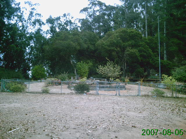
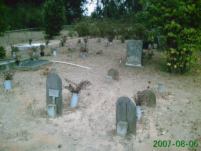
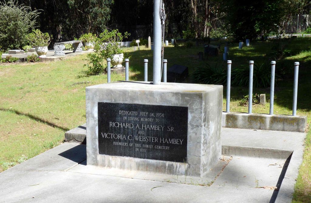
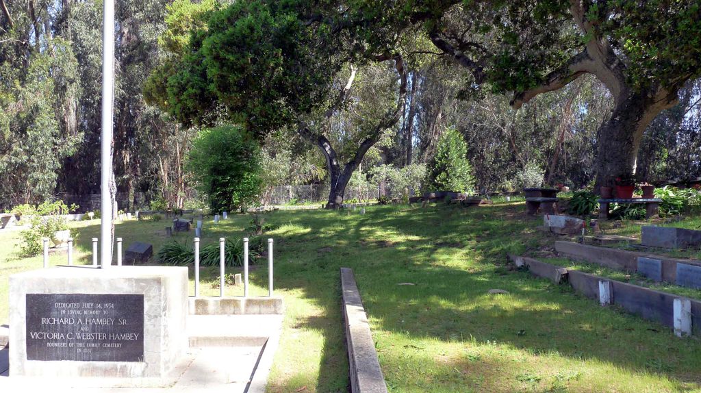
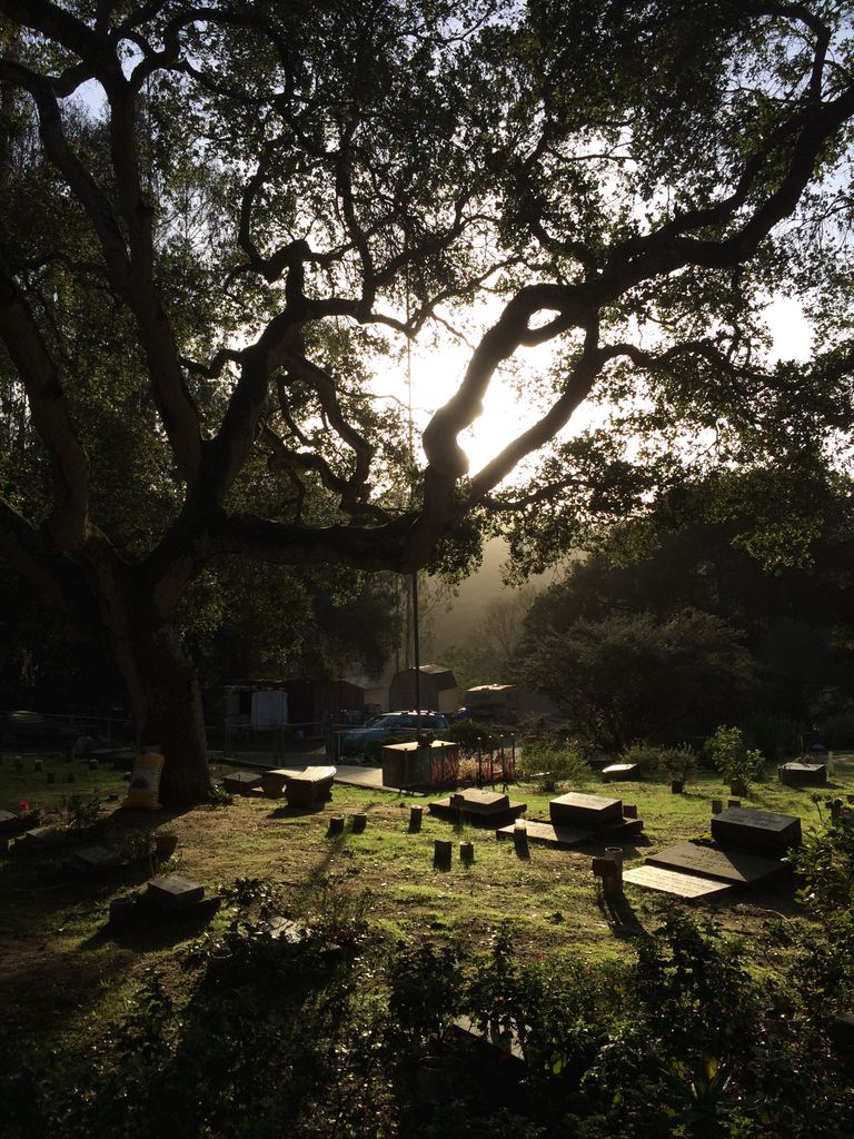
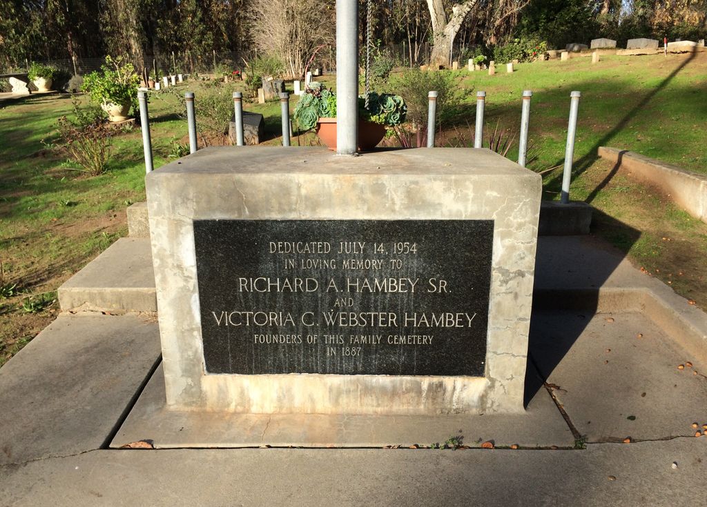
| Description | : | Hambey Cemetery (aka Prunedale Cemetery), 1555 Strong Circle, Royal Oaks (south of Watsonville), Monterey County, California. (Hambey Cemetery was founded in 1887 by Richard Hambey, Sr and Victoria W. Hambey. It is located on private property but is accessible to the public through the gate entrance at 1555 Strong Circle, Royal Oaks, California (off San Miguel Canyon Road). It is located at the very end of the 1555 Strong circle Drive way, and I mean at the very end on the left hand side, just keep to the left and you will pass two to three residences on your right... Read More |
frequently asked questions (FAQ):
-
Where is Hambey Cemetery?
Hambey Cemetery is located at Monterey County ,California ,USA.
-
Hambey Cemetery cemetery's updated grave count on graveviews.com?
10 memorials
-
Where are the coordinates of the Hambey Cemetery?
Latitude: 36.8372002
Longitude: -121.6793976

Nearby Cemetories:
1. Monterey Bay Loved Pet Cemetery
Monterey County, USA
Coordinate: 36.8326160, -121.6812820
2. Stephen Norriss Gravesite
Monterey County, USA
Coordinate: 36.8214110, -121.7601080
3. Queen of Heaven Cemetery
Prunedale, Monterey County, USA
Coordinate: 36.7602425, -121.6611252
4. Castroville Public Cemetery
Moss Landing, Monterey County, USA
Coordinate: 36.7930145, -121.7851410
5. All Saints Episcopal Church Memorial Garden
Watsonville, Santa Cruz County, USA
Coordinate: 36.9102310, -121.7568950
6. San Juan Bautista Cemetery
San Juan Bautista, San Benito County, USA
Coordinate: 36.8457985, -121.5438995
7. Santa Rita Chapel and Cemetery
Salinas, Monterey County, USA
Coordinate: 36.7281303, -121.6565475
8. Pioneer Cemetery
Watsonville, Santa Cruz County, USA
Coordinate: 36.9258560, -121.7642790
9. Watsonville Catholic Cemetery
Watsonville, Santa Cruz County, USA
Coordinate: 36.9278564, -121.7658463
10. Valley Catholic Cemetery
Watsonville, Santa Cruz County, USA
Coordinate: 36.9415932, -121.7405777
11. Valley Public Cemetery
Watsonville, Santa Cruz County, USA
Coordinate: 36.9418983, -121.7400513
12. Mission San Juan Bautista Cemetery
San Juan Bautista, San Benito County, USA
Coordinate: 36.8460007, -121.5339966
13. Pajaro Valley Memorial Park
Watsonville, Santa Cruz County, USA
Coordinate: 36.9629669, -121.7219391
14. Saint Georges Episcopal Church Columbarium
Salinas, Monterey County, USA
Coordinate: 36.7062580, -121.6440980
15. Monterey County Potters Field Cemetery
Salinas, Monterey County, USA
Coordinate: 36.6960900, -121.6381950
16. Chinese Cemetery
Salinas, Monterey County, USA
Coordinate: 36.6952057, -121.6390381
17. Calvary Catholic Cemetery
Salinas, Monterey County, USA
Coordinate: 36.6880341, -121.6818085
18. Saint Pauls Episcopal Church Columbarium
Salinas, Monterey County, USA
Coordinate: 36.6588430, -121.6558850
19. Garden of Memories
Salinas, Monterey County, USA
Coordinate: 36.6565247, -121.6384125
20. Yamato Cemetery
Salinas, Monterey County, USA
Coordinate: 36.6552811, -121.6307297
21. Gavilan Hills Memorial Park
Gilroy, Santa Clara County, USA
Coordinate: 37.0124000, -121.5909200
22. Saint Mary Cemetery
Gilroy, Santa Clara County, USA
Coordinate: 37.0134300, -121.5882000
23. Whitcher Cemetery
East Garrison, Monterey County, USA
Coordinate: 36.6501730, -121.7305270
24. Saint Mary Church Cemetery
Gilroy, Santa Clara County, USA
Coordinate: 37.0155970, -121.5765950