
| Memorials | : | 4571 |
| Location | : | Mottram in Longdendale, Metropolitan Borough of Tameside, England |
| Phone | : | 0161 342 4461 |
| Website | : | www.tameside.gov.uk/bereavement |
| Coordinate | : | 53.4546420, -2.0086900 |
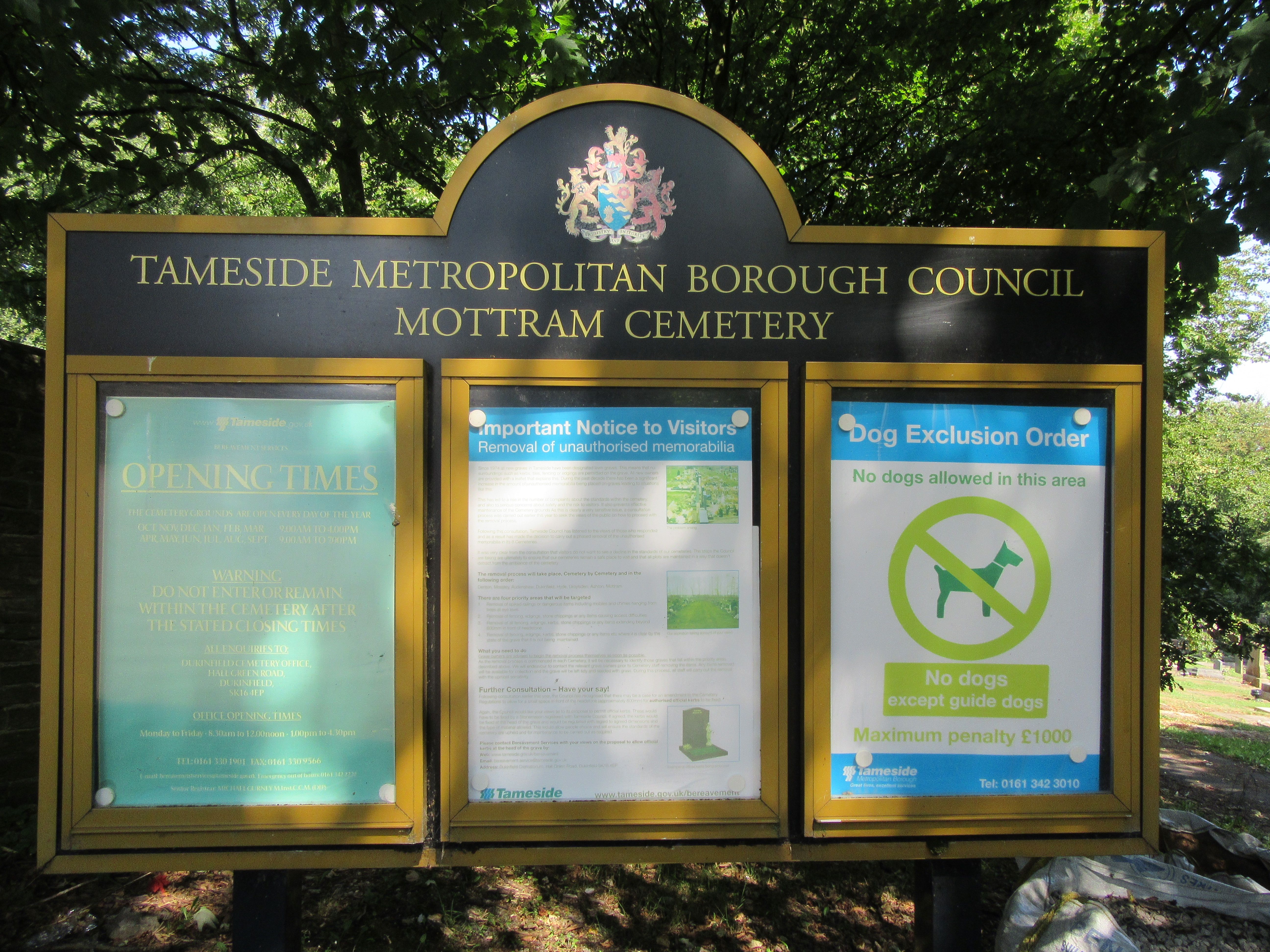
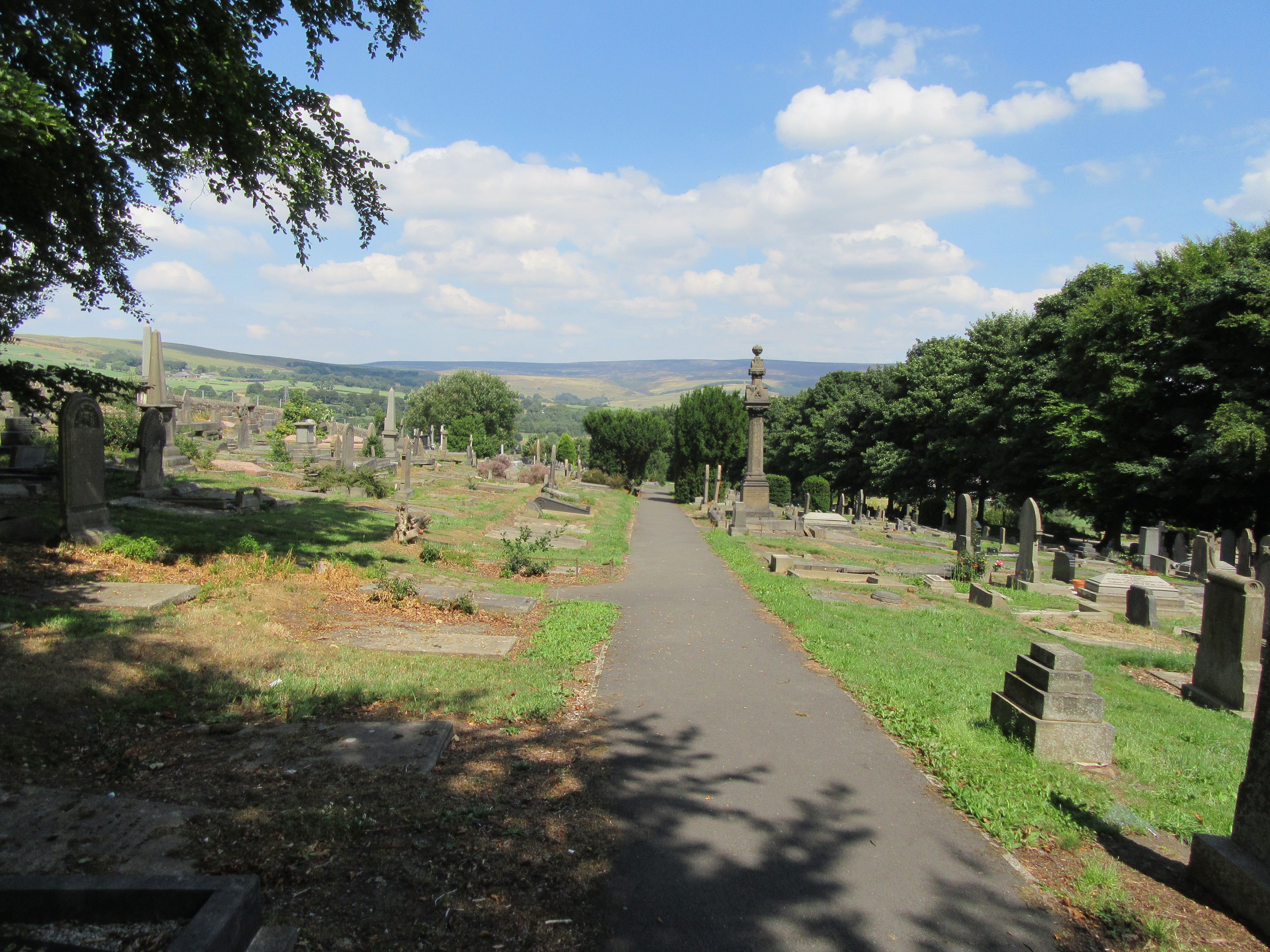
| Description | : | This municipal cemetery opened 1861. It is administered by Tameside Metropolitan Borough Council. The cemetery grounds are open every day of the year. October, November, December, January, February, March: 9.00am - 4.00pm April, May, June, July, August, September: 9.00am - 7.00pm The municipal cemetery lies immediately below the graveyard of St. Michael & All Angels Church. The church is accessed via Church Brow, Mottram in Longdendale. The oldest grave at St Michael's church is dated 1649. It is easy to walk from the municipal cemetery into the church graveyard, and vica versa. |
frequently asked questions (FAQ):
-
Where is Mottram Cemetery?
Mottram Cemetery is located at War Hill Mottram in Longdendale, Metropolitan Borough of Tameside ,Greater Manchester , SK14 6JLEngland.
-
Mottram Cemetery cemetery's updated grave count on graveviews.com?
4569 memorials
-
Where are the coordinates of the Mottram Cemetery?
Latitude: 53.4546420
Longitude: -2.0086900
Nearby Cemetories:
1. St. Michael Churchyard
Mottram in Longdendale, Metropolitan Borough of Tameside, England
Coordinate: 53.4544040, -2.0101460
2. Hollingworth United Methodist Cemetery
Hollingworth, Metropolitan Borough of Tameside, England
Coordinate: 53.4632891, -1.9958244
3. St. John the Evangelist Churchyard
Charlesworth, High Peak Borough, England
Coordinate: 53.4327430, -1.9945570
4. St. Mary's Independent Chapel
Charlesworth, High Peak Borough, England
Coordinate: 53.4317127, -1.9856703
5. Tintwistle Churchyard
Tintwistle, High Peak Borough, England
Coordinate: 53.4719150, -1.9685915
6. United Reformed Church
Tintwistle, High Peak Borough, England
Coordinate: 53.4729900, -1.9657910
7. St Mary's Churchyard
Hyde, Metropolitan Borough of Tameside, England
Coordinate: 53.4652400, -2.0599700
8. St. John The Baptist Churchyard
Hyde, Metropolitan Borough of Tameside, England
Coordinate: 53.4548411, -2.0644712
9. Glossop Cemetery
Glossop, High Peak Borough, England
Coordinate: 53.4573090, -1.9506990
10. Holy Trinity Churchyard
Gee Cross, Metropolitan Borough of Tameside, England
Coordinate: 53.4393900, -2.0645500
11. Saint James Churchyard
Whitfield, High Peak Borough, England
Coordinate: 53.4388640, -1.9529100
12. St Paul Churchyard
Stalybridge, Metropolitan Borough of Tameside, England
Coordinate: 53.4852000, -2.0440300
13. Saint Thomas The Apostle Churchyard
Hyde, Metropolitan Borough of Tameside, England
Coordinate: 53.4509000, -2.0707000
14. Hyde Cemetery
Hyde, Metropolitan Borough of Tameside, England
Coordinate: 53.4437910, -2.0684130
15. Littlemoor Chapel
Glossop, High Peak Borough, England
Coordinate: 53.4412869, -1.9498293
16. All Saints RC Churchyard
Glossop, High Peak Borough, England
Coordinate: 53.4499300, -1.9438570
17. Bethel Chapel Chapelyard
Stalybridge, Metropolitan Borough of Tameside, England
Coordinate: 53.4820413, -2.0576195
18. St George's Old Churchyard
Stalybridge, Metropolitan Borough of Tameside, England
Coordinate: 53.4844700, -2.0538800
19. Hyde Chapel Chapelyard
Gee Cross, Metropolitan Borough of Tameside, England
Coordinate: 53.4374900, -2.0728100
20. All Saints Churchyard
Glossop, High Peak Borough, England
Coordinate: 53.4501340, -1.9386090
21. St George Churchyard
Hyde, Metropolitan Borough of Tameside, England
Coordinate: 53.4466540, -2.0789750
22. St Georges Cemetery
Stalybridge, Metropolitan Borough of Tameside, England
Coordinate: 53.4873400, -2.0576800
23. St John's Churchyard
Dukinfield, Metropolitan Borough of Tameside, England
Coordinate: 53.4771000, -2.0726000
24. Dukinfield Cemetery and Crematorium
Dukinfield, Metropolitan Borough of Tameside, England
Coordinate: 53.4800300, -2.0857150