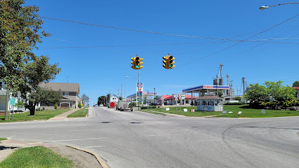
| Memorials | : | 0 |
| Location | : | Mount Eaton, Wayne County, USA |
| Coordinate | : | 40.6924440, -81.7001670 |
| Description | : | The cemetery is the southeastern-most cemetery of three adjacent cemeteries on the south side of Berry Street about 250 east of Canton Street. The cemetery is located in Paint Township, Wayne County, Ohio, and is # 12717 (Mount Eaton French and German Reformed Cemetery) in “Ohio Cemeteries 1803-2003”, compiled by the Ohio Genealogical Society. |
frequently asked questions (FAQ):
-
Where is Mount Eaton French and German Reformed Cemetery?
Mount Eaton French and German Reformed Cemetery is located at Berry Street Mount Eaton, Wayne County ,Ohio , 44624USA.
-
Mount Eaton French and German Reformed Cemetery cemetery's updated grave count on graveviews.com?
0 memorials
-
Where are the coordinates of the Mount Eaton French and German Reformed Cemetery?
Latitude: 40.6924440
Longitude: -81.7001670
Nearby Cemetories:
1. Mount Eaton Lutheran Cemetery
Mount Eaton, Wayne County, USA
Coordinate: 40.6926003, -81.7005005
2. Westlawn Cemetery
Mount Eaton, Wayne County, USA
Coordinate: 40.6973000, -81.7026978
3. Yoder Cemetery
Mount Eaton, Wayne County, USA
Coordinate: 40.6753006, -81.7268982
4. Hershberger Cemetery
Mount Eaton, Wayne County, USA
Coordinate: 40.6968994, -81.7367020
5. Menno Miller Farm Cemetery
Mount Eaton, Wayne County, USA
Coordinate: 40.6844480, -81.6627220
6. Joe Zook Cemetery
Mount Eaton, Wayne County, USA
Coordinate: 40.7190580, -81.7214860
7. Simon Farm Cemetery
Mount Eaton, Wayne County, USA
Coordinate: 40.7068890, -81.6532220
8. Hershberger Cemetery
Mount Eaton, Wayne County, USA
Coordinate: 40.6758003, -81.7461014
9. Stephen Keim Farm Cemetery
Winesburg, Holmes County, USA
Coordinate: 40.6558610, -81.6818560
10. Keim Cemetery
Holmes County, USA
Coordinate: 40.6557999, -81.6819000
11. West Lebanon Union Cemetery
West Lebanon, Wayne County, USA
Coordinate: 40.7262170, -81.6736130
12. West Lebanon Lutheran Cemetery
West Lebanon, Wayne County, USA
Coordinate: 40.7258987, -81.6653976
13. Andy C Slabaugh Cemetery
Mount Eaton, Wayne County, USA
Coordinate: 40.6937030, -81.7576880
14. Sugar Creek Township Cemetery
West Lebanon, Wayne County, USA
Coordinate: 40.7294998, -81.6688004
15. Yoder Cemetery
Mount Hope, Holmes County, USA
Coordinate: 40.6535988, -81.7296982
16. Ananias Hershberger Farm Cemetery
West Lebanon, Wayne County, USA
Coordinate: 40.7350190, -81.6700240
17. Beidler Cemetery
Paint Township, Holmes County, USA
Coordinate: 40.6472015, -81.6699982
18. Pleasant Grove Cemetery
Minerva, Stark County, USA
Coordinate: 40.7018190, -81.6339770
19. Noah Petersheim Farm Cemetery
Fredericksburg, Wayne County, USA
Coordinate: 40.6786693, -81.7673547
20. Foxfield Preserve Cemetery
Wilmot, Stark County, USA
Coordinate: 40.6819150, -81.6312930
21. Longenecker Mennonite Cemetery
Winesburg, Holmes County, USA
Coordinate: 40.6383930, -81.6948510
22. Light of Truth Mennonite Church Cemetery
Wilmot, Stark County, USA
Coordinate: 40.6545660, -81.6445410
23. Greenlawn Cemetery
Wilmot, Stark County, USA
Coordinate: 40.6583930, -81.6392925
24. Ben J P Weaver Farm Cemetery
Mount Hope, Holmes County, USA
Coordinate: 40.6616180, -81.7652340

