
| Memorials | : | 14 |
| Location | : | Norbeck, Montgomery County, USA |
| Coordinate | : | 39.1104800, -77.0810960 |
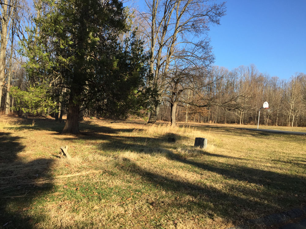
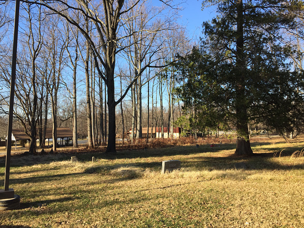
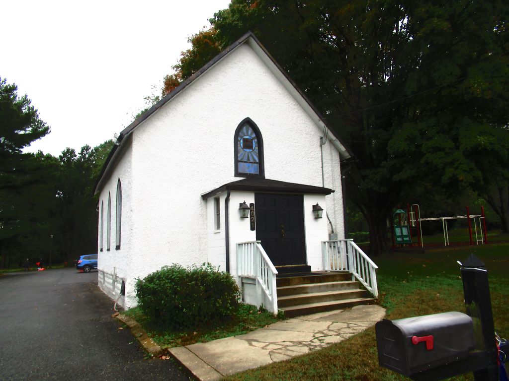
| Description | : | The Mt. Pleasant Methodist Church Cemetery is located on Muncaster Mill Road behind the Norbeck-Muncaster Mill Neighborhood Park recreation center. It was first described on an unrecorded 1869 plat subdividing property owned by Adrian R. Wadsworth. The death dates on the visible markers in the cemetery range from 1891-1961. The latest known burial was in 1966. Mt. Pleasant Church, along with Jerusalem Church in Rockville, was a part of the Rockville Charge of the Methodist Conference. The two churches shared ministers. In 1989 the two churches merged, becoming Jerusalem-Mt. Pleasant United Methodist Church which is located in Rockville,... Read More |
frequently asked questions (FAQ):
-
Where is Mount Pleasant Methodist Church Cemetery?
Mount Pleasant Methodist Church Cemetery is located at 4021 Muncaster Mill Road Norbeck, Montgomery County ,Maryland , 20853USA.
-
Mount Pleasant Methodist Church Cemetery cemetery's updated grave count on graveviews.com?
11 memorials
-
Where are the coordinates of the Mount Pleasant Methodist Church Cemetery?
Latitude: 39.1104800
Longitude: -77.0810960
Nearby Cemetories:
1. Norbeck Memorial Park
Olney, Montgomery County, USA
Coordinate: 39.1217003, -77.0717010
2. Judean Memorial Gardens
Olney, Montgomery County, USA
Coordinate: 39.1225800, -77.0714200
3. Prather Family Cemetery
Montgomery County, USA
Coordinate: 39.1133330, -77.1147220
4. Beall Cemetery
Silver Spring, Montgomery County, USA
Coordinate: 39.0877991, -77.0607986
5. Gate of Heaven Cemetery
Silver Spring, Montgomery County, USA
Coordinate: 39.0825005, -77.0738983
6. Owen Family Cemetery
Olney, Montgomery County, USA
Coordinate: 39.1362800, -77.0969200
7. Aspin Hill Memorial Park
Silver Spring, Montgomery County, USA
Coordinate: 39.0799600, -77.0772300
8. Parker Family Cemetery (Defunct)
Layhill, Montgomery County, USA
Coordinate: 39.0886230, -77.0472120
9. Bready Family Cemetery
Norwood, Montgomery County, USA
Coordinate: 39.1123480, -77.0369050
10. Avery Road Colored Cemetery
Rockville, Montgomery County, USA
Coordinate: 39.0897220, -77.1255560
11. Rockville United Church Memorial Garden
Rockville, Montgomery County, USA
Coordinate: 39.0783570, -77.1158440
12. Rockville Cemetery
Rockville, Montgomery County, USA
Coordinate: 39.0844002, -77.1260986
13. New Saint Mary's Catholic Church Cemetery
Rockville, Montgomery County, USA
Coordinate: 39.0830994, -77.1268997
14. Saint Johns Episcopal Cemetery
Olney, Montgomery County, USA
Coordinate: 39.1547012, -77.0686035
15. Bonifant Family Cemetery
Layhill, Montgomery County, USA
Coordinate: 39.0908012, -77.0218964
16. Martin Family Cemetery
Rockville, Montgomery County, USA
Coordinate: 39.0960100, -77.1428960
17. Parklawn Memorial Park and Menorah Gardens
Rockville, Montgomery County, USA
Coordinate: 39.0639000, -77.1091995
18. Lincoln Park Cemetery
Rockville, Montgomery County, USA
Coordinate: 39.0954300, -77.1452900
19. Montgomery County Rural Family Cemetery
Brookeville, Montgomery County, USA
Coordinate: 39.1608330, -77.0611110
20. Bowie Family Cemetery
Olney, Montgomery County, USA
Coordinate: 39.1635300, -77.0941800
21. Saint Lukes Lutheran Cemetery
Derwood, Montgomery County, USA
Coordinate: 39.1304800, -77.1494800
22. Sandy Spring Friends Meeting House Cemetery
Sandy Spring, Montgomery County, USA
Coordinate: 39.1478900, -77.0249700
23. Old Saint Mary's Catholic Church Cemetery
Rockville, Montgomery County, USA
Coordinate: 39.0819830, -77.1453850
24. Higgins Family Cemetery
Rockville, Montgomery County, USA
Coordinate: 39.0597400, -77.1162300