
| Memorials | : | 0 |
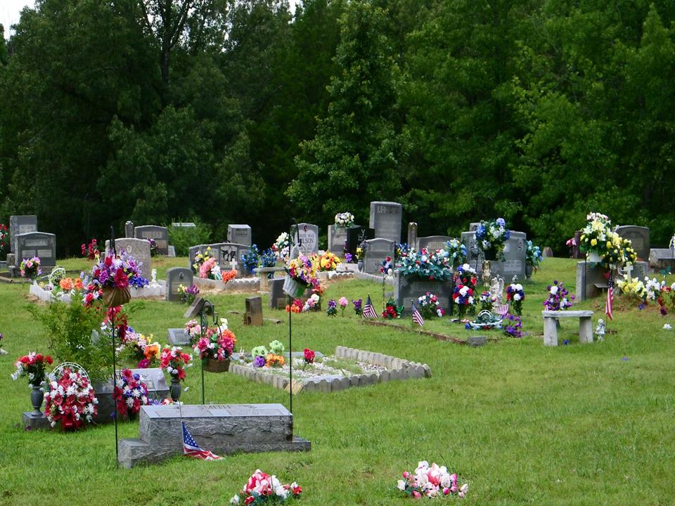
| Location | : | Stantonville, McNairy County, USA |
| Coordinate | : | 35.1499480, -88.4779570 |
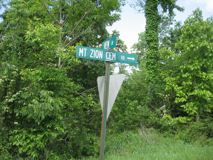
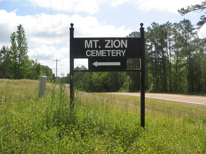
| Description | : | From the intersection of Mt Zion Cemetery Rd. & TN-142 W, west of Stantonville, travel north on Mt Zion Cemetery Rd., going 0.2 mi. to this large cemetery. |
frequently asked questions (FAQ):
-
Where is Mount Zion Cemetery?
Mount Zion Cemetery is located at Highway 142 Stantonville, McNairy County ,Tennessee ,USA.
-
Mount Zion Cemetery cemetery's updated grave count on graveviews.com?
0 memorials
-
Where are the coordinates of the Mount Zion Cemetery?
Latitude: 35.1499480
Longitude: -88.4779570
Nearby Cemetories:
1. Erwin Cemetery
McNairy County, USA
Coordinate: 35.1483190, -88.4735440
2. Prospect Church Cemetery
Selmer, McNairy County, USA
Coordinate: 35.1453460, -88.5053200
3. Union Grove Church Cemetery
Selmer, McNairy County, USA
Coordinate: 35.1463330, -88.5071040
4. Pleasant Site Church Cemetery
Stantonville, McNairy County, USA
Coordinate: 35.1248340, -88.4950890
5. Sanders Cemetery #4
Stantonville, McNairy County, USA
Coordinate: 35.1793350, -88.4793370
6. Spring Hill Cemetery
Selmer, McNairy County, USA
Coordinate: 35.1193700, -88.5061040
7. Pounds Cemetery
Stantonville, McNairy County, USA
Coordinate: 35.1889630, -88.4763830
8. Stantonville Cemetery
Stantonville, McNairy County, USA
Coordinate: 35.1585460, -88.4311860
9. Fink Cemetery
Purdy, McNairy County, USA
Coordinate: 35.1898540, -88.4780670
10. McKenzie Cemetery
Stantonville, McNairy County, USA
Coordinate: 35.1788640, -88.4397660
11. Cobb Cemetery
Stantonville, McNairy County, USA
Coordinate: 35.1706640, -88.4320490
12. Wardlow Cemetery
Michie, McNairy County, USA
Coordinate: 35.1005840, -88.4605110
13. Fellowship Baptist Church Cemetery
Selmer, McNairy County, USA
Coordinate: 35.1519470, -88.5456420
14. Sand Hill Church Cemetery
Michie, McNairy County, USA
Coordinate: 35.0939820, -88.4807960
15. Clear Creek Church Cemetery
New Lawton, McNairy County, USA
Coordinate: 35.2059380, -88.4723690
16. Emmanuel Tabernacle Church Cemetery
Stantonville, McNairy County, USA
Coordinate: 35.1843910, -88.4190730
17. Clear Creek Cemetery
Stantonville, McNairy County, USA
Coordinate: 35.1609250, -88.4066740
18. Meeks Grove Church Cemetery
Stantonville, McNairy County, USA
Coordinate: 35.1836930, -88.4138630
19. Sanders Cemetery #2
Old Lawton, McNairy County, USA
Coordinate: 35.2137200, -88.4724260
20. Pebble Hill Church Cemetery
Michie, McNairy County, USA
Coordinate: 35.0995510, -88.4230940
21. Thacker Cemetery
West Shiloh, McNairy County, USA
Coordinate: 35.1191610, -88.4006070
22. Poor Farm Cemetery
McNairy County, USA
Coordinate: 35.1802990, -88.5564760
23. Brooks Family Cemetery
West Shiloh, McNairy County, USA
Coordinate: 35.1134000, -88.4027000
24. Sanders Cemetery #1
Adamsville, McNairy County, USA
Coordinate: 35.2060110, -88.4220870