
| Memorials | : | 26 |
| Location | : | Boxford, Babergh District, England |
| Coordinate | : | 52.0280870, 0.8594160 |
frequently asked questions (FAQ):
-
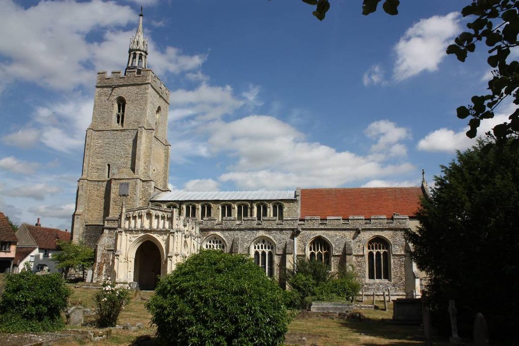
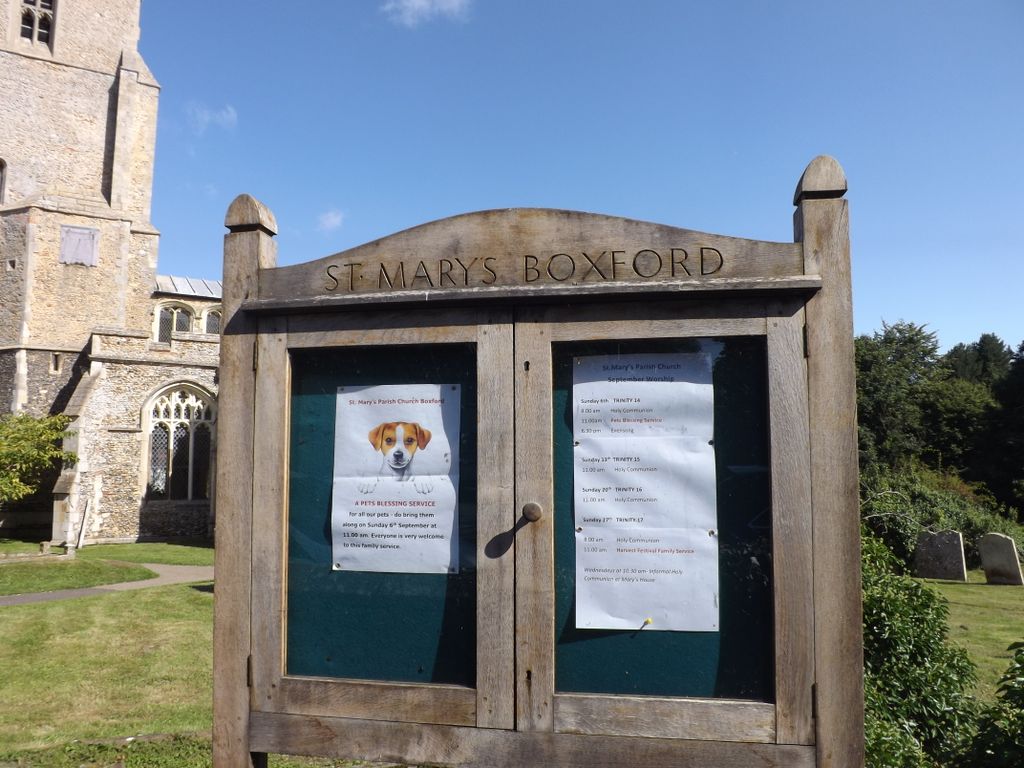
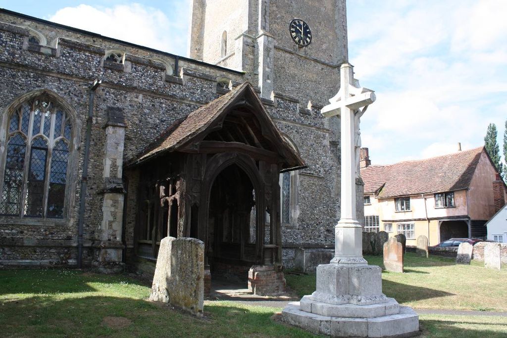
Where is St Mary's Churchyard?
St Mary's Churchyard is located at Boxford, Babergh District ,Suffolk ,England.
-
St Mary's Churchyard cemetery's updated grave count on graveviews.com?
26 memorials
-
Where are the coordinates of the St Mary's Churchyard?
Latitude: 52.0280870
Longitude: 0.8594160
Nearby Cemetories:
1. Boxford Cemetery
Boxford, Babergh District, England
Coordinate: 52.0268400, 0.8601300
2. St. Bartholomew's Churchyard
Groton, Babergh District, England
Coordinate: 52.0388810, 0.8558090
3. St Mary the Virgin Churchyard
Edwardstone, Babergh District, England
Coordinate: 52.0435300, 0.8283500
4. St Edmund King and Martyr Churchyard
Assington, Babergh District, England
Coordinate: 52.0138120, 0.8194260
5. World War I Memorial
Assington, Babergh District, England
Coordinate: 52.0138200, 0.8193504
6. St Mary Churchyard
Polstead, Babergh District, England
Coordinate: 52.0054860, 0.8964940
7. All Saints Churchyard
Newton, Babergh District, England
Coordinate: 52.0364000, 0.7966500
8. St Peter's Churchyard
Lindsey, Babergh District, England
Coordinate: 52.0672960, 0.8842620
9. Saint Mary Churchyard
Stoke by Nayland, Babergh District, England
Coordinate: 51.9895000, 0.8925210
10. St. Mary's Churchyard
Kersey, Babergh District, England
Coordinate: 52.0574611, 0.9190082
11. St Peter's Churchyard
Milden, Babergh District, England
Coordinate: 52.0824970, 0.8569200
12. St Lawrence Churchyard
Little Waldingfield, Babergh District, England
Coordinate: 52.0715620, 0.8059600
13. St Lawrence Churchyard
Great Waldingfield, Babergh District, England
Coordinate: 52.0606620, 0.7879070
14. Nayland Cemetery
Nayland, Babergh District, England
Coordinate: 51.9735000, 0.8677410
15. All Saints Churchyard
Little Cornard, Babergh District, England
Coordinate: 52.0175530, 0.7703720
16. Our Lady Immaculate Withermarsh Green
Stoke by Nayland, Babergh District, England
Coordinate: 51.9950800, 0.9326260
17. Friars Road Cemetery
Hadleigh, Babergh District, England
Coordinate: 52.0481800, 0.9453100
18. St. James' Churchyard
Nayland, Babergh District, England
Coordinate: 51.9715440, 0.8748140
19. St. Mary's Churchyard
Hadleigh, Babergh District, England
Coordinate: 52.0436290, 0.9526880
20. Hadleigh United Reformed Churchyard
Hadleigh, Babergh District, England
Coordinate: 52.0426790, 0.9533380
21. St. Andrew's Churchyard
Layham, Babergh District, England
Coordinate: 52.0240520, 0.9580820
22. St Andrew Churchyard
Great Cornard, Babergh District, England
Coordinate: 52.0304820, 0.7602450
23. Hadleigh Baptist Churchyard
Hadleigh, Babergh District, England
Coordinate: 52.0444510, 0.9562658
24. St. Mary's Church of England
Milton Keynes Borough, England
Coordinate: 52.0769560, 0.7937130