
| Memorials | : | 2 |
| Location | : | Stoke by Nayland, Babergh District, England |
| Website | : | www.geograph.org.uk/photo/5516091 |
| Coordinate | : | 51.9950800, 0.9326260 |
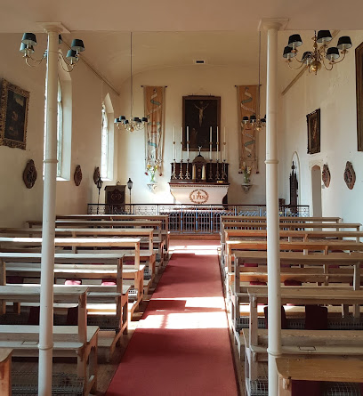
| Description | : | Church of Our Lady Immaculate, Withermarsh Green Chapel Lane near to Thorington Street, Stoke by Nayland, Babergh District, Suffolk, Great Britain ie. England Chapel Lane is a Street in the Suffolk hamlet of Thorington Street . The local council responsible for Chapel Lane is Babergh District Council which is a District Council and the local parish council is Stoke-by-Nayland Civil Parish. |
frequently asked questions (FAQ):
-
Where is Our Lady Immaculate Withermarsh Green?
Our Lady Immaculate Withermarsh Green is located at Thorington Street Stoke by Nayland, Babergh District ,Suffolk ,England.
-
Our Lady Immaculate Withermarsh Green cemetery's updated grave count on graveviews.com?
2 memorials
-
Where are the coordinates of the Our Lady Immaculate Withermarsh Green?
Latitude: 51.9950800
Longitude: 0.9326260
Nearby Cemetories:
1. St Mary Churchyard
Polstead, Babergh District, England
Coordinate: 52.0054860, 0.8964940
2. St Mary's Church Burial Ground
Higham, Forest Heath District, England
Coordinate: 51.9782680, 0.9626690
3. Saint Mary Churchyard
Stoke by Nayland, Babergh District, England
Coordinate: 51.9895000, 0.8925210
4. St. Andrew's Churchyard
Layham, Babergh District, England
Coordinate: 52.0240520, 0.9580820
5. St. Mary Churchyard
Raydon, Babergh District, England
Coordinate: 52.0081090, 0.9847290
6. St Mary the Virgin Churchyard
Langham, Colchester Borough, England
Coordinate: 51.9644450, 0.9596300
7. Saint Peters Churchyard
Boxted, Colchester Borough, England
Coordinate: 51.9617380, 0.9072480
8. St Mary's Churchyard
Stratford St Mary, Babergh District, England
Coordinate: 51.9718250, 0.9862600
9. St. Mary's Churchyard
Holton St Mary, Babergh District, England
Coordinate: 51.9911800, 0.9982800
10. St Bartholomew's Church
Snarestone, North West Leicestershire District, England
Coordinate: 52.0000000, 1.0000000
11. St. James' Churchyard
Nayland, Babergh District, England
Coordinate: 51.9715440, 0.8748140
12. Nayland Cemetery
Nayland, Babergh District, England
Coordinate: 51.9735000, 0.8677410
13. Hadleigh United Reformed Churchyard
Hadleigh, Babergh District, England
Coordinate: 52.0426790, 0.9533380
14. St. Mary's Churchyard
Hadleigh, Babergh District, England
Coordinate: 52.0436290, 0.9526880
15. Hadleigh Baptist Churchyard
Hadleigh, Babergh District, England
Coordinate: 52.0444510, 0.9562658
16. St John Church
Great Wenham (Wenham Magna), Babergh District, England
Coordinate: 52.0029360, 1.0157390
17. St. Mary the Virgin Churchyard
Dedham, Colchester Borough, England
Coordinate: 51.9586270, 0.9927610
18. East Bergholt Cemetery
East Bergholt, Babergh District, England
Coordinate: 51.9714670, 1.0086430
19. East Bergholt Congregational Churchyard
East Bergholt, Babergh District, England
Coordinate: 51.9716960, 1.0102980
20. Friars Road Cemetery
Hadleigh, Babergh District, England
Coordinate: 52.0481800, 0.9453100
21. Boxford Cemetery
Boxford, Babergh District, England
Coordinate: 52.0268400, 0.8601300
22. St. Mary the Virgin Churchyard
East Bergholt, Babergh District, England
Coordinate: 51.9699760, 1.0125630
23. St Mary's Churchyard
Boxford, Babergh District, England
Coordinate: 52.0280870, 0.8594160
24. Franciscan Cemetery
East Bergholt, Babergh District, England
Coordinate: 51.9698890, 1.0148040