
| Memorials | : | 151 |
| Location | : | Leach, Carroll County, USA |
| Coordinate | : | 35.9374770, -88.4971760 |
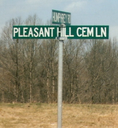
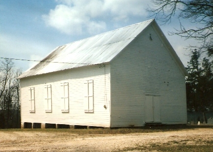
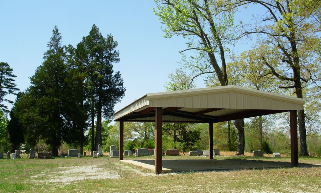
| Description | : | From the intersection of US-70 & S. Veterans Dr. Loop, in S. Huntingdon, travel southeast on US-70/S. Main St., for 5.3 mi., turning northerly (right) onto Humphrey Rd., going 0.4 mi., turning west (left) onto Pleasant Hill Cemetery Rd., going 0.2 mi. to the cemetery behind the shelter building. |
frequently asked questions (FAQ):
-
Where is Pleasant Hill Cemetery?
Pleasant Hill Cemetery is located at Pleasant Hill Cemetery Road Leach, Carroll County ,Tennessee ,USA.
-
Pleasant Hill Cemetery cemetery's updated grave count on graveviews.com?
0 memorials
-
Where are the coordinates of the Pleasant Hill Cemetery?
Latitude: 35.9374770
Longitude: -88.4971760
Nearby Cemetories:
1. Leach Full Gospel Church Cemetery
Leach, Carroll County, USA
Coordinate: 35.9337950, -88.4917900
2. Antioch Cemetery
Leach, Carroll County, USA
Coordinate: 35.9249992, -88.4852982
3. Giles Cemetery
Carroll County, USA
Coordinate: 35.9536018, -88.4918976
4. Christian Chapel Cemetery
Cedar Grove, Carroll County, USA
Coordinate: 35.9180984, -88.5038986
5. New Independence Church Cemetery
Huntingdon, Carroll County, USA
Coordinate: 35.9513120, -88.5213620
6. Price Cemetery
Trezevant, Carroll County, USA
Coordinate: 35.9534410, -88.5290640
7. Oak Grove Congregational Methodist Church Cemetery
Huntingdon, Carroll County, USA
Coordinate: 35.9576500, -88.4631500
8. Mount Olive Cemetery
McLemoresville, Carroll County, USA
Coordinate: 35.9685900, -88.5205840
9. Carroll County Poor Farm Cemetery
McLemoresville, Carroll County, USA
Coordinate: 35.9760000, -88.4982000
10. McLeod Cemetery
Huntingdon, Carroll County, USA
Coordinate: 35.9460500, -88.4500700
11. Stanford Cemetery
Leach, Carroll County, USA
Coordinate: 35.9053610, -88.4572780
12. Liberty All Church Cemetery
Huntingdon, Carroll County, USA
Coordinate: 35.9849180, -88.4772700
13. Leach Seventh Day Adventist Cemetery
Leach, Carroll County, USA
Coordinate: 35.8909988, -88.5358963
14. Bennett Cemetery
Huntingdon, Carroll County, USA
Coordinate: 35.9611700, -88.4337600
15. Palmer Shelter Cemetery
Huntingdon, Carroll County, USA
Coordinate: 35.9434760, -88.4275770
16. Pearson Cemetery
Cedar Grove, Carroll County, USA
Coordinate: 35.9003660, -88.5531730
17. Obion Chapel Church Cemetery
Cedar Grove, Carroll County, USA
Coordinate: 35.9198630, -88.5673110
18. New Liberty Church Cemetery
Carroll County, USA
Coordinate: 35.8779730, -88.4817660
19. Black Cemetery
Carroll County, USA
Coordinate: 35.8835983, -88.4610977
20. Everett Family Cemetery
Lakewood, Carroll County, USA
Coordinate: 35.9984900, -88.4878500
21. Carters Chapel Cemetery
Carroll County, USA
Coordinate: 35.9247017, -88.5727997
22. New Spring Hill Cemetery
Huntingdon, Carroll County, USA
Coordinate: 36.0058030, -88.5012580
23. New Reedy Creek Baptist Church Cemetery
McLemoresville, Carroll County, USA
Coordinate: 35.9693570, -88.5737870
24. Bledsoe Cemetery #2
Huntingdon, Carroll County, USA
Coordinate: 35.9675000, -88.4177000