| Memorials | : | 0 |
| Location | : | Dalton, Wayne County, USA |
| Phone | : | 330-828-0467 |
| Coordinate | : | 40.7626200, -81.6680700 |
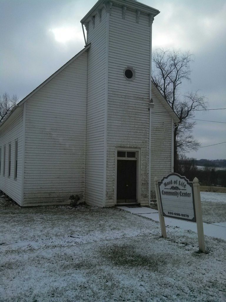
| Description | : | New Life Chapel (previously was Word of Life Community Center) 18015 Goudy Rd Dalton, OH 44618 330-828-0467 GPS Coordinates: Latitude: 40.762620 Longitude: -81.668070 There are currently four graves located onsite at New Life Chapel; just to the side of the driveway. The cemetery is located in Sugar Creek Township, Wayne County, Ohio, and is # 12757 (New Life Chapel Cemetery / Pleasant Valley Cemetery) in “Ohio Cemeteries 1803-2003”, compiled by the Ohio Genealogical Society. |
frequently asked questions (FAQ):
-
Where is New Life Chapel Cemetery?
New Life Chapel Cemetery is located at 18015 Goudy Rd Dalton, Wayne County ,Ohio , 44618USA.
-
New Life Chapel Cemetery cemetery's updated grave count on graveviews.com?
0 memorials
-
Where are the coordinates of the New Life Chapel Cemetery?
Latitude: 40.7626200
Longitude: -81.6680700
Nearby Cemetories:
1. Pleasant Valley Cemetery
Wayne County, USA
Coordinate: 40.7622986, -81.6677017
2. Stanwood Cemetery
Stanwood, Stark County, USA
Coordinate: 40.7591019, -81.6340027
3. Ananias Hershberger Farm Cemetery
West Lebanon, Wayne County, USA
Coordinate: 40.7350190, -81.6700240
4. Sugar Creek Township Cemetery
West Lebanon, Wayne County, USA
Coordinate: 40.7294998, -81.6688004
5. West Lebanon Union Cemetery
West Lebanon, Wayne County, USA
Coordinate: 40.7262170, -81.6736130
6. West Lebanon Lutheran Cemetery
West Lebanon, Wayne County, USA
Coordinate: 40.7258987, -81.6653976
7. Sonnenberg Pioneer Cemetery
Kidron, Wayne County, USA
Coordinate: 40.7600010, -81.7210720
8. Dalton Cemetery
Dalton, Wayne County, USA
Coordinate: 40.7972500, -81.6987500
9. Sonnenberg Mennonite Cemetery
Kidron, Wayne County, USA
Coordinate: 40.7561989, -81.7267990
10. Salem Mennonite Church Cemetery
Kidron, Wayne County, USA
Coordinate: 40.7589989, -81.7321014
11. East Greenville Cemetery
East Greenville, Stark County, USA
Coordinate: 40.8006100, -81.6270700
12. McFarren Cemetery
Brewster, Stark County, USA
Coordinate: 40.7233900, -81.6254000
13. Arnold Cemetery
Kidron, Wayne County, USA
Coordinate: 40.7853012, -81.7335968
14. Sixteen Church Cemetery
Massillon, Stark County, USA
Coordinate: 40.7882996, -81.6025009
15. Simon Farm Cemetery
Mount Eaton, Wayne County, USA
Coordinate: 40.7068890, -81.6532220
16. Boughman Cemetery
Brewster, Stark County, USA
Coordinate: 40.7216650, -81.6145560
17. Joe Zook Cemetery
Mount Eaton, Wayne County, USA
Coordinate: 40.7190580, -81.7214860
18. Kidron Mennonite Church Cemetery
Kidron, Wayne County, USA
Coordinate: 40.7507019, -81.7462997
19. County Line Mennonite Cemetery
Wayne County, USA
Coordinate: 40.8218002, -81.6483994
20. Bethel Mennonite Cemetery
Riceland, Wayne County, USA
Coordinate: 40.7784004, -81.7465973
21. Pleasant Grove Cemetery
Minerva, Stark County, USA
Coordinate: 40.7018190, -81.6339770
22. Pleasant View Church Cemetery
North Lawrence, Stark County, USA
Coordinate: 40.8256111, -81.6312332
23. Pigeon Run Cemetery
Stark County, USA
Coordinate: 40.7495000, -81.5781800
24. Westlawn Cemetery
Mount Eaton, Wayne County, USA
Coordinate: 40.6973000, -81.7026978

