
| Memorials | : | 0 |
| Location | : | Veenhuizen, Heerhugowaard Municipality, Netherlands |
| Coordinate | : | 52.7027900, 4.8905700 |
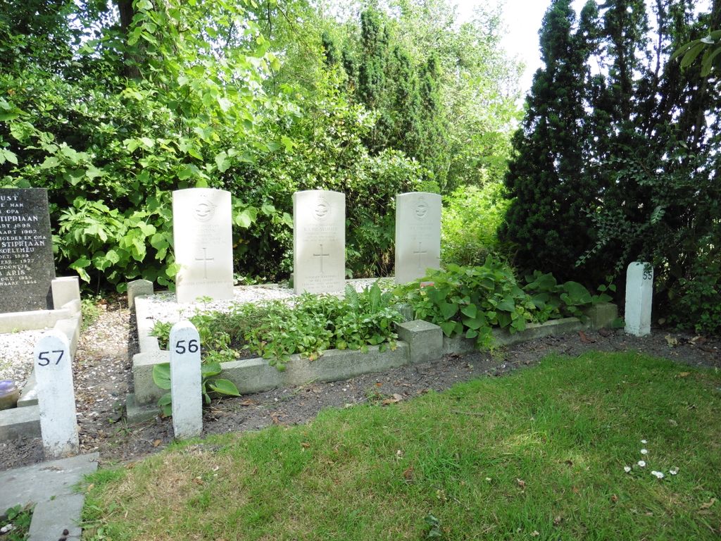
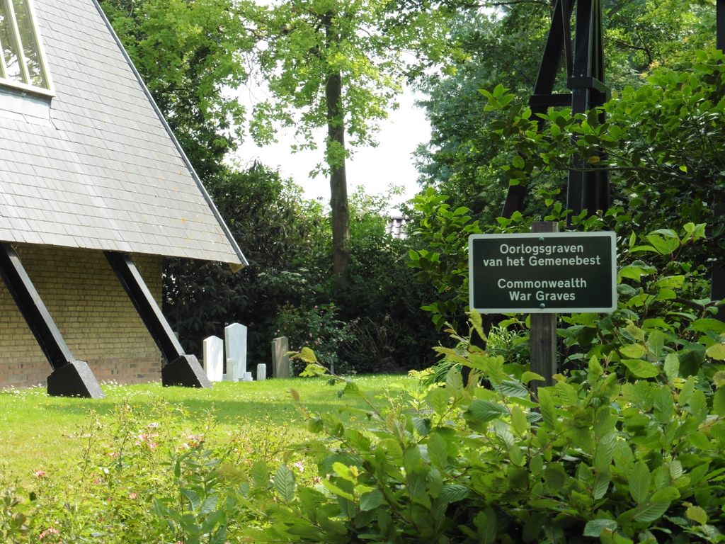
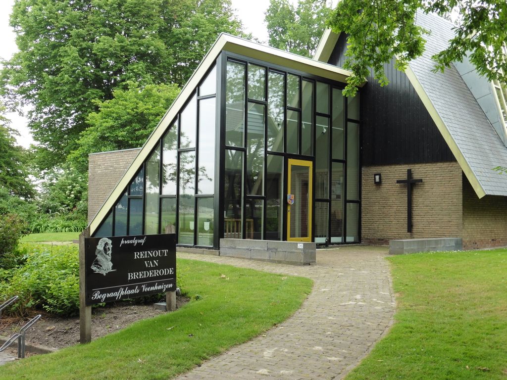
| Description | : | Veenhuigen, in the commune of Heerhugowaard, is a village 21 kilometres north-east of Alkmaar, 40 kilometres north of Amsterdam, and about 2 kilometres south of the secondary road from Den Helder to Amsterdam. From the N241 turn into Dijkweg by the canal then first right into Kerkweg.The small churchyard is No.26 along this road. |
frequently asked questions (FAQ):
-
Where is Veenhuizen Churchyard?
Veenhuizen Churchyard is located at Veenhuizen, Heerhugowaard Municipality ,Noord-Holland ,Netherlands.
-
Veenhuizen Churchyard cemetery's updated grave count on graveviews.com?
0 memorials
-
Where are the coordinates of the Veenhuizen Churchyard?
Latitude: 52.7027900
Longitude: 4.8905700
Nearby Cemetories:
1. Spanbroek Churchyard
Spanbroek, Opmeer Municipality, Netherlands
Coordinate: 52.6980200, 4.9442730
2. Winkel Protestant Churchyard
Winkel, Hollands Kroon Municipality, Netherlands
Coordinate: 52.7588800, 4.9132200
3. Rooms Katholieke Begraafplaats
Ursem, Koggenland Municipality, Netherlands
Coordinate: 52.6267350, 4.8897360
4. Rooms Katholieke Begraafplaats
De Goorn, Koggenland Municipality, Netherlands
Coordinate: 52.6267350, 4.9455000
5. Wognum Protestant Churchyard
Wognum, Medemblik Municipality, Netherlands
Coordinate: 52.6802100, 5.0260100
6. Westerbegraafplaats
Barsingerhorn, Hollands Kroon Municipality, Netherlands
Coordinate: 52.7849938, 4.8340670
7. Kolhorn General Cemetery
Kolhorn, Hollands Kroon Municipality, Netherlands
Coordinate: 52.7955800, 4.8907200
8. Begraafplaats de Hoep
Schagen, Schagen Municipality, Netherlands
Coordinate: 52.7874920, 4.8065280
9. Stompetoren Churchyard
Stompetoren, Alkmaar Municipality, Netherlands
Coordinate: 52.6115300, 4.8197300
10. Nieuwe Algemene Begraafplaats
Hoorn Municipality, Netherlands
Coordinate: 52.6459000, 5.0378800
11. Nieuwe Algemene Begraafplaats
Sint Maarten, Schagen Municipality, Netherlands
Coordinate: 52.7691500, 4.7489600
12. Twisk Churchyard
Twisk, Medemblik Municipality, Netherlands
Coordinate: 52.7442300, 5.0603400
13. Hoorn General Cemetery
Hoorn, Hoorn Municipality, Netherlands
Coordinate: 52.6461800, 5.0486800
14. Bergen General Cemetery
Bergen, Bergen Municipality, Netherlands
Coordinate: 52.6772500, 4.7098600
15. Grote Sint Laurenskerk
Alkmaar, Alkmaar Municipality, Netherlands
Coordinate: 52.6325150, 4.7440124
16. Oude Algemene Begraafplaats
Sint Maarten, Schagen Municipality, Netherlands
Coordinate: 52.7743800, 4.7428100
17. Schoorl General Cemetery
Schoorl, Bergen Municipality, Netherlands
Coordinate: 52.7060800, 4.6981500
18. Ruinekerk
Bergen, Bergen Municipality, Netherlands
Coordinate: 52.6703450, 4.7054100
19. Drieboomlaan
Hoorn, Hoorn Municipality, Netherlands
Coordinate: 52.6524706, 5.0707404
20. Alkmaar Algemene Begraafplaats
Alkmaar, Alkmaar Municipality, Netherlands
Coordinate: 52.6277500, 4.7302600
21. Rooms Katholieke Begraafplaats
Hoorn, Hoorn Municipality, Netherlands
Coordinate: 52.6494000, 5.0737800
22. Alkmaar Sint-Barbara Roman Catholic Cemetery
Alkmaar, Alkmaar Municipality, Netherlands
Coordinate: 52.6243500, 4.7318460
23. Joodse Begraafplaats
Alkmaar Municipality, Netherlands
Coordinate: 52.6255000, 4.7279200
24. Gemeentelijke begraafplaats Middenmeer
Middenmeer, Hollands Kroon Municipality, Netherlands
Coordinate: 52.8112000, 4.9979100