
| Memorials | : | 0 |
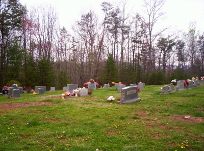
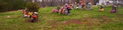
| Location | : | Marion, McDowell County, USA |
| Coordinate | : | 35.6461500, -82.0699590 |
| Description | : | Sugar Hill Road, turn right on to Zion Hill Rd, turn right on to Nix Creek Rd, left on to Nix Creek Church Rd. The church is located app. 1/4 mile on the left. Cemetery is located behind the church. |
frequently asked questions (FAQ):
-
Where is Nix Creek Free Will Baptist Church?
Nix Creek Free Will Baptist Church is located at Marion, McDowell County ,North Carolina ,USA.
-
Nix Creek Free Will Baptist Church cemetery's updated grave count on graveviews.com?
0 memorials
-
Where are the coordinates of the Nix Creek Free Will Baptist Church?
Latitude: 35.6461500
Longitude: -82.0699590

Nearby Cemetories:
1. Glades Cemetery
McDowell County, USA
Coordinate: 35.6422005, -82.0669022
2. Zion Hill Baptist Church Cemetery
Marion, McDowell County, USA
Coordinate: 35.6314011, -82.0686035
3. Providence United Methodist Church Cemetery
Marion, McDowell County, USA
Coordinate: 35.6368860, -82.0503680
4. McDowell Cemetery
McDowell County, USA
Coordinate: 35.6638380, -82.0587210
5. Mount Calvary Free Will Baptist Church Cemetery
McDowell County, USA
Coordinate: 35.6617550, -82.0401430
6. Greenlee Hill Cemetery
McDowell County, USA
Coordinate: 35.6688700, -82.1106810
7. West Marion United Methodist Church Cemetery
Marion, McDowell County, USA
Coordinate: 35.6609920, -82.0235890
8. Patton-Logan Cemetery
Pleasant Gardens, McDowell County, USA
Coordinate: 35.6907230, -82.0767370
9. Mount Olive Cemetery
Pleasant Gardens, McDowell County, USA
Coordinate: 35.6815300, -82.1076500
10. Pleasant Gardens Baptist Church Cemetery
Marion, McDowell County, USA
Coordinate: 35.6933390, -82.0719010
11. Liberty Cemetery
Marion, McDowell County, USA
Coordinate: 35.6892014, -82.0939026
12. Cross Mill Cemetery
Marion, McDowell County, USA
Coordinate: 35.6736341, -82.0221047
13. Mount Pleasant Baptist Church Cemetery
Marion, McDowell County, USA
Coordinate: 35.6174650, -82.0190030
14. Brown Family Cemetery
Pleasant Gardens, McDowell County, USA
Coordinate: 35.6967239, -82.0679550
15. Vess Family Cemetery
Pleasant Gardens, McDowell County, USA
Coordinate: 35.6993532, -82.0866362
16. Patton Cemetery
McDowell County, USA
Coordinate: 35.7008630, -82.0873780
17. Ridgeway Freewill Baptist Church Cemetery
McDowell County, USA
Coordinate: 35.6319070, -82.0010530
18. Old Ebenezer Cemetery
Old Fort, McDowell County, USA
Coordinate: 35.6432360, -82.1433220
19. Carsons Chapel Cemetery
McDowell County, USA
Coordinate: 35.7070550, -82.0706850
20. Ebenezer United Methodist Church Cemetery
Old Fort, McDowell County, USA
Coordinate: 35.6497002, -82.1453018
21. Saint John's Episcopal Church Columbarium
Marion, McDowell County, USA
Coordinate: 35.6793360, -82.0058020
22. Round Hill Baptist Church Cemetery
McDowell County, USA
Coordinate: 35.7050620, -82.0468440
23. Duncan Family Cemetery
Marion, McDowell County, USA
Coordinate: 35.6791540, -82.0011160
24. Old Marion Methodist Episcopal Church Cemetery
McDowell County, USA
Coordinate: 35.6856260, -82.0063220