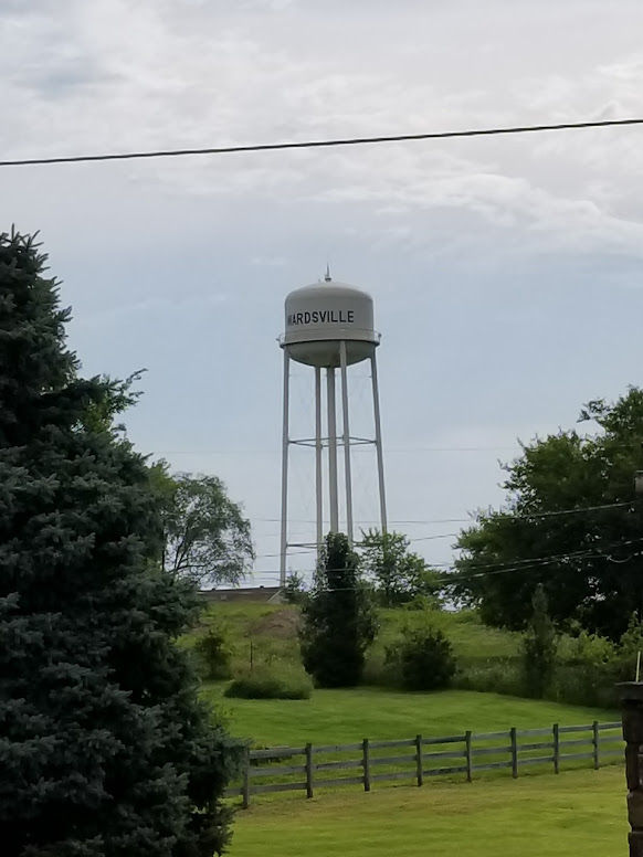
| Memorials | : | 0 |
| Location | : | Wardsville, Cole County, USA |
| Coordinate | : | 38.4912500, -92.1656900 |
| Description | : | East of Wardsville on Highway M on the old Vanloo farm. Information here was taken from "Cemeteries in Cole County, Missouri" as recorded in the 1930's by Thenia (Bolton) McHenry. Photos were taken in August, 2017 by Keith B. Ward and his family who made a pilgrimage to Cole County to locate the cemetery. Keith said that the tombstones in this cemetery were moved by a previous owner and placed near a barn on the property. Though the remains are still interred at the original cemetery site, it is no longer possible to identify that precise location, but, based on historic... Read More |
frequently asked questions (FAQ):
-
Where is Ward Burial Grounds?
Ward Burial Grounds is located at Wardsville, Cole County ,Missouri ,USA.
-
Ward Burial Grounds cemetery's updated grave count on graveviews.com?
0 memorials
-
Where are the coordinates of the Ward Burial Grounds?
Latitude: 38.4912500
Longitude: -92.1656900
Nearby Cemetories:
1. Saint Stanislaus Catholic Church Cemetery
Wardsville, Cole County, USA
Coordinate: 38.4863450, -92.1756730
2. Enloe Cemetery
Wardsville, Cole County, USA
Coordinate: 38.4780360, -92.1772050
3. Rice-Sone Cemetery
Jefferson City, Cole County, USA
Coordinate: 38.5115900, -92.1658000
4. Ott Burial Ground
Wardsville, Cole County, USA
Coordinate: 38.4955560, -92.1930280
5. Lamkin Family Cemetery
Wardsville, Cole County, USA
Coordinate: 38.5318985, -92.1903000
6. Wolfrum Cemetery
Cole County, USA
Coordinate: 38.5368996, -92.1213989
7. Rouschelback Cemetery
Cole County, USA
Coordinate: 38.5116997, -92.2382965
8. August Henry Family Cemetery
Jefferson City, Cole County, USA
Coordinate: 38.5414510, -92.1174150
9. Columbarium of Community Christian Church
Jefferson City, Cole County, USA
Coordinate: 38.5527500, -92.1934300
10. Immanuel Lutheran Church Cemetery
Honey Creek, Cole County, USA
Coordinate: 38.4617500, -92.2432600
11. New Saint Xaviers Catholic Church Cemetery
Taos, Cole County, USA
Coordinate: 38.5052986, -92.0802994
12. Johannes Lumpe Gravesite
Jefferson City, Cole County, USA
Coordinate: 38.5446300, -92.2210100
13. Ferguson Family Cemetery
Jefferson City, Cole County, USA
Coordinate: 38.5593000, -92.1836700
14. Islamic Cemetery of Mid Missouri
Jefferson City, Cole County, USA
Coordinate: 38.5117410, -92.2512620
15. Jefferson City National Cemetery
Jefferson City, Cole County, USA
Coordinate: 38.5660477, -92.1621857
16. Old Saint Xaviers Catholic Church Cemetery
Taos, Cole County, USA
Coordinate: 38.5059390, -92.0715080
17. Woodland-Old City Cemetery
Jefferson City, Cole County, USA
Coordinate: 38.5674200, -92.1621070
18. Eilenstein Burial Ground
Cole County, USA
Coordinate: 38.5477600, -92.2352200
19. Osage Bluff Methodist Cemetery
Osage Bluff, Cole County, USA
Coordinate: 38.4497910, -92.2513809
20. Trinity Lutheran Cemetery
Jefferson City, Cole County, USA
Coordinate: 38.5700070, -92.1844380
21. Missouri State Penitentiary Cemetery (Defunct)
Jefferson City, Cole County, USA
Coordinate: 38.5719130, -92.1612510
22. Zion Lutheran Cemetery
Cole County, USA
Coordinate: 38.5360985, -92.2521973
23. Hedler Cemetery
Jefferson City, Cole County, USA
Coordinate: 38.4814000, -92.2705700
24. Saint Margaret Cemetery
Osage Bend, Cole County, USA
Coordinate: 38.4079500, -92.1425100

