
| Memorials | : | 0 |
| Location | : | Wardsville, Cole County, USA |
| Coordinate | : | 38.4780360, -92.1772050 |
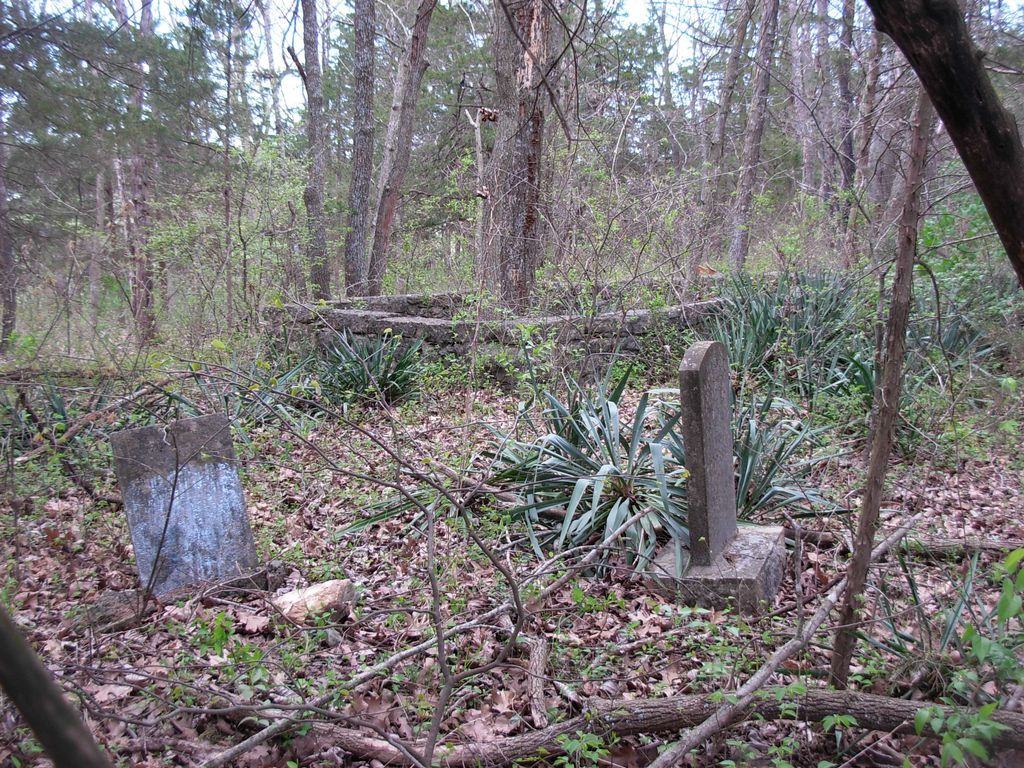
| Description | : | This small, African American Cemetery is located on Highway W about 3/4 mile outside Wardsville. Most of the burials are toward the front and sides of a rock wall. Inside the wall is one engraved tombstone and a two native stone markers with no inscription. There are also several stone markers outside the wall. There are numerous yucca plants inside and outside the wall which may also mark burials. |
frequently asked questions (FAQ):
-
Where is Enloe Cemetery?
Enloe Cemetery is located at Wardsville, Cole County ,Missouri ,USA.
-
Enloe Cemetery cemetery's updated grave count on graveviews.com?
0 memorials
-
Where are the coordinates of the Enloe Cemetery?
Latitude: 38.4780360
Longitude: -92.1772050
Nearby Cemetories:
1. Saint Stanislaus Catholic Church Cemetery
Wardsville, Cole County, USA
Coordinate: 38.4863450, -92.1756730
2. Ward Burial Grounds
Wardsville, Cole County, USA
Coordinate: 38.4912500, -92.1656900
3. Ott Burial Ground
Wardsville, Cole County, USA
Coordinate: 38.4955560, -92.1930280
4. Rice-Sone Cemetery
Jefferson City, Cole County, USA
Coordinate: 38.5115900, -92.1658000
5. Immanuel Lutheran Church Cemetery
Honey Creek, Cole County, USA
Coordinate: 38.4617500, -92.2432600
6. Lamkin Family Cemetery
Wardsville, Cole County, USA
Coordinate: 38.5318985, -92.1903000
7. Rouschelback Cemetery
Cole County, USA
Coordinate: 38.5116997, -92.2382965
8. Osage Bluff Methodist Cemetery
Osage Bluff, Cole County, USA
Coordinate: 38.4497910, -92.2513809
9. Islamic Cemetery of Mid Missouri
Jefferson City, Cole County, USA
Coordinate: 38.5117410, -92.2512620
10. Hedler Cemetery
Jefferson City, Cole County, USA
Coordinate: 38.4814000, -92.2705700
11. Wolfrum Cemetery
Cole County, USA
Coordinate: 38.5368996, -92.1213989
12. Johannes Lumpe Gravesite
Jefferson City, Cole County, USA
Coordinate: 38.5446300, -92.2210100
13. Saint Margaret Cemetery
Osage Bend, Cole County, USA
Coordinate: 38.4079500, -92.1425100
14. Columbarium of Community Christian Church
Jefferson City, Cole County, USA
Coordinate: 38.5527500, -92.1934300
15. August Henry Family Cemetery
Jefferson City, Cole County, USA
Coordinate: 38.5414510, -92.1174150
16. New Saint Xaviers Catholic Church Cemetery
Taos, Cole County, USA
Coordinate: 38.5052986, -92.0802994
17. Ferguson Family Cemetery
Jefferson City, Cole County, USA
Coordinate: 38.5593000, -92.1836700
18. Zion Lutheran Cemetery
Cole County, USA
Coordinate: 38.5360985, -92.2521973
19. Eilenstein Burial Ground
Cole County, USA
Coordinate: 38.5477600, -92.2352200
20. Saint Anthony of Padua Cemetery
Folk, Osage County, USA
Coordinate: 38.4214320, -92.0990120
21. Sommerer Farm Cemetery
Brazito, Cole County, USA
Coordinate: 38.4546500, -92.2801800
22. Eberhardt Cemetery
Cole County, USA
Coordinate: 38.5257988, -92.2668991
23. Old Saint Xaviers Catholic Church Cemetery
Taos, Cole County, USA
Coordinate: 38.5059390, -92.0715080
24. Peace Lutheran Cemetery
Brazito, Cole County, USA
Coordinate: 38.4676600, -92.2889300